
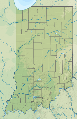
Ofbyld:USA Indiana relief location map.svg

Size of this PNG preview of this SVG file: 388 × 600 piksels. Oare resolúsjes: 155 × 240 piksels | 310 × 480 piksels | 496 × 768 piksels | 662 × 1.024 piksels | 1.324 × 2.048 piksels | 776 × 1.200 piksels.
Oarspronklik bestân (SVG-bestân, nominaal 776 × 1.200 pixels, bestânsgrutte: 1,38 MB)
Gearfetting
| Beskriuwing | |
| Datum | |
| Boarne |
Eigen wurk
|
| Auteur | SANtosito |
| Oare ferzjes |
 |
Lisinsje
I, the copyright holder of this work, hereby publish it under the following license:
This file is licensed under the Creative Commons Attribution-Share Alike 4.0 International license.
- Fiel jo frij:
- te dielen – it wurk te kopiearjen, fersprieden en út te stjoeren
- te fermingen – it wurk oan te passen
- Under de neikommende betingsten:
- Nammefermelding – You must give appropriate credit, provide a link to the license, and indicate if changes were made. You may do so in any reasonable manner, but not in any way that suggests the licensor endorses you or your use.
- Lyk diele – If you remix, transform, or build upon the material, you must distribute your contributions under the same or compatible license as the original.
Triemskiednis
Klik op in datum/tiid om it bestân te besjen sa't it op dat stuit wie.
| Datum/Tiid | Miniatuer | ôfmjittings | Meidogger | Opmerking | |
|---|---|---|---|---|---|
| lêste | 31 jan 2021, 02.44 | | 776 × 1.200 (1,38 MB) | SANtosito | Uploaded own work with UploadWizard |
Bestânsgebrûk
De neikommende side brûkt dit bestân:
Globaal bestânsgebrûk
De neikommende oare wiki's brûke dit bestân:
- Gebrûk op ca.wikipedia.org
- Gebrûk op de.wikipedia.org
- Turkey Run State Park
- Vorlage:Positionskarte USA Indiana
- Indiana Dunes State Park
- Versailles State Park
- Falls of the Ohio State Park
- Mounds State Park
- Chain O’Lakes State Park (Indiana)
- Prophetstown State Park
- Amazon Lake (Indiana)
- Lake Primrose (Indiana)
- Hayward Lake (Indiana)
- Cagles Mill Lake
- Ernie Pyle Island
- Cataract Falls (Indiana)
- Hoosier Hill
- WLDE
- WDKS
- WOWO
- Rock-Island-Raffinerie
- Gebrûk op en.wikipedia.org
- Columbus, Indiana
- Fort Wayne, Indiana
- Gary, Indiana
- Indianapolis
- Battle of Tippecanoe
- Terre Haute, Indiana
- Muncie, Indiana
- Elkhart, Indiana
- Kokomo, Indiana
- Bloomington, Indiana
- South Bend, Indiana
- Lafayette, Indiana
- West Lafayette, Indiana
- Evansville, Indiana
- Gainbridge Fieldhouse
- Eel River (Wabash River tributary)
- Patoka Lake
- Lake Wawasee
- Lake Lemon
- Indian Lake (Indiana)
- Ross–Ade Stadium
- Scheumann Stadium
- Allen County War Memorial Coliseum
- Indiana Farmers Coliseum
- Monroe Lake
- George Rogers Clark National Historical Park
- Tippecanoe Lake
- Lucas Oil Stadium
- Lake Manitou (Indiana)
Mear globaal gebrûk fan dit bestân besjen.