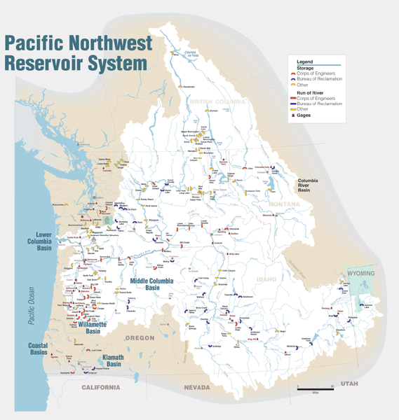
Ofbyld:Pacific Northwest River System.png

Grutte fan dit proefbyld: 569 × 599 piksels. Oare resolúsjes: 228 × 240 piksels | 456 × 480 piksels | 729 × 768 piksels | 973 × 1.024 piksels | 1.930 × 2.032 piksels.
Oarspronklik bestân (1.930 × 2.032 pixels, bestânsgrutte: 412 KB, MIME-type: image/png)
Triemskiednis
Klik op in datum/tiid om it bestân te besjen sa't it op dat stuit wie.
| Datum/Tiid | Miniatuer | ôfmjittings | Meidogger | Opmerking | |
|---|---|---|---|---|---|
| lêste | 12 jan 2010, 00.31 |  | 1.930 × 2.032 (412 KB) | Spankston | larger file, higher resolution |
| 11 jan 2010, 23.56 |  | 914 × 963 (565 KB) | Spankston | {{Information |Description={{en|1=Maps of dams, drainage and estuaries along the Columbia River in North America (USA, Canada). Original caption: The Columbia River carved the Interior Columbia River Basin from the landscape of seven Western states a |
Bestânsgebrûk
De neikommende side brûkt dit bestân:
Globaal bestânsgebrûk
De neikommende oare wiki's brûke dit bestân:
- Gebrûk op bg.wikipedia.org
- Gebrûk op de.wikipedia.org
- Gebrûk op en.wikipedia.org
- Rocky Reach Dam
- Rock Island Dam
- Wanapum Dam
- Priest Rapids Dam
- Bonneville Dam
- Salmon River (Idaho)
- List of rivers of Washington (state)
- List of dams in the Columbia River watershed
- Revelstoke Dam
- The Dalles Dam
- Keenleyside Dam
- Columbia River Treaty
- Little Goose Dam
- Lower Granite Dam
- Lower Monumental Dam
- Ice Harbor Dam
- Dworshak Dam
- Palisades Dam
- Hells Canyon Dam
- Oxbow Dam
- Brownlee Dam
- Jackson Lake Dam
- C. J. Strike Dam
- Lake Cascade
- Deadwood Reservoir
- Lucky Peak Dam
- Arrowrock Dam
- Anderson Ranch Dam
- Zosel Dam
- User:Mdmunabbir/sandbox
- Gebrûk op fi.wikipedia.org
- Gebrûk op fr.wikipedia.org
- Gebrûk op he.wikipedia.org
- Gebrûk op it.wikipedia.org
- Gebrûk op nl.wikipedia.org
- Gebrûk op no.wikipedia.org
Mear globaal gebrûk fan dit bestân besjen.

