
Ofbyld:Map of Russian subjects by type, 2008-03-01.svg

Size of this PNG preview of this SVG file: 800 × 462 piksels. Oare resolúsjes: 320 × 185 piksels | 640 × 369 piksels | 1.024 × 591 piksels | 1.280 × 738 piksels | 2.560 × 1.477 piksels | 1.092 × 630 piksels.
Oarspronklik bestân (SVG-bestân, nominaal 1.092 × 630 pixels, bestânsgrutte: 256 KB)
| Beskriuwing |
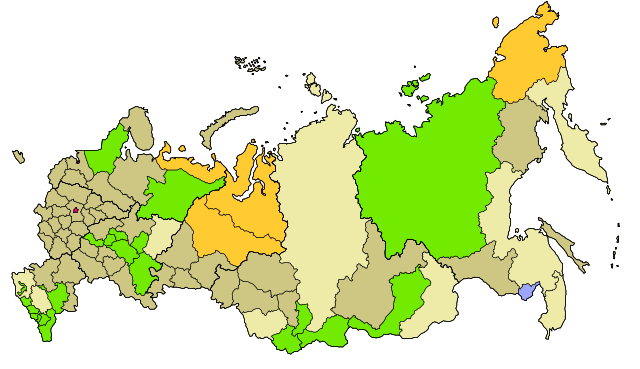
Map of Russia with merged subjects (01.03.2008, last merger Chita Oblast+Agin-Buryat Autonomous Okrug to form Zabaykalsky Krai.) Republics
Krais (territories)
Oblasts (provinces)
federal cities
Autonomous oblasts (provinces)
Autonomous okrugs (districts)
|
| Datum | |
| Boarne | Based on Map of Russian subjects, 2008-03-01.svg by Lokal_Profil and colours from Federal subjects of Russia (by type).svg by CrazyPhunk, edits by Lokal_Profil |
| Auteur |
This vector image was created with Inkscape . |
| Tastimming (Reusing this file) |
This file is licensed under the Creative Commons Attribution-Share Alike 2.5 Generic license. Nammefermelding: Lokal_Profil
|
.svg)
Triemskiednis
Klik op in datum/tiid om it bestân te besjen sa't it op dat stuit wie.
| Datum/Tiid | Miniatuer | ôfmjittings | Meidogger | Opmerking | |
|---|---|---|---|---|---|
| lêste | 20 apr 2008, 18.46 | | 1.092 × 630 (256 KB) | Lokal Profil | Reverted to version as of 22:58, 3 March 2008. Find the new colours to similar |
| 20 apr 2008, 18.13 |  | 1.092 × 630 (254 KB) | SeNeKa~commonswiki | ||
| 4 mrt 2008, 00.58 |  | 1.092 × 630 (256 KB) | Lokal Profil | Update including federal borders | |
| 27 jan 2008, 22.52 |  | 1.092 × 630 (188 KB) | Lokal Profil | Changed colour palett | |
| 27 jan 2008, 22.35 |  | 1.092 × 630 (187 KB) | Lokal Profil | {{Information |Description=Map of Russia with merged subjects (01.03.2008, last merger Chita Oblast+Agin-Buryat Autonomous Okrug to form Zabaykalsky Krai.)<br> Colour tagged by type. {{legend|#db |
Bestânsgebrûk
De neikommende side brûkt dit bestân:
Globaal bestânsgebrûk
De neikommende oare wiki's brûke dit bestân:
- Gebrûk op af.wikipedia.org
- Gebrûk op de.wikipedia.org
- Gebrûk op el.wikipedia.org
- Gebrûk op en.wikipedia.org
- Talk:Chechnya
- Talk:Kaliningrad Oblast
- Talk:Königsberg
- Talk:Soviet Union
- Talk:Republics of the Soviet Union
- Talk:Saint Petersburg
- Talk:Yekaterinburg
- Talk:Ulan-Ude
- Talk:Eastern Europe
- Talk:Sápmi
- Talk:Scandinavian Peninsula
- Talk:Kalmykia
- Talk:House of Vasa
- Talk:Akademgorodok
- Talk:Vyborg
- Talk:Jewish Autonomous Oblast
- Talk:Unalaska, Alaska
- Talk:Old Harbor, Alaska
- Talk:Golovin, Alaska
- Talk:Volgograd
- Talk:Ruthenia
- Talk:Bashkortostan
- Talk:Nizhny Novgorod
- Talk:Tartary
- Talk:Ingushetia
- Talk:Pale of Settlement
- Talk:Political divisions of Russia
- Talk:Yasnaya Polyana, Kaliningrad Oblast
- Talk:Gorki Leninskiye
- Talk:Chernyakhovsk
- Talk:Novosibirsk
- Talk:Republic of Karelia
- Talk:Tuva
- Talk:Krasnolesye
- Talk:Galicia (Eastern Europe)
- Talk:Red Square
- Talk:Vladimir-Suzdal
- Talk:Sarkel
- Talk:Dagestan
- Talk:Kazan
- Talk:Arkhangelsk
- Talk:Derbent
- Talk:Okrug
- Talk:Dubna
- Talk:Dalnegorsk
- Talk:Karelia (historical province of Finland)
Mear globaal gebrûk fan dit bestân besjen.