
Ofbyld:Vernal Regional Airport.jpg
Grutte fan dit proefbyld: 368 × 599 piksels. Oare resolúsjes: 147 × 240 piksels | 294 × 480 piksels | 471 × 768 piksels | 628 × 1.024 piksels | 1.515 × 2.468 piksels.
Oarspronklik bestân (1.515 × 2.468 pixels, bestânsgrutte: 1,12 MB, MIME-type: image/jpeg)
Gearfetting
| Beskriuwing | |
| Datum | |
| Boarne |
USGS The National Map, via MSR Maps (formerly TerraServer-USA) |
| Auteur | United States Geological Survey (USGS) |
| Tastimming (Reusing this file) |
Public domain |
Lisinsje
This image is in the public domain in the United States because it only contains materials that originally came from the United States Geological Survey, an agency of the United States Department of the Interior. For more information, see the official USGS copyright policy.
|
Triemskiednis
Klik op in datum/tiid om it bestân te besjen sa't it op dat stuit wie.
| Datum/Tiid | Miniatuer | ôfmjittings | Meidogger | Opmerking | |
|---|---|---|---|---|---|
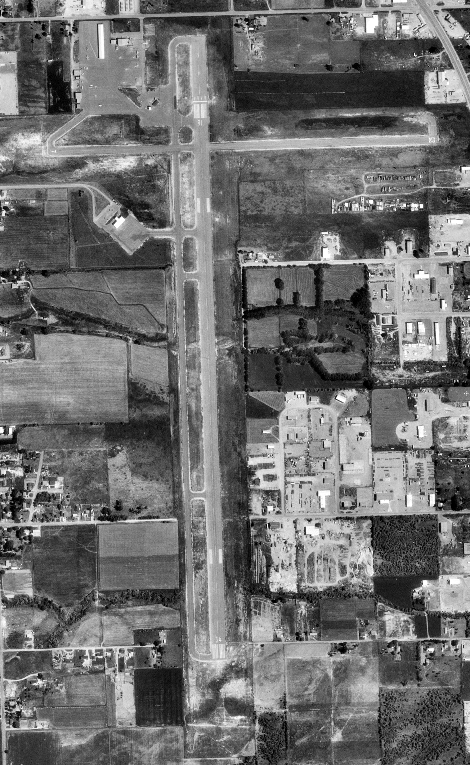
| lêste | 12 jun 2009, 05.04 | | 1.515 × 2.468 (1,12 MB) | AuburnPilot | == Summary == {{Information |Description=Satellite image of Vernal Regional Airport in Vernal, Utah on 4 July 1997 |Source=United States Geological Survey, TerraServer-USA |Date=1997-07-04 |Author=USGS |Permission=Public dom |
Bestânsgebrûk
De neikommende side brûkt dit bestân:
Globaal bestânsgebrûk
De neikommende oare wiki's brûke dit bestân:
- Gebrûk op arz.wikipedia.org
- Gebrûk op ceb.wikipedia.org
- Gebrûk op en.wikipedia.org
- Gebrûk op fa.wikipedia.org
- Gebrûk op tg.wikipedia.org
- Gebrûk op ur.wikipedia.org
- Gebrûk op www.wikidata.org