
Ofbyld:South Africa Eastern Cape relief location map.svg

Size of this PNG preview of this SVG file: 800 × 556 piksels. Oare resolúsjes: 320 × 222 piksels | 640 × 445 piksels | 1.024 × 712 piksels | 1.280 × 889 piksels | 2.560 × 1.779 piksels | 1.298 × 902 piksels.
Oarspronklik bestân (SVG-bestân, nominaal 1.298 × 902 pixels, bestânsgrutte: 2,29 MB)
| Beskriuwing |
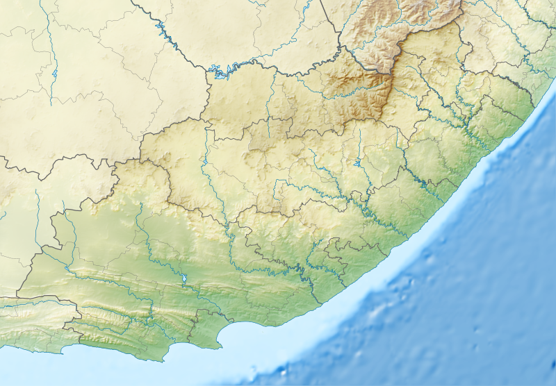
English: Relief location map of the Eastern Cape
Equirectangular projection, N/S stretching 117%. Geographic limits of the map:
|
| Datum | |
| Boarne |
|
| Auteur | Htonl |
| Tastimming (Reusing this file) |
I, the copyright holder of this work, hereby publish it under the following license: This file is licensed under the Creative Commons Attribution-Share Alike 3.0 Unported license.
|
| Oare ferzjes | File:South Africa Eastern Cape location map.svg |
Triemskiednis
Klik op in datum/tiid om it bestân te besjen sa't it op dat stuit wie.
| Datum/Tiid | Miniatuer | ôfmjittings | Meidogger | Opmerking | |
|---|---|---|---|---|---|
| lêste | 5 jan 2013, 00.05 | | 1.298 × 902 (2,29 MB) | Htonl | Fix Lesotho masking |
| 4 jan 2013, 23.48 |  | 1.298 × 902 (2,29 MB) | Htonl | {{Information |Description ={{en|1=Relief location map of the Eastern Cape Equirectangular projection, N/S stretching 117%. Geographic limits of the map: * N: 29.75° S * S: 34.5° S * W: 22.5° E * E: 30.5° E}} |Source ... |
Bestânsgebrûk
De neikommende side brûkt dit bestân:
Globaal bestânsgebrûk
De neikommende oare wiki's brûke dit bestân:
- Gebrûk op af.wikipedia.org
- Gebrûk op ar.wikipedia.org
- Gebrûk op ban.wikipedia.org
- Gebrûk op bg.wikipedia.org
- Gebrûk op bn.wikipedia.org
- Gebrûk op ceb.wikipedia.org
- Gebrûk op de.wikipedia.org
- Gebrûk op en.wikipedia.org
- King Phalo Airport
- Chief Dawid Stuurman International Airport
- MTS Oceanos
- Ben Macdhui (Eastern Cape)
- Mountain Zebra National Park
- Mthatha
- Nahoon River
- South African PGA Championship
- Shamwari Game Reserve
- Port Alfred Airport
- Inkwenkwezi Private Game Reserve
- User:Xhantar/Sandbox2
- Mthatha Airport
- Doddington (East Indiaman)
- Kouga Dam
- Orange–Fish River Tunnel
- South African Masters
- Africa Open
- Great Fish River Nature Reserve
- Baviaanskloof Mega Reserve
- Commando Drift Nature Reserve
- East London Coast Nature Reserve
- Hluleka Nature Reserve
- Mpofu Nature Reserve
Mear globaal gebrûk fan dit bestân besjen.