
Ofbyld:Roman.Britain.north.350.400.jpg

Grutte fan dit proefbyld: 735 × 599 piksels. Oare resolúsjes: 294 × 240 piksels | 589 × 480 piksels | 942 × 768 piksels | 1.256 × 1.024 piksels | 2.511 × 2.048 piksels | 2.862 × 2.334 piksels.
Oarspronklik bestân (2.862 × 2.334 pixels, bestânsgrutte: 822 KB, MIME-type: image/jpeg)
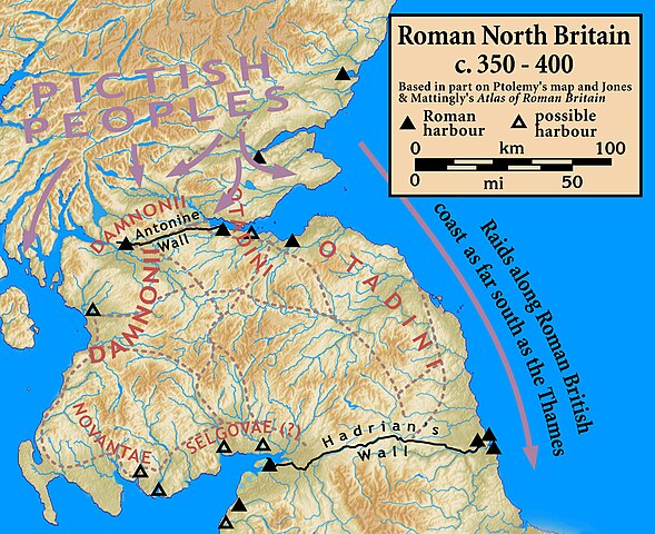
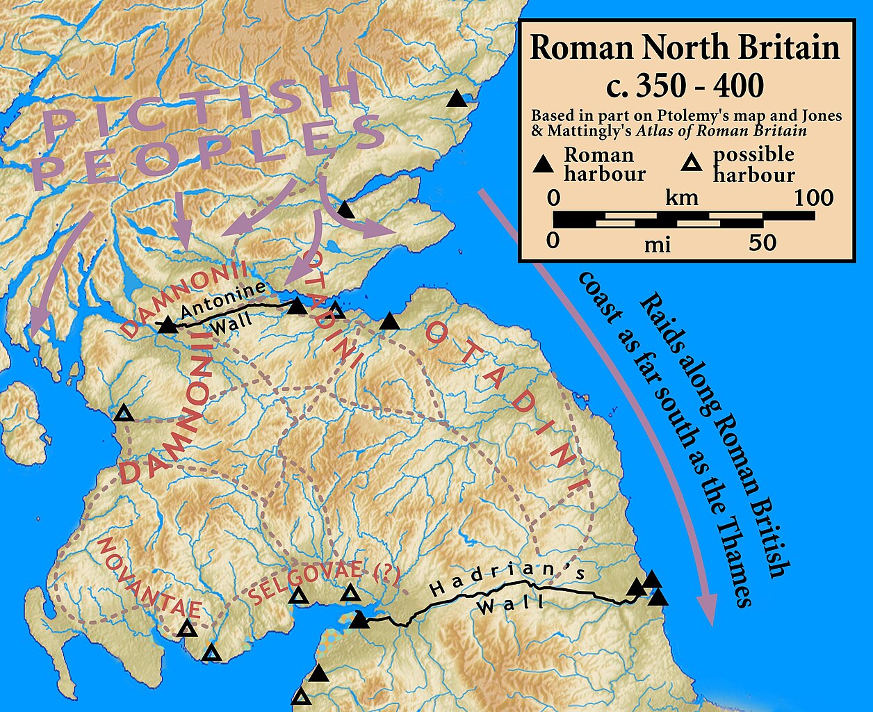
| Beskriuwing | Northern Roman Britain, c. 350–400 |
| Datum | |
| Boarne |
Based on Ptolemy's map and other sources; harbor locations and other information based on Jones & Mattingly's Atlas of Roman Britain (ISBN 978-1-84217-06700, 1990, reprinted 2007) — the sources are cited in the image legend
|
| Auteur | my work |
I, the copyright holder of this work, hereby publish it under the following license:
This file is licensed under the Creative Commons Attribution-Share Alike 3.0 Unported license.
- Fiel jo frij:
- te dielen – it wurk te kopiearjen, fersprieden en út te stjoeren
- te fermingen – it wurk oan te passen
- Under de neikommende betingsten:
- Nammefermelding – You must give appropriate credit, provide a link to the license, and indicate if changes were made. You may do so in any reasonable manner, but not in any way that suggests the licensor endorses you or your use.
- Lyk diele – If you remix, transform, or build upon the material, you must distribute your contributions under the same or compatible license as the original.
Triemskiednis
Klik op in datum/tiid om it bestân te besjen sa't it op dat stuit wie.
| Datum/Tiid | Miniatuer | ôfmjittings | Meidogger | Opmerking | |
|---|---|---|---|---|---|
| lêste | 1 okt 2010, 00.00 | | 2.862 × 2.334 (822 KB) | Notuncurious | {{Information |Description=Northern Roman Britain, c. 350–400 |Source=Based on Ptolemy's map and other sources; harbor locations and other information based on Jones & Mattingly's ''Atlas of Roman Britain'' (ISBN 978-1-84217-06700, 1990, reprinted 2 |
Bestânsgebrûk
De neikommende side brûkt dit bestân:
Globaal bestânsgebrûk
De neikommende oare wiki's brûke dit bestân:
- Gebrûk op br.wikipedia.org
- Gebrûk op de.wikipedia.org
- Gebrûk op en.wikipedia.org
- Gebrûk op es.wikipedia.org
- Gebrûk op fa.wikipedia.org
- Gebrûk op fr.wikipedia.org
- Gebrûk op it.wikipedia.org
- Gebrûk op nl.wikipedia.org
- Gebrûk op pt.wikipedia.org
- Gebrûk op ru.wikipedia.org
- Gebrûk op www.wikidata.org