
Ofbyld:Ph locator map luzon.png
Gjin hegere resolúsje beskikber.
Ph_locator_map_luzon.png (300 × 440 pixels, bestânsgrutte: 20 KB, MIME-type: image/png)
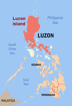
Map of the Philippines showing the location of the island of Luzon.
Edited map by Magalhães from original by en:User:seav

|
Der wurdt tastimming jûn ta kopiearjen, fersprieden en/of wizigjen fan dit dokumint ûnder de betinksten fan de GNU-lisinsje foar iepen dokumintaasje, ferzje 1.2, as eltse lettere ferzje útjûn troch de Free Software Foundation; sûnder Ynfariante Seksjes, sûnder Omkaftteksten foar de Foarkante en sûnder Omkaftteksten foar de Efterkante. In kopy fan de lisinsje is opnaam yn de seksje "Text of the GNU Free Documentation License". |
| This file is licensed under the Creative Commons Attribution-Share Alike 3.0 Unported license. | ||
| ||
| This licensing tag was added to this file as part of the GFDL licensing update. |
Triemskiednis
Klik op in datum/tiid om it bestân te besjen sa't it op dat stuit wie.
| Datum/Tiid | Miniatuer | ôfmjittings | Meidogger | Opmerking | |
|---|---|---|---|---|---|
| lêste | 20 jun 2006, 21.38 | | 300 × 440 (20 KB) | Magalhães | Map of the Philippines showing the location of Luzon Island. Editted map by ~~~ from [:Image:Ph locator map ilocos norte.png original] by en:User:seav {{GFDL}} |
Bestânsgebrûk
De neikommende side brûkt dit bestân:
Globaal bestânsgebrûk
De neikommende oare wiki's brûke dit bestân:
- Gebrûk op bn.wikipedia.org
- Gebrûk op br.wikipedia.org
- Gebrûk op cs.wikinews.org
- Gebrûk op cy.wikipedia.org
- Gebrûk op de.wikipedia.org
- Gebrûk op el.wikipedia.org
- Gebrûk op en.wikipedia.org
- Gebrûk op en.wikinews.org
- Gebrûk op es.wikipedia.org
- Gebrûk op fi.wikipedia.org
- Gebrûk op frr.wikipedia.org
- Gebrûk op he.wikivoyage.org
- Gebrûk op incubator.wikimedia.org
- Gebrûk op ja.wikipedia.org
- Gebrûk op ka.wikipedia.org
- Gebrûk op lt.wikipedia.org
- Gebrûk op mr.wikipedia.org
- Gebrûk op nl.wikipedia.org
- Gebrûk op pl.wikivoyage.org
- Gebrûk op pt.wikipedia.org
- Gebrûk op simple.wikipedia.org
- Gebrûk op sw.wikipedia.org
- Gebrûk op uk.wikipedia.org
- Gebrûk op xmf.wikipedia.org