
Ofbyld:Map of USA MO.svg

Size of this PNG preview of this SVG file: 286 × 186 piksels. Oare resolúsjes: 320 × 208 piksels | 640 × 416 piksels | 1.024 × 666 piksels | 1.280 × 832 piksels | 2.560 × 1.665 piksels.
Oarspronklik bestân (SVG-bestân, nominaal 286 × 186 pixels, bestânsgrutte: 167 KB)
Clickable version
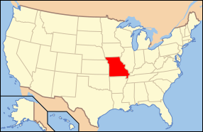
| Beskriuwing | Map of USA with Missouri highlighted | ||||||||
| Datum | see file history below. | ||||||||
| Boarne | Eigen wurk (Original text: own work by uploader, based on Image:Map of USA without state names.svg) | ||||||||
| Auteur |
This version: uploader Base versions this one is derived from: originally created by en:User:Wapcaplet |
||||||||
| Tastimming (Reusing this file) |
This file is licensed under the Creative Commons Attribution 2.0 Generic license.
|
||||||||
| Oare ferzjes |
Derivative works of this file: Missouri Lead Belt counties locator v1.svg image:Map of USA with state names.svg |
||||||||
| SVG genesis |

Triemskiednis
Klik op in datum/tiid om it bestân te besjen sa't it op dat stuit wie.
| Datum/Tiid | Miniatuer | ôfmjittings | Meidogger | Opmerking | |
|---|---|---|---|---|---|
| lêste | 9 jun 2006, 09.18 | | 286 × 186 (167 KB) | Huebi~commonswiki | {{Information| |Description=Map of USA with Missouri highlighted |other_versions=image:Map of USA with state names.svg }} Category:Maps of the United States Category:Maps of Missouri Category:SVG maps {{GFDL-en}}{{cc-by-2.0}}{{cc-by-sa- |
Bestânsgebrûk
Der binne gjin siden dy't dit bestân brûke.
Globaal bestânsgebrûk
De neikommende oare wiki's brûke dit bestân:
- Gebrûk op af.wikipedia.org
- Gebrûk op ang.wikipedia.org
- Gebrûk op an.wikipedia.org
- Gebrûk op arc.wikipedia.org
- Gebrûk op arz.wikipedia.org
- Gebrûk op ay.wikipedia.org
- Gebrûk op azb.wikipedia.org
- Gebrûk op az.wikipedia.org
- Gebrûk op az.wiktionary.org
- Gebrûk op bat-smg.wikipedia.org
- Gebrûk op ba.wikipedia.org
- Gebrûk op be-tarask.wikipedia.org
- Gebrûk op bg.wikipedia.org
- Одрейн (окръг, Мисури)
- Бери (окръг, Мисури)
- Бентън (окръг, Мисури)
- Болинджър (окръг, Мисури)
- Бун (окръг, Мисури)
- Бюканън (окръг, Мисури)
- Колдуел (окръг, Мисури)
- Колъуей (окръг, Мисури)
- Камдън (окръг, Мисури)
- Кейп Жирардо (окръг, Мисури)
- Керъл (окръг, Мисури)
- Картър (окръг, Мисури)
- Кас (окръг, Мисури)
- Сидър (окръг, Мисури)
- Шаритън (окръг, Мисури)
- Крисчън (окръг, Мисури)
- Кларк (окръг, Мисури)
- Клинтън (окръг, Мисури)
- Коул (окръг, Мисури)
- Купър (окръг, Мисури)
- Кроуфорд (окръг, Мисури)
- Дейд (окръг, Мисури)
- Далас (окръг, Мисури)
- Дейвис (окръг, Мисури)
- Дикалб (окръг, Мисури)
- Дент (окръг, Мисури)
- Дъглас (окръг, Мисури)
- Дънклин (окръг, Мисури)
- Франклин (окръг, Мисури)
- Гаскънейд (окръг, Мисури)
- Джентри (окръг, Мисури)
- Грийн (окръг, Мисури)
- Грънди (окръг, Мисури)
- Харисън (окръг, Мисури)
- Хенри (окръг, Мисури)
- Хикъри (окръг, Мисури)
Mear globaal gebrûk fan dit bestân besjen.