
Ofbyld:Frisian kingdom.gif
Grutte fan dit proefbyld: 640 × 599 piksels. Oare resolúsjes: 256 × 240 piksels | 945 × 885 piksels.
Oarspronklik bestân (945 × 885 pixels, bestânsgrutte: 98 KB, MIME-type: image/gif, looped, 10 frames, 30 s)
Gearfetting
| Beskriuwing |
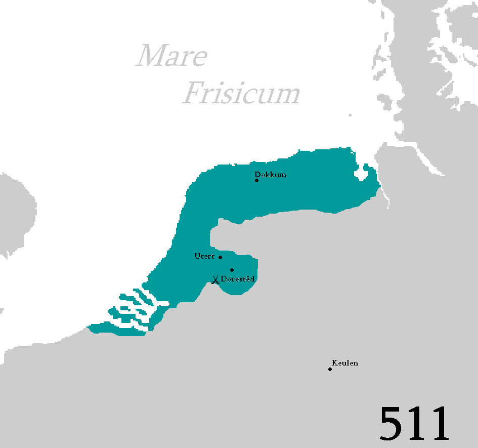
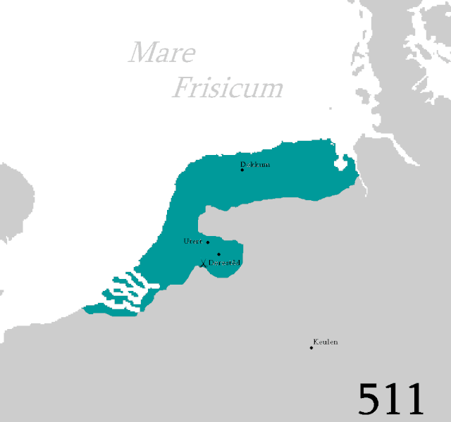
Frysk: Kaart fan it Fryske keningryk yn de 6e, 7e en 8e ieu.
English: Map of the Frisian kingdom in the 6th, 7th and 8th century.
Русский: Карта Фризского королевства в 6, 7 и 8 веке. |
| Datum | |
| Boarne | Eigen wurk |
| Auteur | Blautosk |
Lisinsje
| I, the copyright holder of this work, release this work into the public domain. This applies worldwide. In some countries this may not be legally possible; if so: I grant anyone the right to use this work for any purpose, without any conditions, unless such conditions are required by law. |
Triemskiednis
Klik op in datum/tiid om it bestân te besjen sa't it op dat stuit wie.
| Datum/Tiid | Miniatuer | ôfmjittings | Meidogger | Opmerking | |
|---|---|---|---|---|---|
| lêste | 7 feb 2021, 03.26 | | 945 × 885 (98 KB) | Alphathon | removed dither pattern to prevent Moiré when scaled |
| 16 mai 2009, 14.25 |  | 945 × 885 (136 KB) | Blautosk | {{Information |Description={{fy|1=Kaart fan it Fryske keningryk yn de 6e, 7e en 8e ieu.}} {{en|1=Map of the Frisian kingdom in the 6th, 7th and 8th century.}} |Source=Own work by uploader |Author=Blautosk |Date=2009-05-15 |Permission= |o |
Bestânsgebrûk
Der binne gjin siden dy't dit bestân brûke.
Globaal bestânsgebrûk
De neikommende oare wiki's brûke dit bestân:
- Gebrûk op be.wikipedia.org
- Gebrûk op da.wikipedia.org
- Gebrûk op en.wikipedia.org
- Gebrûk op et.wikipedia.org
- Gebrûk op fr.wikipedia.org
- Gebrûk op gl.wikipedia.org
- Gebrûk op mzn.wikipedia.org
- Gebrûk op pl.wikipedia.org
- Gebrûk op ru.wikipedia.org
- Gebrûk op uk.wikipedia.org
- Gebrûk op www.wikidata.org