
Ofbyld:BlankEurope.png

Grutte fan dit proefbyld: 595 × 599 piksels. Oare resolúsjes: 238 × 240 piksels | 477 × 480 piksels | 762 × 768 piksels | 1.236 × 1.245 piksels.
Oarspronklik bestân (1.236 × 1.245 pixels, bestânsgrutte: 78 KB, MIME-type: image/png)

|
Ofbyld:Blank map of Europe (with disputed regions).svg is in fektorferzje fan dizze triem. As net fan sljochtere kwaliteit tsjinnet dizze brûkt te wurden yn plak fan dizze rasterôfbylding.
File:BlankEurope.png → File:Blank map of Europe (with disputed regions).svg
Sjoch Help:SVG foar mear ynformaasje. |
.svg) |
Gearfetting
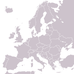
A blank political map of Europe extracted from Image:European Union member states by number of houses.png. +Hexagon1 (t) 04:47, 26 November 2006 (UTC)
Other versions: if you wish to use a map to show historical information before 2008, use Image:BlankEurope-BeforeKosovo.png
Lisinsje

|
Der wurdt tastimming jûn ta kopiearjen, fersprieden en/of wizigjen fan dit dokumint ûnder de betinksten fan de GNU-lisinsje foar iepen dokumintaasje, ferzje 1.2, as eltse lettere ferzje útjûn troch de Free Software Foundation; sûnder Ynfariante Seksjes, sûnder Omkaftteksten foar de Foarkante en sûnder Omkaftteksten foar de Efterkante. In kopy fan de lisinsje is opnaam yn de seksje "Text of the GNU Free Documentation License". |
| This file is licensed under the Creative Commons Attribution-Share Alike 3.0 Unported license. | ||
| ||
| This licensing tag was added to this file as part of the GFDL licensing update. |
Triemskiednis
Klik op in datum/tiid om it bestân te besjen sa't it op dat stuit wie.
| Datum/Tiid | Miniatuer | ôfmjittings | Meidogger | Opmerking | |
|---|---|---|---|---|---|
| lêste | 26 sep 2022, 15.31 | | 1.236 × 1.245 (78 KB) | BlackShadowG | Reverted to version as of 14:55, 27 October 2008 (UTC) |
| 24 feb 2009, 00.40 |  | 1.236 × 1.245 (78 KB) | Avala | ||
| 27 okt 2008, 16.55 |  | 1.236 × 1.245 (78 KB) | Quilbert | Reverted to version as of 05:53, 5 April 2008 – there is already Image:BlankEurope-BeforeKosovo.png | |
| 24 okt 2008, 20.13 |  | 1.236 × 1.245 (78 KB) | Avala | ||
| 5 apr 2008, 07.53 |  | 1.236 × 1.245 (78 KB) | Hoshie | redid microstates, beefed up Spanish N. Africa, SBAs, and Gibraltar | |
| 25 feb 2008, 20.42 |  | 1.236 × 1.245 (78 KB) | Hoshie | fixed Gibraltar, Ceuta and Melilla, and the SBAs | |
| 24 feb 2008, 04.39 |  | 1.236 × 1.245 (78 KB) | Hoshie | Added Kosovo since it has been internationally recognized | |
| 4 jan 2008, 00.40 |  | 1.236 × 1.245 (78 KB) | Hoshie | Re-drew ESBA and WSBA with circles until I study the CIA maps, boundary between Gibraltar and Spain. | |
| 26 nov 2006, 06.47 |  | 1.236 × 1.245 (44 KB) | Happenstance | A blank map of Europe extracted from Image:European Union member states by number of houses.png. ~~~~ |
Bestânsgebrûk
Der binne gjin siden dy't dit bestân brûke.
Globaal bestânsgebrûk
De neikommende oare wiki's brûke dit bestân:
- Gebrûk op de.wiktionary.org
- Gebrûk op hu.wikipedia.org
- Gebrûk op incubator.wikimedia.org
- Gebrûk op it.wiktionary.org
- Gebrûk op sl.wiktionary.org
- Gebrûk op uk.wikipedia.org