
Ofbyld:Beleg van Grol (Groenlo) - Siege of Grol - 1627 - Approches.jpg

Grutte fan dit proefbyld: 800 × 583 piksels. Oare resolúsjes: 320 × 233 piksels | 640 × 466 piksels | 1.024 × 746 piksels | 1.280 × 932 piksels | 2.768 × 2.016 piksels.
Oarspronklik bestân (2.768 × 2.016 pixels, bestânsgrutte: 1,44 MB, MIME-type: image/jpeg)
_-_Siege_of_Grol_-_1627_-_Approches.jpg)
Gearfetting
| Beskriuwing |
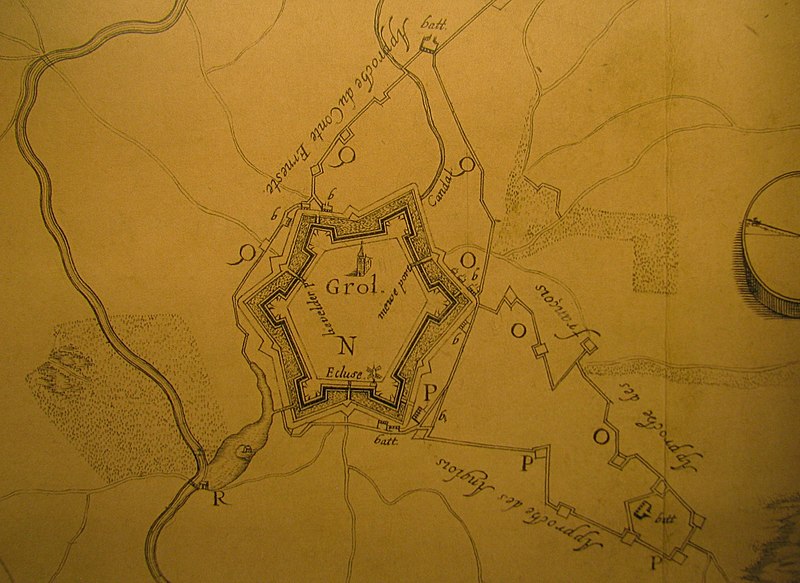
English: The siege of Grol (Groenlo) of 1627: detail of a map by Hondius, showing the 'approches' that have been dug towards the city of Grol.
Nederlands: Detail van een kaart van het beleg van Grol (Groenlo) in 1627, door Hendrick Hondius. Te zien zijn de approches die gegraven zijn richting de stad. |
|||||||||||||||||||||||||
| Datum | ||||||||||||||||||||||||||
| Boarne | Collectie Bodel Nijenhuis, Universiteitsbibliotheek Leiden | |||||||||||||||||||||||||
| Auteur |
|
|||||||||||||||||||||||||
Lisinsje
|
This work is in the public domain in its country of origin and other countries and areas where the copyright term is the author's life plus 100 years or fewer. | |
| This file has been identified as being free of known restrictions under copyright law, including all related and neighboring rights. | |
Triemskiednis
Klik op in datum/tiid om it bestân te besjen sa't it op dat stuit wie.
| Datum/Tiid | Miniatuer | ôfmjittings | Meidogger | Opmerking | |
|---|---|---|---|---|---|
| lêste | 17 sep 2008, 22.20 | | 2.768 × 2.016 (1,44 MB) | Kweniston | {{Information |Description={{en|1=The siege of Grol (Groenlo) of 1627: detail of a map by Hondius, showing the 'approches' that have been dug towards the city of Grol.}} {{nl|1=Detail van een kaart van het beleg van Grol (Groenlo) in 1627, door Hendrick H |
Bestânsgebrûk
De neikommende side brûkt dit bestân:
Globaal bestânsgebrûk
De neikommende oare wiki's brûke dit bestân:
- Gebrûk op nl.wikipedia.org
_-_Siege_of_Grol_-_1627_-_Approches.jpg)