
Ofbyld:Aerial photograph 400D 2012 05 28 9026 DxO.jpg

Oarspronklik bestân (3.888 × 2.592 pixels, bestânsgrutte: 3,01 MB, MIME-type: image/jpeg)
Gearfetting
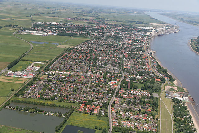
| Beskriuwing | An aerial photograph of Brake (Unterweser). |
| Datum | |
| Boarne | Eigen wurk |
| Auteur | Walter Rademacher |
| Camera location | | View this and other nearby images on: OpenStreetMap |
|---|
Lisinsje
- Fiel jo frij:
- te dielen – it wurk te kopiearjen, fersprieden en út te stjoeren
- te fermingen – it wurk oan te passen
- Under de neikommende betingsten:
- Nammefermelding – You must give appropriate credit, provide a link to the license, and indicate if changes were made. You may do so in any reasonable manner, but not in any way that suggests the licensor endorses you or your use.
- Lyk diele – If you remix, transform, or build upon the material, you must distribute your contributions under the same or compatible license as the original.

|
Der wurdt tastimming jûn ta kopiearjen, fersprieden en/of wizigjen fan dit dokumint ûnder de betinksten fan de GNU-lisinsje foar iepen dokumintaasje, ferzje 1.2, as eltse lettere ferzje útjûn troch de Free Software Foundation; sûnder Ynfariante Seksjes, sûnder Omkaftteksten foar de Foarkante en sûnder Omkaftteksten foar de Efterkante. In kopy fan de lisinsje is opnaam yn de seksje "Text of the GNU Free Documentation License". |

Foto: Walter Rademacher / Wikipedia, Original; Lizenz: CC by-sa 3.0

I have published this image as author under the "CC-BY-SA-3.0" in Wikipedia. This means that free, commercial usage outside of Wikipedia is permitted under the following licence terms:
- Online media:
- The author " Walter Rademacher/Wikipedia " is named
- A weblink to the original image is provided: https://commons.wikimedia.org/wiki/File:Aerial_photograph_400D_2012_05_28_9026_DxO.jpg
- A copy of, or the Uniform Resource Identifier (https://creativecommons.org/licenses/by-sa/3.0/de/legalcode) for, this License with every copy
- Print media:
- The author "Walter Rademacher/Wikipedia" is named
- A copy of, or the Uniform Resource Identifier (https://creativecommons.org/licenses/by-sa/3.0/de/legalcode) for, this License with every copy
Please send me a specimen copy or the URL of the website where the image is used.
Please write an email to buelsdorf@gmx.de, if you
- need the image in a higher resolution
- need my postal address for sending a specimen copy
- have further questions about the terms of the licence
PS:Any of the above conditions can be waived if you get permission from the copyright holder.
-
| Dieses Foto entstand aufgrund eines Projektes, das von Wikimedia Deutschland e. V. gefördert wurde.
Im Rahmen des „Community-Projektbudgets“ sollen Luftbilder u.a. von Inseln, Halligen, Sanden und Küstenstädten der deutschen Nordseeküste angefertigt werden. Das Projekt „Fotoflüge“ wurde im September 2011 begonnen. |
Foto selbst aufgenommen mit Canon EOS 60D:
von Wikipedia-User:Walter Rademacher |

|
Triemskiednis
Klik op in datum/tiid om it bestân te besjen sa't it op dat stuit wie.
| Datum/Tiid | Miniatuer | ôfmjittings | Meidogger | Opmerking | |
|---|---|---|---|---|---|
| lêste | 8 jun 2012, 11.59 | | 3.888 × 2.592 (3,01 MB) | Walter Rademacher |
Bestânsgebrûk
De neikommende side brûkt dit bestân:
Globaal bestânsgebrûk
De neikommende oare wiki's brûke dit bestân:
- Gebrûk op azb.wikipedia.org
- Gebrûk op da.wikipedia.org
- Gebrûk op de.wikipedia.org
- Gebrûk op fr.wikipedia.org
- Gebrûk op la.wikipedia.org
- Gebrûk op mk.wikipedia.org
- Gebrûk op pl.wikipedia.org
- Gebrûk op pt.wikipedia.org
- Gebrûk op sr.wikipedia.org
- Gebrûk op sv.wikipedia.org
- Gebrûk op uk.wikipedia.org