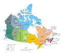
Ofbyld:Political map of Canada ar.png
Appearance
Political_map_of_Canada_ar.png (693 × 599 pixels, bestânsgrutte: 147 KB, MIME-type: image/png)
Triemskiednis
Klik op in datum/tiid om it bestân te besjen sa't it op dat stuit wie.
| Datum/Tiid | Miniatuer | ôfmjittings | Meidogger | Opmerking | |
|---|---|---|---|---|---|
| lêste | 19 jan 2011, 16.54 |  | 693 × 599 (147 KB) | باسم | Grammatical correction |
| 19 jan 2011, 16.51 |  | 693 × 599 (147 KB) | باسم | Grammatical correction | |
| 19 jan 2011, 16.21 |  | 693 × 599 (147 KB) | باسم | Grammatical corrections | |
| 2 des 2010, 17.05 |  | 693 × 599 (148 KB) | باسم | {{Information |Description={{en|1=A map of Canada exhibiting its ten provinces and three territories, and their capitals. (Lambert conformal conic projection from [http://atlas.gc.ca/site/english/maps/reference/national/can_political_e The Atlas of Canada |
Bestânsgebrûk
Der binne gjin siden dy't dit bestân brûke.
Globaal bestânsgebrûk
De neikommende oare wiki's brûke dit bestân:
- Gebrûk op ar.wikipedia.org
- Gebrûk op ckb.wikipedia.org

