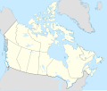
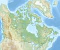
Dit bestân komt fan Wikimedia Commons, en kin ek troch oare projekten brûkt wurde.
De beskriuwing op syn bestânsside dêre wurdt hjirûnder werjûn.
Gearfetting
Map Info
Properties
Projection:
Lambert conformal conic
Datum:
WGS84
Central Meridian:
95.000000°W
Latitude of Origin:
60.000000°N
Standard Parallel #1:
49.000000°N
Standard Parallel #2:
77.000000°N
Mathematics (conversion from latitude and longitude to image coordinate)
x (%)=
201.7818903*(((tan(pi*(90-$1)/360))*(((1+0.08181919084*sin(pi*$1/180))/(1-0.08181919084*sin(pi*$1/180)))^0.04090959542))^0.9007900864)*sin(0.01572175288*($2+95))+43.98563734
y (%)=
238.6252927*(((tan(pi*(90-$1)/360))*(((1+0.08181919084*sin(pi*$1/180))/(1-0.08181919084*sin(pi*$1/180)))^0.04090959542))^0.9007900864)*cos(0.01572175288*($2+95))-15.81495465
$1:
latitude in degrees (positive for all locations in Canada).
$2:
longitude in degrees (negative for all locations in Canada).
x (%):
x coordinate expressed as percentage of image width (measured from left edge).
y (%):
y coordinate expressed as percentage of image height (measured from top edge).
POIs
x (px)
y (px)
x (%)
y (%)
Latitude
Longitude
Top Left Corner:
0.000
0.000
0.00
0.00
68.220310°N
176.138684°W
Top Right Corner:
1114.000
0.000
100.00
0.00
62.238635°N
9.994317°W
Bottom Right Corner:
1114.000
942.000
100.00
100.00
34.831244°N
61.953430°W
Bottom Left Corner:
0.000
942.000
0.00
100.00
37.392537°N
121.850536°W
Centre:
557.000
471.000
50.00
50.00
63.068962°N
88.152750°W
Origin:
490.000
541.000
43.99
57.43
60.000000°N
95.000000°W
North Pole:
490.000
-148.977
43.99
-15.81
90.000000°N
⸻
Thechàl Dhâl:
67.523
368.241
6.06
39.09
61.022873°N
138.564925°W
Lisinsje
I, the copyright holder of this work, hereby publish it under the following license:
Fiel jo frij:
te dielen – it wurk te kopiearjen, fersprieden en út te stjoerente fermingen – it wurk oan te passen
Under de neikommende betingsten:
Nammefermelding – You must give appropriate credit, provide a link to the license, and indicate if changes were made. You may do so in any reasonable manner, but not in any way that suggests the licensor endorses you or your use.Lyk diele – If you remix, transform, or build upon the material, you must distribute your contributions under the same or compatible license as the original. https://creativecommons.org/licenses/by-sa/4.0 CC BY-SA 4.0 Creative Commons Attribution-Share Alike 4.0 true true Frysk Add a one-line explanation of what this file represents
Frânsk carte politique du Canada
Cajun French Location map of Canada
Triemskiednis
Bestânsgebrûk
Der binne gjin siden dy't dit bestân brûke.
Globaal bestânsgebrûk
De neikommende oare wiki's brûke dit bestân:
Gebrûk op af.wikipedia.org
Gebrûk op azb.wikipedia.org
Gebrûk op ban.wikipedia.org
Gebrûk op ca.wikipedia.org
Gebrûk op en.wikipedia.org
Mear globaal gebrûk fan dit bestân besjen.
Dit bestân befettet oanfoljende ynformaasje, dy't troch in fotokamera, scanner of fotobewurkingsprogramma tafoege wêze kin. As it bestân oanpast is, komme de details mûglik net folslein oerien mei de feroare ôfbylding.


