
Ofbyld:Utrecht position.svg

Size of this PNG preview of this SVG file: 200 × 236 piksels. Oare resolúsjes: 203 × 240 piksels | 407 × 480 piksels | 651 × 768 piksels | 868 × 1.024 piksels | 1.736 × 2.048 piksels.
Oarspronklik bestân (SVG-bestân, nominaal 200 × 236 pixels, bestânsgrutte: 157 KB)
Gearfetting
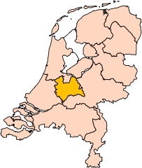
| Beskriuwing | Location of the province of Utrecht in the Netherlands. |
| Datum | |
| Boarne | Own work, based on freely available GIS data |
| Auteur | User:Mtcv |
| Tastimming (Reusing this file) |
Data: attribution required; my work: PD |
| Oare ferzjes | I attempted to make an svg version of Image:Utrecht-Position.png (with less simplified boundaries) |
Clickable version

Lisinsje

|
The copyright holder of this file, Centraal Bureau voor de Statistiek, allows anyone to use it for any purpose, provided that the copyright holder is properly attributed. Redistribution, derivative work, commercial use, and all other use is permitted. |
Nammefermelding:
|
| Annotations | This image is annotated: View the annotations at Commons |


Triemskiednis
Klik op in datum/tiid om it bestân te besjen sa't it op dat stuit wie.
| Datum/Tiid | Miniatuer | ôfmjittings | Meidogger | Opmerking | |
|---|---|---|---|---|---|
| lêste | 2 mrt 2019, 19.20 | | 200 × 236 (157 KB) | Thayts | update |
| 3 okt 2006, 02.49 |  | 200 × 236 (158 KB) | Mtcv | {{Information| |Description=Location of the province of Noord-Holland (North Holland) in the Netherlands. |Source=Own work, based on freely available GIS data |Date=2006-10-03 |Author=User:Mtcv |Permission=Data: attribution required; my work: PD |othe |
Bestânsgebrûk
Der binne gjin siden dy't dit bestân brûke.
Globaal bestânsgebrûk
De neikommende oare wiki's brûke dit bestân:
- Gebrûk op ar.wikipedia.org
- Gebrûk op be-tarask.wikipedia.org
- Gebrûk op be.wikipedia.org
- Gebrûk op cy.wikipedia.org
- Gebrûk op en.wikipedia.org
Mear globaal gebrûk fan dit bestân besjen.