
Ofbyld:Utrecht hill ridge netherlands.svg

Size of this PNG preview of this SVG file: 480 × 599 piksels. Oare resolúsjes: 192 × 240 piksels | 385 × 480 piksels | 616 × 768 piksels | 821 × 1.024 piksels | 1.642 × 2.048 piksels | 485 × 605 piksels.
Oarspronklik bestân (SVG-bestân, nominaal 485 × 605 pixels, bestânsgrutte: 24 KB)
Gearfetting
| Beskriuwing |
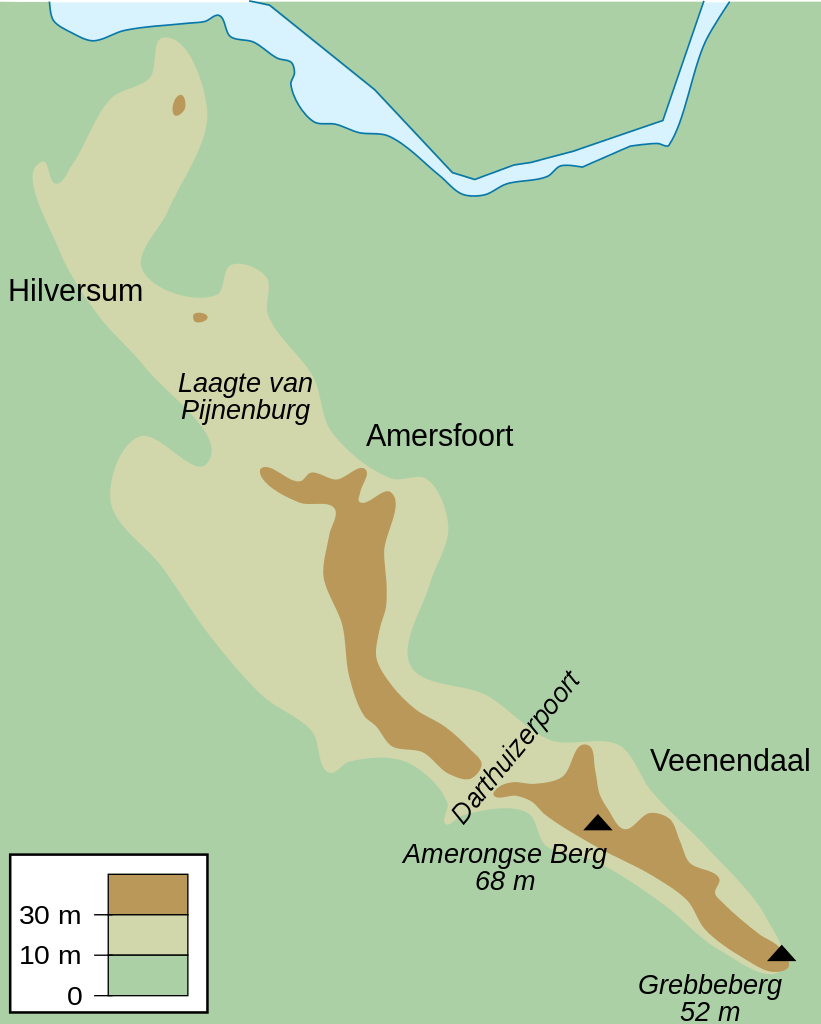
English: Map of the Utrecht Hill Ridge, a chain of hills located largely in the province of Utrecht, the Netherlands. The map shows the 10 m and 30 m contour lines, the two main peaks and the general location of several towns in the area.
Nederlands: Kaart van de Utrechtse Heuvelrug, grotendeels gelegen in de Nederlandse provincie Utrecht. De kaart toont de 10-meterlijn, de 30-meterlijn, de twee bekendste toppen en de ruwe locatie van een aantal naburige plaatsen. |
| Datum | |
| Boarne | Eigen wurk |
| Auteur | DennisM |
Lisinsje
| I, the copyright holder of this work, release this work into the public domain. This applies worldwide. In some countries this may not be legally possible; if so: I grant anyone the right to use this work for any purpose, without any conditions, unless such conditions are required by law. |
Triemskiednis
Klik op in datum/tiid om it bestân te besjen sa't it op dat stuit wie.
| Datum/Tiid | Miniatuer | ôfmjittings | Meidogger | Opmerking | |
|---|---|---|---|---|---|
| lêste | 25 jul 2010, 12.50 | | 485 × 605 (24 KB) | DennisM | {{Information |Description={{en|1=Map of the Utrecht Hill Ridge, a chain of hills located largely in the province of Utrecht, the Netherlands. The map shows the 10 m and 30 m contour lines, the two main peaks and the general location of several towns in t |
Bestânsgebrûk
De neikommende side brûkt dit bestân:
Globaal bestânsgebrûk
De neikommende oare wiki's brûke dit bestân:
- Gebrûk op en.wikipedia.org
- Gebrûk op fr.wikipedia.org
- Gebrûk op li.wikipedia.org
- Gebrûk op nl.wikipedia.org
- Gebrûk op sl.wikipedia.org
- Gebrûk op www.wikidata.org