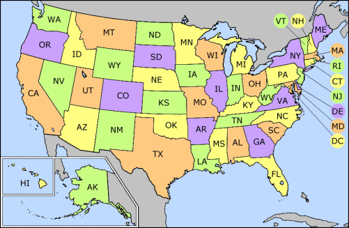
Ofbyld:US state abbrev map.png
US_state_abbrev_map.png (501 × 327 pixels, bestânsgrutte: 31 KB, MIME-type: image/png)
Triemskiednis
Klik op in datum/tiid om it bestân te besjen sa't it op dat stuit wie.
| Datum/Tiid | Miniatuer | ôfmjittings | Meidogger | Opmerking | |
|---|---|---|---|---|---|
| lêste | 24 sep 2014, 19.31 |  | 501 × 327 (31 KB) | Robin van der Vliet | Lossless compression |
| 5 mai 2005, 05.24 |  | 501 × 327 (32 KB) | Mattes | new |
Bestânsgebrûk
Der binne gjin siden dy't dit bestân brûke.
Globaal bestânsgebrûk
De neikommende oare wiki's brûke dit bestân:
- Gebrûk op ar.wikinews.org
- Gebrûk op azb.wikipedia.org
- Gebrûk op bh.wikipedia.org
- Gebrûk op bn.wikipedia.org
- Gebrûk op bs.wikipedia.org
- Kategorija:Gradovi u Sjedinjenim Američkim Državama
- Kategorija:Okruzi u Sjedinjenim Američkim Državama po saveznim državama
- Kategorija:Glavni gradovi okruga u Sjedinjenim Američkim Državama
- Kategorija:Američka kultura po saveznim državama
- Kategorija:Američki mediji po saveznim državama
- Kategorija:Košarka u Sjedinjenim Američkim Državama po saveznim državama
- Kategorija:Sport u Sjedinjenim Američkim Državama po saveznim državama
- Gebrûk op ca.wikipedia.org
- Gebrûk op cs.wikipedia.org
- Gebrûk op da.wikipedia.org
- Gebrûk op de.wikipedia.org
- Gebrûk op el.wikipedia.org
- Gebrûk op en.wikipedia.org
- List of American military installations
- List of U.S. state and territory abbreviations
- Category:State governments of the United States
- Category:Categories by state or territory of the United States
- User:Fadookie
- Category:States of the United States
- User:Fadookie/Userbox
- Category:Radio stations in the United States by state
- Category:Mass media in the United States by state or territory
- Category:Communications in the United States by state or territory
- Category:Lists of newspapers published in the United States by state
- Category:Television stations in the United States by state
- Category:Films set in the United States by state
- Category:Restaurants in the United States by state or territory
- Category:American people by state or territory
- Category:Architecture in the United States by state
- Category:Health in the United States by state
- User:Northamerica1000/Notepad
- Category:Newspapers published in the United States by state
- Lists of restaurants
- User:Visviva/Map
- Category:Lists of African-American newspapers
- Category:COVID-19 pandemic in the United States by state
- User:Iketsi/sandbox/disc golf
- Gebrûk op eo.wikipedia.org
- Gebrûk op fa.wikipedia.org
- Gebrûk op fr.wikipedia.org
Mear globaal gebrûk fan dit bestân besjen.


