
Ofbyld:USA Minnesota location map.svg

Size of this PNG preview of this SVG file: 514 × 599 piksels. Oare resolúsjes: 206 × 240 piksels | 412 × 480 piksels | 658 × 768 piksels | 878 × 1.024 piksels | 1.756 × 2.048 piksels | 1.029 × 1.200 piksels.
Oarspronklik bestân (SVG-bestân, nominaal 1.029 × 1.200 pixels, bestânsgrutte: 697 KB)
Gearfetting
| Beskriuwing |
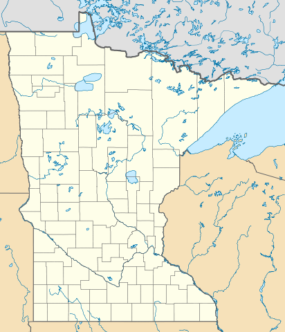
Deutsch: Positionskarte von Minnesota, USA
Quadratische Plattkarte, N-S-Streckung 150.0 %. Geographische Begrenzung der Karte:
|
| Datum | |
| Boarne | Eigen wurk |
| Auteur | Alexrk2 |
| Oare ferzjes |
Derivative works of this file: BMO Harris Bank 2012-06.png Derivative works of this file: |

|
This map has been made or improved in the German Kartenwerkstatt (Map Lab). You can propose maps to improve as well.
|
Lisinsje
I, the copyright holder of this work, hereby publish it under the following licenses:

|
Der wurdt tastimming jûn ta kopiearjen, fersprieden en/of wizigjen fan dit dokumint ûnder de betinksten fan de GNU-lisinsje foar iepen dokumintaasje, ferzje 1.2, as eltse lettere ferzje útjûn troch de Free Software Foundation; sûnder Ynfariante Seksjes, sûnder Omkaftteksten foar de Foarkante en sûnder Omkaftteksten foar de Efterkante. In kopy fan de lisinsje is opnaam yn de seksje "Text of the GNU Free Documentation License". |
This file is licensed under the Creative Commons Attribution 3.0 Unported license.
- Fiel jo frij:
- te dielen – it wurk te kopiearjen, fersprieden en út te stjoeren
- te fermingen – it wurk oan te passen
- Under de neikommende betingsten:
- Nammefermelding – You must give appropriate credit, provide a link to the license, and indicate if changes were made. You may do so in any reasonable manner, but not in any way that suggests the licensor endorses you or your use.
You may select the license of your choice.
| Annotations | This image is annotated: View the annotations at Commons |
Triemskiednis
Klik op in datum/tiid om it bestân te besjen sa't it op dat stuit wie.
| Datum/Tiid | Miniatuer | ôfmjittings | Meidogger | Opmerking | |
|---|---|---|---|---|---|
| lêste | 21 jun 2009, 14.06 | | 1.029 × 1.200 (697 KB) | Alexrk2 | simp water |
| 21 jun 2009, 13.53 |  | 1.029 × 1.200 (700 KB) | Alexrk2 | == Beschreibung == {{Information |Description= {{de|Positionskarte von Minnesota, USA}} Quadratische Plattkarte, N-S-Streckung 150.0 %. Geographische Begrenzung der Karte: * N: 49.6° N * S: 43.3° N * W: 97.4° W * O: 89.3° |
Bestânsgebrûk
De neikommende 7 siden brûke dit bestân:
Globaal bestânsgebrûk
De neikommende oare wiki's brûke dit bestân:
- Gebrûk op an.wikipedia.org
- Gebrûk op ar.wikipedia.org
- Gebrûk op arz.wikipedia.org
- Gebrûk op ast.wikipedia.org
- Gebrûk op azb.wikipedia.org
- فرونتنک، مینهسوتا
- رایس لیک، مینهسوتا
- الکور، مینهسوتا
- فیش لیک، مینهسوتا
- ساوت تروی، مینهسوتا
- برنتساید، مینهسوتا
- بوسترینق، مینهسوتا
- سنترال لیکس، مینهسوتا
- اماویل، مینهسوتا
- جنوا، مینهسوتا
- نیو سوئیدن، مینهسوتا
- سیجینا، مینهسوتا
- میکینن، مینهسوتا
- الدز کورنر، مینهسوتا
- چستر، مینهسوتا
- کورینق، مینهسوتا
- کاشینق، مینهسوتا
- قادال، مینهسوتا
- بتانی، مینهسوتا
- اه-قواه-چینق، مینهسوتا
- فیلمور، مینهسوتا
- کلمنتسون، مینهسوتا
- قریستون، مینهسوتا
- اسنلمن، مینهسوتا
- کرافتویل، مینهسوتا
- دانویلا، مینهسوتا
- بیرچدیل، مینهسوتا
- هاینز، مینهسوتا
- داونر، مینهسوتا
- داقدیل، مینهسوتا
- سیسکو، مینهسوتا
- بیولیو، مینهسوتا
- سودان، مینهسوتا
- کاسن، مینهسوتا
- کانیون، مینهسوتا
- آنقورا، مینهسوتا
- بریمسون، مینهسوتا
- فریزلند، مینهسوتا
- بیور بی شرقی، مینهسوتا
- فرهیون، مینهسوتا
- بال کلاب، مینهسوتا
- اوساقا، مینهسوتا
Mear globaal gebrûk fan dit bestân besjen.