
Ofbyld:Southcentral Alaska Stub.png
Gjin hegere resolúsje beskikber.
Southcentral_Alaska_Stub.png (800 × 423 pixels, bestânsgrutte: 63 KB, MIME-type: image/png)
Gearfetting
| Beskriuwing |
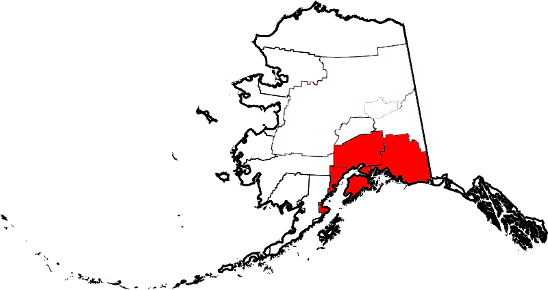
English: Map of Southcentral Alaska as defined by boroughs and census areas, based on this Alaska Office of Economic Development map |
| Datum | |
| Boarne | Image:Map of Alaska highlighting Fairbanks North Star Borough.svg |
| Auteur | L'Aquatique |
Lisinsje
| I, the copyright holder of this work, release this work into the public domain. This applies worldwide. In some countries this may not be legally possible; if so: I grant anyone the right to use this work for any purpose, without any conditions, unless such conditions are required by law. |
Triemskiednis
Klik op in datum/tiid om it bestân te besjen sa't it op dat stuit wie.
| Datum/Tiid | Miniatuer | ôfmjittings | Meidogger | Opmerking | |
|---|---|---|---|---|---|
| lêste | 8 sep 2008, 20.37 | | 800 × 423 (63 KB) | L'Aquatique | revised borders |
| 8 sep 2008, 04.04 |  | 800 × 423 (63 KB) | L'Aquatique | {{Information |Description={{en|1=A map showing the Southcentral Alaska region}} |Source=Image:Map of Alaska highlighting Fairbanks North Star Borough.svg |Author=L'Aquatique |Date=September 2008 |Permission= |other_versions= }} |
Bestânsgebrûk
De neikommende side brûkt dit bestân:
Globaal bestânsgebrûk
De neikommende oare wiki's brûke dit bestân:
- Gebrûk op af.wikipedia.org
- Gebrûk op da.wikipedia.org
- Gebrûk op en.wikipedia.org
- Gebrûk op he.wikipedia.org
- Gebrûk op hu.wikipedia.org
- Gebrûk op it.wikivoyage.org
- Gebrûk op pt.wikipedia.org
- Gebrûk op ru.wikipedia.org
- Gebrûk op simple.wikipedia.org
- Gebrûk op www.wikidata.org