
Ofbyld:Principality of Orange (1633).png
Grutte fan dit proefbyld: 800 × 560 piksels. Oare resolúsjes: 320 × 224 piksels | 640 × 448 piksels | 1.024 × 716 piksels | 1.280 × 895 piksels | 2.276 × 1.592 piksels.
Oarspronklik bestân (2.276 × 1.592 pixels, bestânsgrutte: 9,11 MB, MIME-type: image/png)
.png)
Gearfetting
| Beskriuwing |
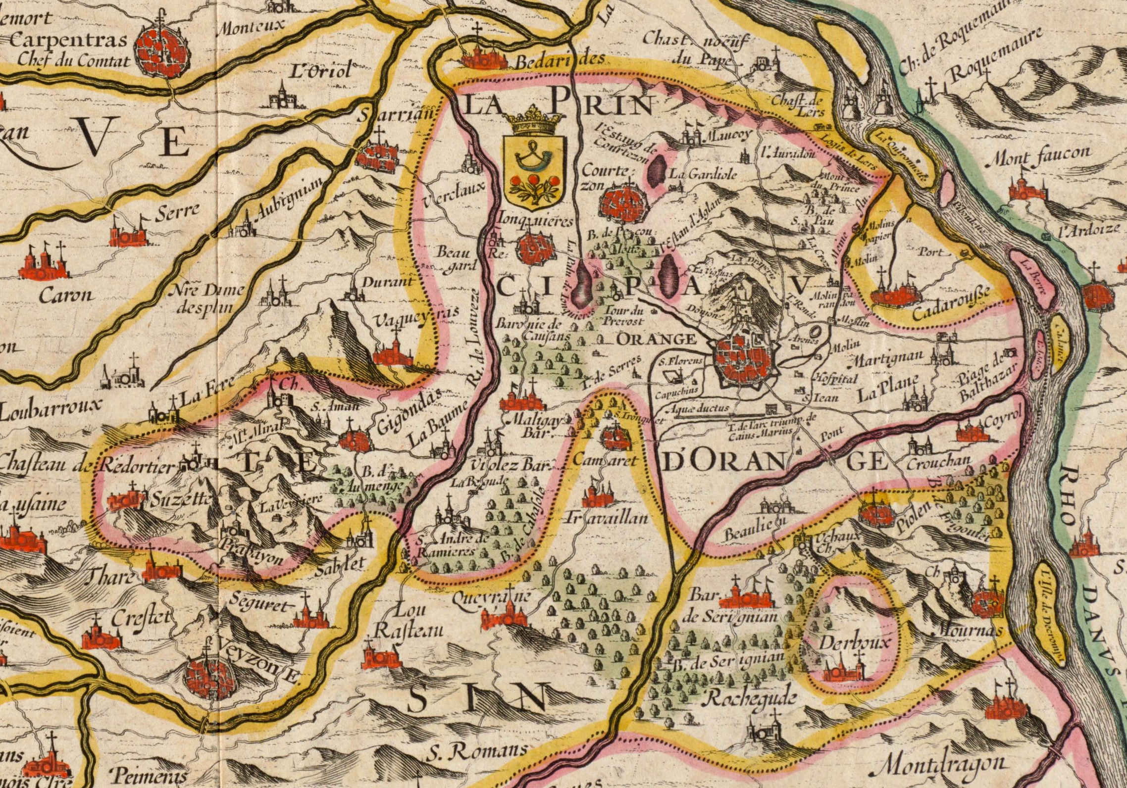
English: Territory of the Principality of Orange. Cropped from a Jan Jansson map from 1633 titled La Principauté d'Orange et comtat de Venaissin. On this map, the south is at the top and the north at the bottom, which explains why the Rhone River is on the right and the city of Carpentras on the left. |
| Datum | |
| Boarne | Digital Commonwealth Massachusetts Collection Online |
| Auteur | Jan Jansson (1588-1664) |
Lisinsje
|
This work is in the public domain in its country of origin and other countries and areas where the copyright term is the author's life plus 100 years or fewer. | |
| This file has been identified as being free of known restrictions under copyright law, including all related and neighboring rights. | |
Triemskiednis
Klik op in datum/tiid om it bestân te besjen sa't it op dat stuit wie.
| Datum/Tiid | Miniatuer | ôfmjittings | Meidogger | Opmerking | |
|---|---|---|---|---|---|
| lêste | 14 sep 2019, 10.51 | | 2.276 × 1.592 (9,11 MB) | Jfblanc | Updrate cropping including the whole Derboux enclave area. |
| 26 nov 2016, 21.20 |  | 1.226 × 687 (2,46 MB) | Lubiesque | User created page with UploadWizard |
Bestânsgebrûk
De neikommende side brûkt dit bestân:
Globaal bestânsgebrûk
De neikommende oare wiki's brûke dit bestân:
- Gebrûk op azb.wikipedia.org
- Gebrûk op en.wikipedia.org
- Gebrûk op it.wikipedia.org
- Gebrûk op ko.wikipedia.org
- Gebrûk op vi.wikipedia.org
.png)