
Ofbyld:PrEdwIsl Map.png
Grutte fan dit proefbyld: 600 × 600 piksels. Oare resolúsjes: 240 × 240 piksels | 480 × 480 piksels | 768 × 768 piksels | 1.024 × 1.024 piksels | 2.207 × 2.207 piksels.
Oarspronklik bestân (2.207 × 2.207 pixels, bestânsgrutte: 789 KB, MIME-type: image/png)
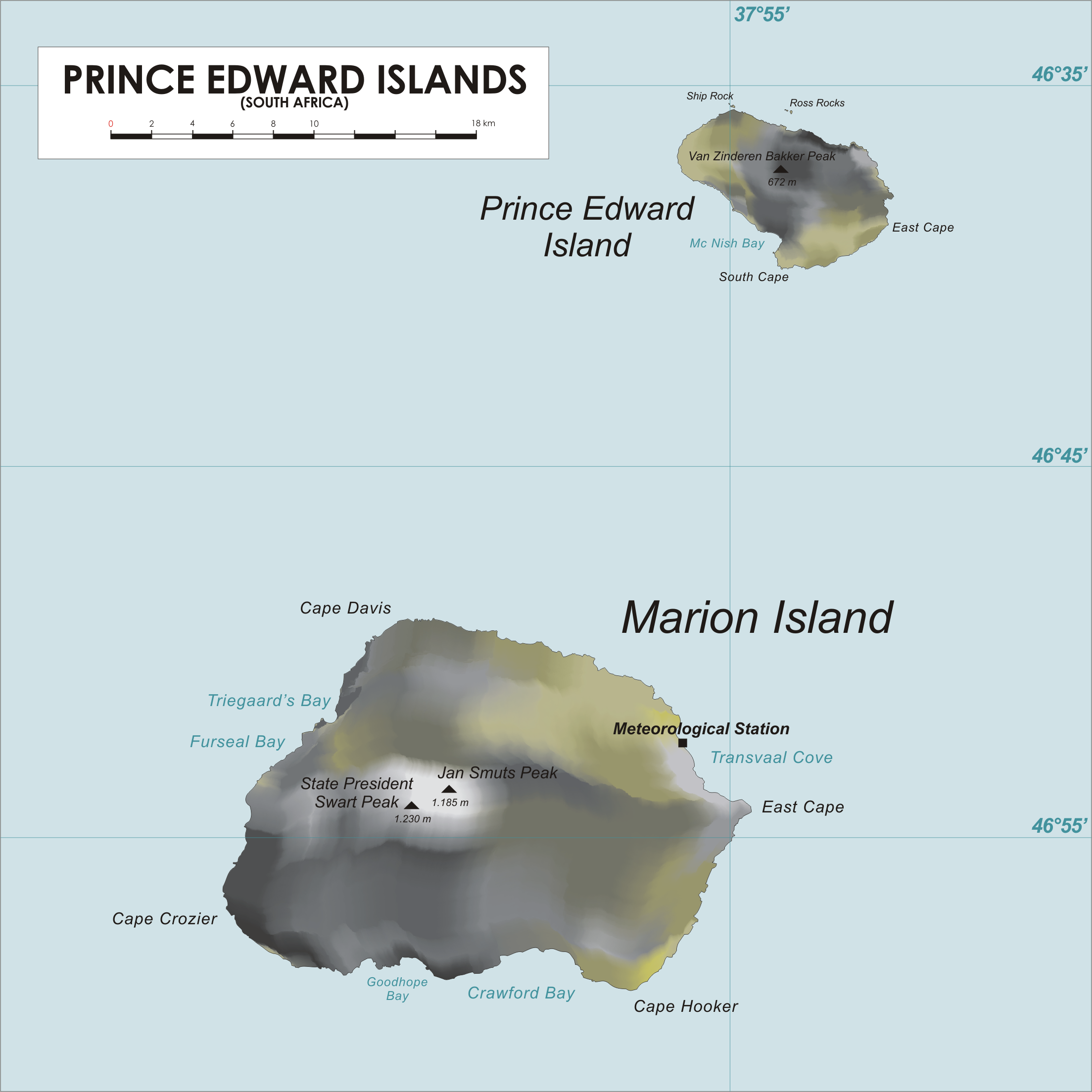
| Beskriuwing | Map of Prince Edward Islands | ||
| Boarne | drawn by varp | ||
| Auteur | drawn by varp | ||
| Tastimming (Reusing this file) |
|
Triemskiednis
Klik op in datum/tiid om it bestân te besjen sa't it op dat stuit wie.
| Datum/Tiid | Miniatuer | ôfmjittings | Meidogger | Opmerking | |
|---|---|---|---|---|---|
| lêste | 24 apr 2006, 15.52 | | 2.207 × 2.207 (789 KB) | Varp~commonswiki | |
| 24 apr 2006, 14.56 |  | 2.207 × 2.207 (740 KB) | Varp~commonswiki | *Map of Prince Edward Islands *drawn by varp |
Bestânsgebrûk
De neikommende side brûkt dit bestân:
Globaal bestânsgebrûk
De neikommende oare wiki's brûke dit bestân:
- Gebrûk op af.wikipedia.org
- Gebrûk op az.wikipedia.org
- Gebrûk op bg.wikipedia.org
- Gebrûk op br.wikipedia.org
- Gebrûk op ca.wikipedia.org
- Gebrûk op ceb.wikipedia.org
- Gebrûk op cs.wikipedia.org
- Gebrûk op da.wikipedia.org
- Gebrûk op de.wikipedia.org
- Gebrûk op el.wikipedia.org
- Gebrûk op en.wikipedia.org
- Gebrûk op eo.wikipedia.org
- Gebrûk op es.wikipedia.org
- Gebrûk op fa.wikipedia.org
- Gebrûk op fi.wikipedia.org
- Gebrûk op fr.wikipedia.org
- Gebrûk op hu.wikipedia.org
- Gebrûk op id.wikipedia.org
- Gebrûk op it.wikipedia.org
- Gebrûk op ja.wikipedia.org
- Gebrûk op ka.wikipedia.org
- Gebrûk op ko.wikipedia.org
- Gebrûk op lv.wikipedia.org
- Gebrûk op mk.wikipedia.org
- Gebrûk op nl.wikipedia.org
- Gebrûk op nn.wikipedia.org
- Gebrûk op no.wikipedia.org
- Gebrûk op pl.wikipedia.org
Mear globaal gebrûk fan dit bestân besjen.