
Ofbyld:Oude-hollandse-waterlinie.png
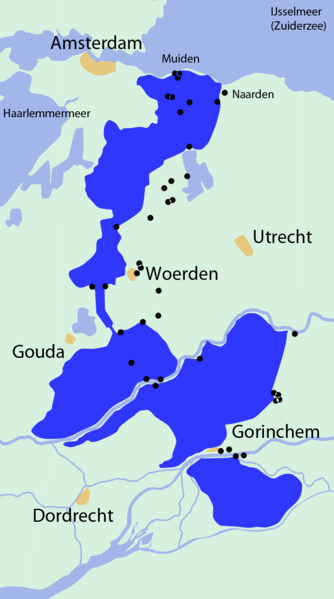
Grutte fan dit proefbyld: 334 × 599 piksels. Oare resolúsjes: 134 × 240 piksels | 268 × 480 piksels | 844 × 1.513 piksels.
Oarspronklik bestân (844 × 1.513 pixels, bestânsgrutte: 126 KB, MIME-type: image/png)
Gearfetting
| Description |
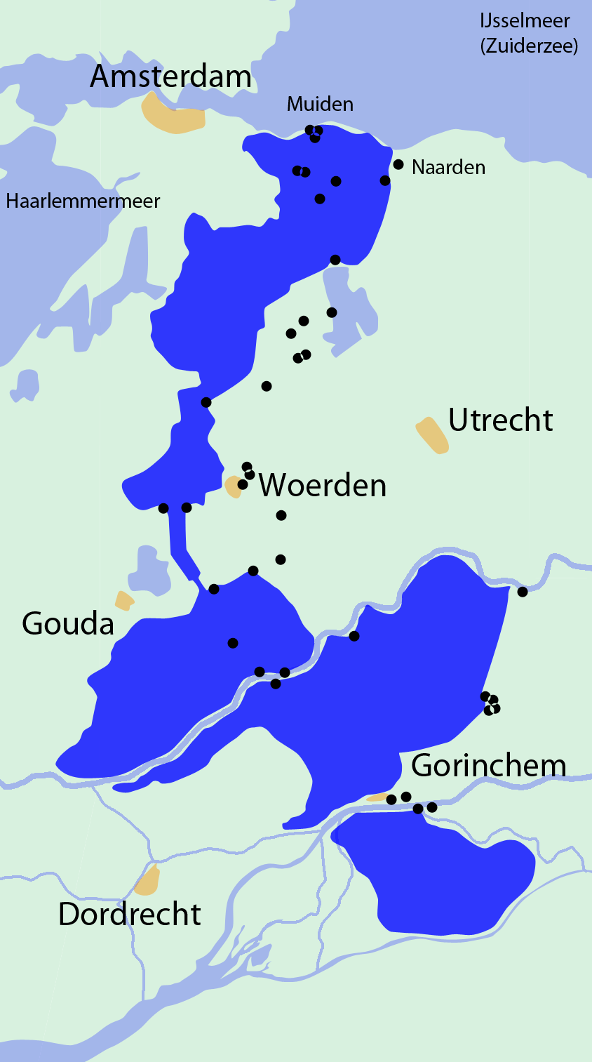
English: "Old" Dutch Water Line in the 17th and 18th century.
Nederlands: Oude Hollandse Waterlinie in the 17e en 18e eeuw. Overzicht van de inundaties en forten. |
|||||||||
| Datum | ||||||||||
| Boarne | Eigen wurk | |||||||||
| Makker | ||||||||||
| Geotemporal data | ||||||||||
| Bounding box |
|
|||||||||
| Georeferencing | ||||||||||

|
This military map image could be re-created using vector graphics as an SVG file. This has several advantages; see Commons:Media for cleanup for more information. If an SVG form of this image is available, please upload it and afterwards replace this template with
{{vector version available|new image name}}.
It is recommended to name the SVG file “Oude-hollandse-waterlinie.svg”—then the template Vector version available (or Vva) does not need the new image name parameter. |
Lisinsje
I, the copyright holder of this work, hereby publish it under the following license:
This file is licensed under the Creative Commons Attribution-Share Alike 3.0 Unported license.
- Fiel jo frij:
- te dielen – it wurk te kopiearjen, fersprieden en út te stjoeren
- te fermingen – it wurk oan te passen
- Under de neikommende betingsten:
- Nammefermelding – You must give appropriate credit, provide a link to the license, and indicate if changes were made. You may do so in any reasonable manner, but not in any way that suggests the licensor endorses you or your use.
- Lyk diele – If you remix, transform, or build upon the material, you must distribute your contributions under the same or compatible license as the original.
Triemskiednis
Klik op in datum/tiid om it bestân te besjen sa't it op dat stuit wie.
| Datum/Tiid | Miniatuer | ôfmjittings | Meidogger | Opmerking | |
|---|---|---|---|---|---|
| lêste | 21 aug 2009, 13.19 | | 844 × 1.513 (126 KB) | NielsB | {{Information |Description={{en|1="Old" Dutch Water Line in the 17th and 18th century.}} {{nl|1=Oude Hollandse Waterlinie in the 17e en 18e eeuw.}} |Source=Own work by uploader |Author=NielsB |Date=2009-08-21 |Permission= |other_versions= |
Bestânsgebrûk
De neikommende side brûkt dit bestân:
Globaal bestânsgebrûk
De neikommende oare wiki's brûke dit bestân:
- Gebrûk op da.wikipedia.org
- Gebrûk op de.wikipedia.org
- Gebrûk op en.wikipedia.org
- Gebrûk op es.wikipedia.org
- Gebrûk op fr.wikipedia.org
- Gebrûk op hu.wikipedia.org
- Gebrûk op mt.wikipedia.org
- Gebrûk op nl.wikipedia.org
- Gebrûk op pt.wikipedia.org
- Gebrûk op ru.wikipedia.org
- Gebrûk op uk.wikipedia.org
- Gebrûk op www.wikidata.org