
Ofbyld:Norway location map.svg

Size of this PNG preview of this SVG file: 564 × 599 piksels. Oare resolúsjes: 226 × 240 piksels | 452 × 480 piksels | 723 × 768 piksels | 964 × 1.024 piksels | 1.928 × 2.048 piksels | 2.215 × 2.353 piksels.
Oarspronklik bestân (SVG-bestân, nominaal 2.215 × 2.353 pixels, bestânsgrutte: 1,32 MB)
Gearfetting
| Beskriuwing |
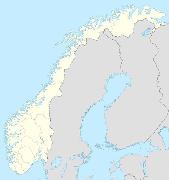
Deutsch: Positionskarte von Norwegen
Quadratische Plattkarte, N-S-Streckung 210 %. Geographische Begrenzung der Karte:
English: Location map of Norway
Equirectangular projection, N/S stretching 210 %. Geographic limits of the map:
|
| Datum | |
| Boarne |
own work, using
|
| Auteur | NordNordWest |
| Oare ferzjes | Derivative works of this file: Regenbogen location map.svg |

|
This map has been made or improved in the German Kartenwerkstatt (Map Lab). You can propose maps to improve as well.
|
Lisinsje
I, the copyright holder of this work, hereby publish it under the following licenses:

|
Der wurdt tastimming jûn ta kopiearjen, fersprieden en/of wizigjen fan dit dokumint ûnder de betinksten fan de GNU-lisinsje foar iepen dokumintaasje, ferzje 1.2, as eltse lettere ferzje útjûn troch de Free Software Foundation; sûnder Ynfariante Seksjes, sûnder Omkaftteksten foar de Foarkante en sûnder Omkaftteksten foar de Efterkante. In kopy fan de lisinsje is opnaam yn de seksje "Text of the GNU Free Documentation License". |
This file is licensed under the Creative Commons Attribution-Share Alike 3.0 Unported license.
- Fiel jo frij:
- te dielen – it wurk te kopiearjen, fersprieden en út te stjoeren
- te fermingen – it wurk oan te passen
- Under de neikommende betingsten:
- Nammefermelding – You must give appropriate credit, provide a link to the license, and indicate if changes were made. You may do so in any reasonable manner, but not in any way that suggests the licensor endorses you or your use.
- Lyk diele – If you remix, transform, or build upon the material, you must distribute your contributions under the same or compatible license as the original.
You may select the license of your choice.
Triemskiednis
Klik op in datum/tiid om it bestân te besjen sa't it op dat stuit wie.
| Datum/Tiid | Miniatuer | ôfmjittings | Meidogger | Opmerking | |
|---|---|---|---|---|---|
| lêste | 30 des 2017, 22.59 | | 2.215 × 2.353 (1,32 MB) | NordNordWest | upd |
| 25 okt 2008, 22.26 |  | 2.215 × 2.353 (2,12 MB) | NordNordWest | corrected | |
| 29 aug 2008, 09.56 |  | 2.215 × 2.351 (2,12 MB) | NordNordWest | ||
| 28 jul 2008, 22.12 |  | 2.214 × 2.351 (1,81 MB) | NordNordWest | some corrections | |
| 28 jul 2008, 21.47 |  | 2.214 × 2.351 (1,81 MB) | NordNordWest | {{Information |Description= {{de|Positionskarte der Norwegen}} Quadratische Plattkarte, N-S-Streckung 210 %. Geographische Begrenzung der Karte: * N: 71.5° N * S: 57.6° N * W: 4.1° O * O: 31.6° O {{en|Location map of [[:en:Norway|Norw |
Bestânsgebrûk
De neikommende 24 siden brûke dit bestân:
Globaal bestânsgebrûk
De neikommende oare wiki's brûke dit bestân:
- Gebrûk op af.wikipedia.org
- Gebrûk op als.wikipedia.org
- Gebrûk op an.wikipedia.org
- Gebrûk op ar.wikipedia.org
- Gebrûk op ast.wikipedia.org
- Estrechu de Skagerrak
- Mar del Norte
- Oslu
- Kinnarodden
- Cabu Norte
- Fiordu de Trondheim
- Fiordu de Bøk
- Fiordu de Geiranger
- Fiordu de Nærøy
- Ríu Tana
- Península Escandinava
- Bergen
- Trondheim
- Ópera d'Oslu
- Fiordu d'Oslu
- Edificiu del Storting
- Ramnefjellsfossen
- Mongefossen
- Kjelfossen
- Knivskjelodden
- Magerøyá
- Palaciu Real d'Oslu
- Catedral de Nidaros
- Bolsa d'Oslu
- Módulu:Mapa de llocalización/datos/Noruega
- Módulu:Mapa de llocalización/datos/Noruega/usu
- Haraldshaugen
- Sverd i fjell
- Aeropuertu d'Alta
- Aeropuertu d'Andøyá-Andenes
- Aeropuertu de Bardufoss
Mear globaal gebrûk fan dit bestân besjen.