
Ofbyld:Northumbria 802.jpg

Grutte fan dit proefbyld: 486 × 599 piksels. Oare resolúsjes: 195 × 240 piksels | 389 × 480 piksels | 623 × 768 piksels | 831 × 1.024 piksels | 1.800 × 2.218 piksels.
Oarspronklik bestân (1.800 × 2.218 pixels, bestânsgrutte: 649 KB, MIME-type: image/jpeg)
Gearfetting
| Beskriuwing |
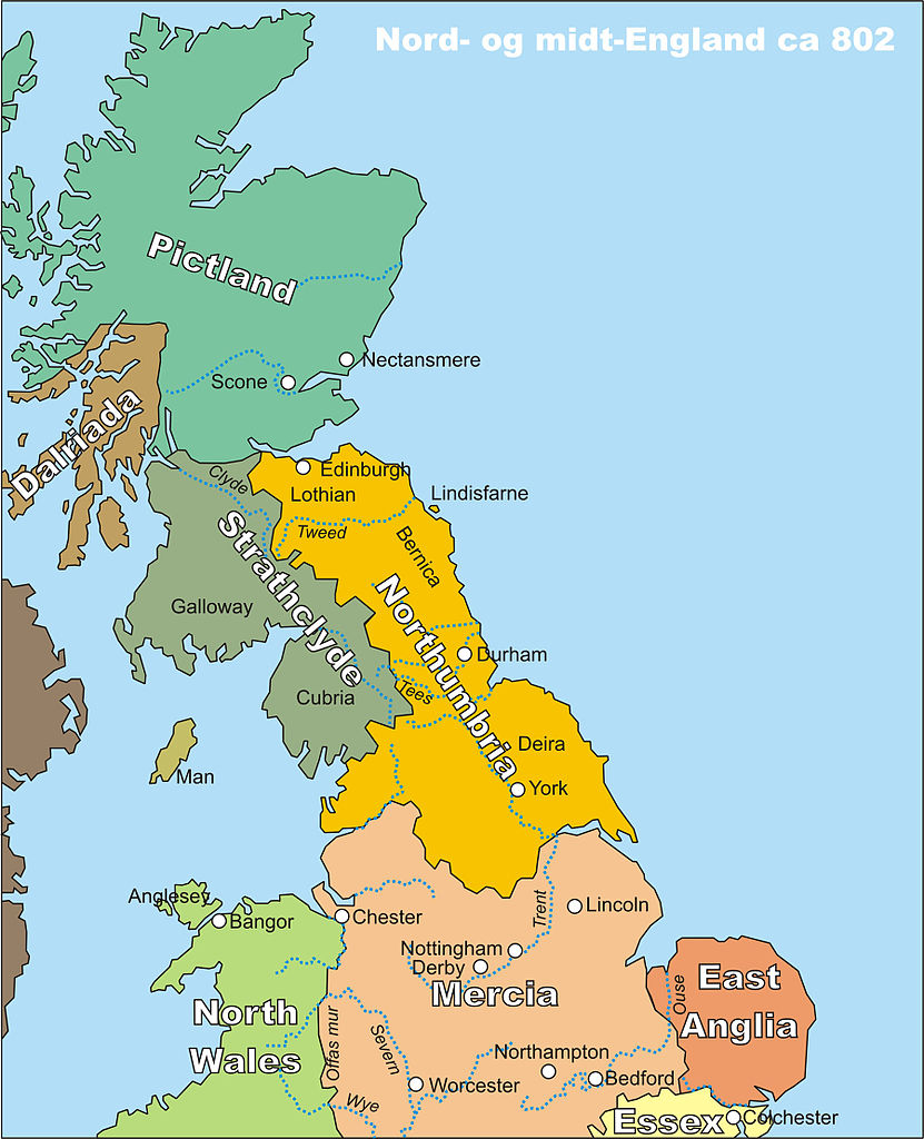
Norsk bokmål: Kart over midt- og nord-England, spesielt Northumbria, rundt år 802
English: Map of middle and northern England, centred around Northumbria, circa 802 |
| Datum | |
| Boarne | My own drawing, drawn in CorelDraw12, source file available on request, or in different file formats |
| Auteur | Finn (the uploader) |
| Tastimming (Reusing this file) |
PD |
Lisinsje
| I, the copyright holder of this work, release this work into the public domain. This applies worldwide. In some countries this may not be legally possible; if so: I grant anyone the right to use this work for any purpose, without any conditions, unless such conditions are required by law. |
Triemskiednis
Klik op in datum/tiid om it bestân te besjen sa't it op dat stuit wie.
| Datum/Tiid | Miniatuer | ôfmjittings | Meidogger | Opmerking | |
|---|---|---|---|---|---|
| lêste | 19 okt 2006, 23.22 | | 1.800 × 2.218 (649 KB) | Finn Bjorklid | == Summary == {{Information |Description=Kart over midt- og nord-England, spesielt Northumbria, rundt år 802 (Map of Middle and Northern England, spc. Northumbria, around 802) |Source=My own drawing, drawn in CorelDraw12, source file available on request |
Bestânsgebrûk
De neikommende side brûkt dit bestân:
Globaal bestânsgebrûk
De neikommende oare wiki's brûke dit bestân:
- Gebrûk op br.wikipedia.org
- Gebrûk op da.wikipedia.org
- Gebrûk op de.wikipedia.org
- Gebrûk op en.wikipedia.org
- Gebrûk op eo.wikipedia.org
- Gebrûk op fr.wikipedia.org
- Gebrûk op fr.wiktionary.org
- Gebrûk op hr.wikipedia.org
- Gebrûk op lv.wikipedia.org
- Gebrûk op nl.wikipedia.org
- Gebrûk op no.wikipedia.org
- Gebrûk op pt.wikipedia.org
- Gebrûk op th.wikipedia.org