
Ofbyld:North Rhine-Westphalia location map G.svg

Size of this PNG preview of this SVG file: 600 × 599 piksels. Oare resolúsjes: 240 × 240 piksels | 481 × 480 piksels | 769 × 768 piksels | 1.026 × 1.024 piksels | 2.051 × 2.048 piksels | 657 × 656 piksels.
Oarspronklik bestân (SVG-bestân, nominaal 657 × 656 pixels, bestânsgrutte: 607 KB)
Gearfetting
| Beskriuwing |
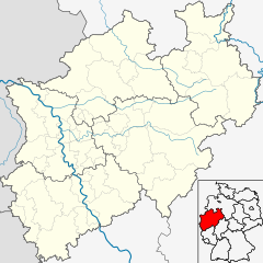
Deutsch: Positionskarte Nordrhein-Westfalen einschl. der Lage innerhalb Deutschlands. Geographische Begrenzung der Karte:
English: Location map North Rhine-Westphalia showing position of NRW within Germany. Geographic limits of the map:
|
| Datum | |
| Boarne | own work, based upon Image:North Rhine-Westphalia location map 01.svg |
| Auteur | Hanhil based on previous work by TUBS |
Lisinsje
I, the copyright holder of this work, hereby publish it under the following licenses:

|
Der wurdt tastimming jûn ta kopiearjen, fersprieden en/of wizigjen fan dit dokumint ûnder de betinksten fan de GNU-lisinsje foar iepen dokumintaasje, ferzje 1.2, as eltse lettere ferzje útjûn troch de Free Software Foundation; sûnder Ynfariante Seksjes, sûnder Omkaftteksten foar de Foarkante en sûnder Omkaftteksten foar de Efterkante. In kopy fan de lisinsje is opnaam yn de seksje "Text of the GNU Free Documentation License". |
This file is licensed under the Creative Commons Attribution-Share Alike 3.0 Unported, 2.5 Generic, 2.0 Generic and 1.0 Generic license.
- Fiel jo frij:
- te dielen – it wurk te kopiearjen, fersprieden en út te stjoeren
- te fermingen – it wurk oan te passen
- Under de neikommende betingsten:
- Nammefermelding – You must give appropriate credit, provide a link to the license, and indicate if changes were made. You may do so in any reasonable manner, but not in any way that suggests the licensor endorses you or your use.
- Lyk diele – If you remix, transform, or build upon the material, you must distribute your contributions under the same or compatible license as the original.
You may select the license of your choice.
Triemskiednis
Klik op in datum/tiid om it bestân te besjen sa't it op dat stuit wie.
| Datum/Tiid | Miniatuer | ôfmjittings | Meidogger | Opmerking | |
|---|---|---|---|---|---|
| lêste | 31 mai 2009, 00.25 | | 657 × 656 (607 KB) | Michiel1972 | frame |
| 19 mai 2009, 20.32 |  | 657 × 656 (603 KB) | Hanhil | {{Information |Description= {{de|Positionskarte Nordrhein-Westfalen einschl. der Lage innerhalb Deutschlands. Geographische Begrenzung der Karte:}} {{en|Location map North Rhine-Westphalia showi |
Bestânsgebrûk
De neikommende 46 siden brûke dit bestân:
- Abdij Marienmünster
- Abdij fan Brauweiler
- Abdinghôfkleaster
- Alde Sint-Martinustsjerke (Düsseldorf)
- Allagen
- Aposteltsjerke (Keulen)
- Augustusburg en Falkenlust
- Bartoloméuskapel (Paderborn)
- Belecke
- Blankenheim (Ahr)
- Boarch Veynau
- Dom fan Keulen
- Dom fan Múnster
- Dom fan Paderborn
- Dom fan Xanten
- Düsseldorf
- Elten
- Emmerik
- Erftstadt
- Genedekapel (Kevelaer)
- Goatsjerke Sint-Ulrich
- Goch
- Grutte Synagoge (Düsseldorf)
- Hirschberg (Warstein)
- Kempen (Dútslân)
- Kersekapel (Kevelaer)
- Keulen
- Kevelaer
- Kleaster Kamp
- Marije-Himelfearttsjerke (Marienbaum)
- Marijebasilyk (Kevelaer)
- Merktsjerke (Paderborn)
- Möhnesee (gemeente)
- Mülheim (Warstein)
- Niederbergheim
- Paderborn
- Pulheim
- Sichtigvor
- Sint-Pantaléontsjerke (Keulen)
- Slot Neuhaus (Paderborn)
- Stasjon Emmerich-Elten
- Stasjon Kaldenkirchen
- Suttrop
- Waldhausen (Warstein)
- Warstein
- Berjocht:Posysjekaart Noardryn-Westfalen
Globaal bestânsgebrûk
De neikommende oare wiki's brûke dit bestân:
- Gebrûk op de.wikivoyage.org
- Gebrûk op fa.wikipedia.org
- Gebrûk op id.wikipedia.org
- Gebrûk op ja.wikipedia.org
- Gebrûk op ka.wikipedia.org
- Gebrûk op ko.wikipedia.org
- Gebrûk op mk.wikipedia.org
- Gebrûk op nds-nl.wikipedia.org
- Gebrûk op nl.wikipedia.org
Mear globaal gebrûk fan dit bestân besjen.