
Ofbyld:Mesoamerica topographic map-blank.svg

Size of this PNG preview of this SVG file: 800 × 533 piksels. Oare resolúsjes: 320 × 213 piksels | 640 × 427 piksels | 1.024 × 683 piksels | 1.280 × 853 piksels | 2.560 × 1.707 piksels | 4.200 × 2.800 piksels.
Oarspronklik bestân (SVG-bestân, nominaal 4.200 × 2.800 pixels, bestânsgrutte: 1,55 MB)
Gearfetting
| Beskriuwing |
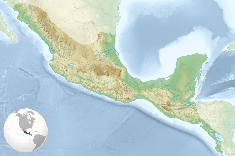
English: Map of Mesoamerican civilizations cultural area. Français : Carte de l'aire culturelle des civilisations de la Mésoamérique. |
| Datum | |
| Boarne |
Eigen wurk. Sources of data:
|
| Auteur | Sémhur |
| Oare ferzjes | |
| Nammefermelding (required by the license) | © Sémhur / Wikimedia Commons / |
| SVG | W3C-validity not checked. |
| Graphic Lab |
.svg)
| Object location | | View this and other nearby images on: OpenStreetMap |
|---|
Lisinsje
I, the copyright holder of this work, hereby publish it under the following licenses:
| Copyleft: This work of art is free; you can redistribute it and/or modify it according to terms of the Free Art License. You will find a specimen of this license on the Copyleft Attitude site as well as on other sites. |
This file is licensed under the Creative Commons Attribution-Share Alike 4.0 International, 3.0 Unported, 2.5 Generic, 2.0 Generic and 1.0 Generic license.
- Fiel jo frij:
- te dielen – it wurk te kopiearjen, fersprieden en út te stjoeren
- te fermingen – it wurk oan te passen
- Under de neikommende betingsten:
- Nammefermelding – You must give appropriate credit, provide a link to the license, and indicate if changes were made. You may do so in any reasonable manner, but not in any way that suggests the licensor endorses you or your use.
- Lyk diele – If you remix, transform, or build upon the material, you must distribute your contributions under the same or compatible license as the original.
You may select the license of your choice.
Triemskiednis
Klik op in datum/tiid om it bestân te besjen sa't it op dat stuit wie.
| Datum/Tiid | Miniatuer | ôfmjittings | Meidogger | Opmerking | |
|---|---|---|---|---|---|
| lêste | 19 sep 2011, 21.23 | | 4.200 × 2.800 (1,55 MB) | Sémhur | Other globe location |
| 19 sep 2011, 20.13 |  | 4.200 × 2.800 (1,52 MB) | Sémhur | + globe location | |
| 17 sep 2011, 17.48 |  | 4.200 × 2.800 (1,35 MB) | Sémhur |
Bestânsgebrûk
De neikommende 2 siden brûke dit bestân:
Globaal bestânsgebrûk
De neikommende oare wiki's brûke dit bestân:
- Gebrûk op ar.wikipedia.org
- Gebrûk op ba.wikipedia.org
- Gebrûk op bn.wikipedia.org
- Gebrûk op ca.wikipedia.org
- Gebrûk op ceb.wikipedia.org
- Gebrûk op cs.wikipedia.org
- Gebrûk op da.wikipedia.org
- Gebrûk op de.wikipedia.org
- Gebrûk op el.wikipedia.org
- Gebrûk op en.wikipedia.org
- Tenochtitlan
- Palenque
- Teotihuacan
- Copán
- Xunantunich
- Mayapan
- Quiriguá
- Uxmal
- Yaxchilan
- Coba
- Lubaantun
- Zaculeu
- El Tajín
- Qʼumarkaj
- Monte Albán
- Xochicalco
- Toniná
- El Mirador
- Naranjo
- Lamanai
- Takalik Abaj
- Cahal Pech
- Calakmul
- Joya de Cerén
- Cuicuilco
- Nakbe
- Cerros
- Dzibilchaltun
- Tazumal
- Pyramid of the Magician
- Guachimontones
- Xtampak
- Chichen Itza
- Muyil
- Cañada de la Virgen
- Module:Location map/data/Mesoamerica/doc
- La Blanca, Peten
- Santa Rita, Corozal
- User:Rsgeek/Dzibanché
Mear globaal gebrûk fan dit bestân besjen.