
Ofbyld:Medieval Arab Palestine.jpg
Grutte fan dit proefbyld: 464 × 599 piksels. Oare resolúsjes: 186 × 240 piksels | 372 × 480 piksels | 824 × 1.064 piksels.
Oarspronklik bestân (824 × 1.064 pixels, bestânsgrutte: 191 KB, MIME-type: image/jpeg)
Gearfetting
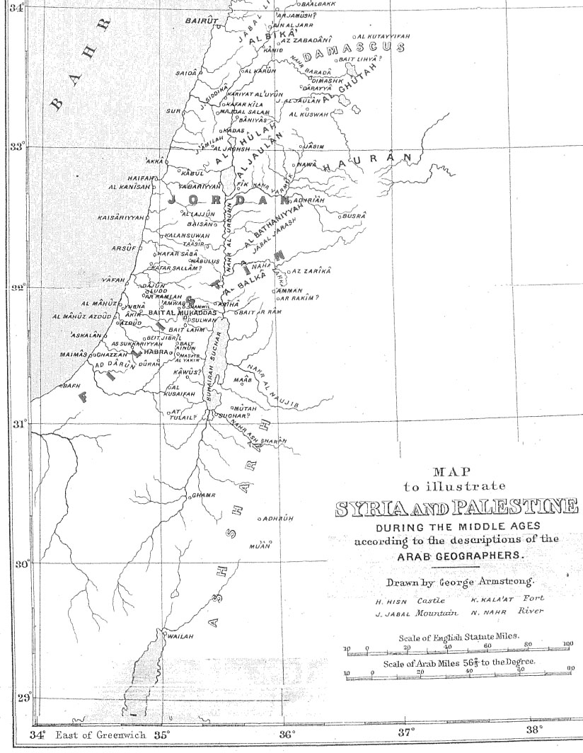
| Beskriuwing | Map of Palestine during the Middle Ages according to the description of the Arab geographers, drawn by Geo. Armstrong, from Palestine Under the Muslims: A Description of Syria and the Holy Land from AD 650 to 1500, by Guy Le Strange, London 1890 |
| Datum | 16 novimber 2004 (original upload date) |
| Boarne | Transferred from en.wikipedia to Commons. |
| Auteur |
The original uploader was Mustafaa at Ingelsk Wikipedy. Later versions were uploaded by AnonMoos at en.wikipedia. |
Lisinsje
|
This work is in the public domain in its country of origin and other countries and areas where the copyright term is the author's life plus 70 years or fewer. This work is in the public domain in the United States because it was published (or registered with the U.S. Copyright Office) before January 1, 1929. | |
| This file has been identified as being free of known restrictions under copyright law, including all related and neighboring rights. | |
Original upload log
The original description page was here. All following user names refer to en.wikipedia.
- 2005-09-21 17:41 AnonMoos 824×1064×8 (195077 bytes) Losslessly cropped image to area of interest
- 2004-11-16 21:36 Mustafaa 979×1072×8 (218293 bytes) Map of Palestine during the Middle Ages according to the description of the Arab geographers, drawn by Geo. Armstrong, from ''Palestine Under the Muslims: A Description of Syria and the Holy Land from AD 650 to 1500'', by Guy Le Strange, London 1890 (henc
Triemskiednis
Klik op in datum/tiid om it bestân te besjen sa't it op dat stuit wie.
| Datum/Tiid | Miniatuer | ôfmjittings | Meidogger | Opmerking | |
|---|---|---|---|---|---|
| lêste | 21 jun 2007, 21.37 | | 824 × 1.064 (191 KB) | Friðrik Bragi Dýrfjörð | {{Information |Description=Map of Palestine during the Middle Ages according to the description of the Arab geographers, drawn by Geo. Armstrong, from ''Palestine Under the Muslims: A Description of Syria and the Holy Land from AD 650 to 1500'', by Guy Le |
Bestânsgebrûk
De neikommende side brûkt dit bestân:
Globaal bestânsgebrûk
De neikommende oare wiki's brûke dit bestân:
- Gebrûk op ar.wikipedia.org
- Gebrûk op azb.wikipedia.org
- Gebrûk op da.wikipedia.org
- Gebrûk op en.wikipedia.org
- Gebrûk op es.wikipedia.org
- Gebrûk op ilo.wikipedia.org
- Gebrûk op is.wikipedia.org
- Gebrûk op lt.wikipedia.org
- Gebrûk op mt.wikipedia.org
- Gebrûk op nl.wikipedia.org
- Gebrûk op nn.wikipedia.org
- Gebrûk op no.wikipedia.org
- Gebrûk op pnb.wikipedia.org
- Gebrûk op ps.wikipedia.org
- Gebrûk op ro.wikipedia.org
- Gebrûk op si.wikipedia.org
- Gebrûk op sk.wikipedia.org
- Gebrûk op ur.wikipedia.org
- Gebrûk op uz.wikipedia.org
- Gebrûk op zh.wikipedia.org