
Ofbyld:Mauritius-CIA WFB Map.png
Gjin hegere resolúsje beskikber.
Mauritius-CIA_WFB_Map.png (330 × 355 pixels, bestânsgrutte: 9 KB, MIME-type: image/png)
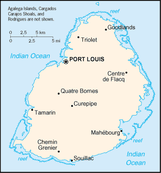
| Beskriuwing | Map of Mauritius showing towns. | |||
| Datum | ||||
| Boarne | CIA, The World Factbook, 2004 | |||
| Auteur | CIA | |||
| Tastimming (Reusing this file) |
|


|
This locator map image could be re-created using vector graphics as an SVG file. This has several advantages; see Commons:Media for cleanup for more information. If an SVG form of this image is available, please upload it and afterwards replace this template with
{{vector version available|new image name}}.
It is recommended to name the SVG file “Mauritius-CIA WFB Map.svg”—then the template Vector version available (or Vva) does not need the new image name parameter. |
Triemskiednis
Klik op in datum/tiid om it bestân te besjen sa't it op dat stuit wie.
| Datum/Tiid | Miniatuer | ôfmjittings | Meidogger | Opmerking | |
|---|---|---|---|---|---|
| lêste | 27 mrt 2005, 11.16 | | 330 × 355 (9 KB) | Wolfman~commonswiki | {{CIA-map}} |
Bestânsgebrûk
De neikommende 2 siden brûke dit bestân:
Globaal bestânsgebrûk
De neikommende oare wiki's brûke dit bestân:
- Gebrûk op als.wikipedia.org
- Gebrûk op arz.wikipedia.org
- Gebrûk op be-tarask.wikipedia.org
- Gebrûk op be.wikipedia.org
- Gebrûk op br.wikipedia.org
- Gebrûk op el.wikipedia.org
- Gebrûk op en.wikisource.org
- Gebrûk op eo.wikipedia.org
- Gebrûk op es.wikipedia.org
- Gebrûk op fi.wikipedia.org
- Gebrûk op fo.wikipedia.org
- Gebrûk op gd.wikipedia.org
- Gebrûk op he.wikipedia.org
- Gebrûk op hr.wikipedia.org
- Gebrûk op ht.wikipedia.org
- Gebrûk op hu.wikipedia.org
- Gebrûk op hu.wiktionary.org
- Gebrûk op ia.wikipedia.org
- Gebrûk op id.wikipedia.org
- Gebrûk op io.wikipedia.org
- Gebrûk op ja.wikipedia.org
- Gebrûk op kn.wikipedia.org
- Gebrûk op la.wikipedia.org
- Gebrûk op lt.wikipedia.org
- Gebrûk op lt.wiktionary.org
- Gebrûk op mr.wikipedia.org
- Gebrûk op ms.wikipedia.org
- Gebrûk op nds-nl.wikipedia.org
- Gebrûk op ne.wikipedia.org
- Gebrûk op nl.wikipedia.org
- Gebrûk op nn.wikipedia.org
- Gebrûk op no.wikipedia.org
- Gebrûk op rue.wikipedia.org
- Gebrûk op ru.wikipedia.org
- Gebrûk op sg.wikipedia.org
- Gebrûk op sg.wiktionary.org
- Gebrûk op sh.wikipedia.org
- Gebrûk op sq.wikipedia.org
- Gebrûk op sr.wikipedia.org
- Gebrûk op sv.wikipedia.org
- Gebrûk op sw.wikipedia.org
- Gebrûk op th.wikipedia.org
Mear globaal gebrûk fan dit bestân besjen.