
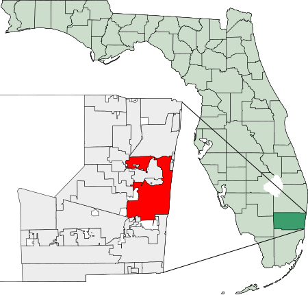
Ofbyld:Map of Florida highlighting Fort Lauderdale.svg

Size of this PNG preview of this SVG file: 450 × 429 piksels. Oare resolúsjes: 252 × 240 piksels | 504 × 480 piksels | 806 × 768 piksels | 1.074 × 1.024 piksels | 2.148 × 2.048 piksels.
Oarspronklik bestân (SVG-bestân, nominaal 450 × 429 pixels, bestânsgrutte: 1,17 MB)
26°08′09″N 80°08′31″W / 26.13583°N 80.14194°W
Created using coordinate data from US Census Bureau, modified in accordance with incorporation data from 2000-2005 in Adobe Illustrator. Now redrawn in Inkscape.

|
Der wurdt tastimming jûn ta kopiearjen, fersprieden en/of wizigjen fan dit dokumint ûnder de betinksten fan de GNU-lisinsje foar iepen dokumintaasje, ferzje 1.2, as eltse lettere ferzje útjûn troch de Free Software Foundation; sûnder Ynfariante Seksjes, sûnder Omkaftteksten foar de Foarkante en sûnder Omkaftteksten foar de Efterkante. In kopy fan de lisinsje is opnaam yn de seksje "Text of the GNU Free Documentation License". |
| This file is licensed under the Creative Commons Attribution-Share Alike 3.0 Unported license. | ||
| ||
| This licensing tag was added to this file as part of the GFDL licensing update. |
Triemskiednis
Klik op in datum/tiid om it bestân te besjen sa't it op dat stuit wie.
| Datum/Tiid | Miniatuer | ôfmjittings | Meidogger | Opmerking | |
|---|---|---|---|---|---|
| lêste | 28 feb 2007, 05.23 | | 450 × 429 (1,17 MB) | Bastique | {{coor dms|26|08|09|N|80|08|31|W|}} Created using coordinate data from US Census Bureau, modified in accordance with incorporation data from 2000-2005 in Adobe Illustrator. {{GDFL}} [[Category:Maps of Broward County, |
Bestânsgebrûk
De neikommende side brûkt dit bestân:
Globaal bestânsgebrûk
De neikommende oare wiki's brûke dit bestân:
- Gebrûk op af.wikipedia.org
- Gebrûk op ar.wikipedia.org
- Gebrûk op arz.wikipedia.org
- Gebrûk op ast.wikipedia.org
- Gebrûk op azb.wikipedia.org
- Gebrûk op ba.wikipedia.org
- Gebrûk op ca.wikipedia.org
- Gebrûk op ceb.wikipedia.org
- Gebrûk op cy.wikipedia.org
- Gebrûk op el.wikipedia.org
- Gebrûk op en.wikinews.org
- Gebrûk op eo.wikipedia.org
- Gebrûk op es.wikipedia.org
- Gebrûk op et.wikipedia.org
- Gebrûk op eu.wikipedia.org
- Gebrûk op fa.wikipedia.org
- Gebrûk op fr.wikipedia.org
- Gebrûk op ga.wikipedia.org
- Gebrûk op gd.wikipedia.org
- Gebrûk op gl.wikipedia.org
- Gebrûk op he.wikipedia.org
- Gebrûk op ht.wikipedia.org
- Gebrûk op hu.wikipedia.org
- Gebrûk op ia.wikipedia.org
- Gebrûk op it.wikipedia.org
- Gebrûk op ja.wikipedia.org
- Gebrûk op ko.wikipedia.org
- Gebrûk op kw.wikipedia.org
- Gebrûk op la.wikipedia.org
- Gebrûk op lb.wikipedia.org
- Gebrûk op ml.wikipedia.org
- Gebrûk op nn.wikipedia.org
- Gebrûk op ro.wikipedia.org
- Gebrûk op sco.wikipedia.org
- Gebrûk op simple.wikipedia.org
- Gebrûk op th.wikipedia.org
- Gebrûk op tr.wikipedia.org
- Gebrûk op tt.wikipedia.org
- Gebrûk op ur.wikipedia.org
- Gebrûk op vo.wikipedia.org
- Gebrûk op www.wikidata.org