
Ofbyld:Lahn-Dill-Kreis Waldsolms.png
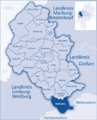
Grutte fan dit proefbyld: 485 × 599 piksels. Oare resolúsjes: 194 × 240 piksels | 388 × 480 piksels | 831 × 1.027 piksels.
Oarspronklik bestân (831 × 1.027 pixels, bestânsgrutte: 165 KB, MIME-type: image/png)
| Beskriuwing |
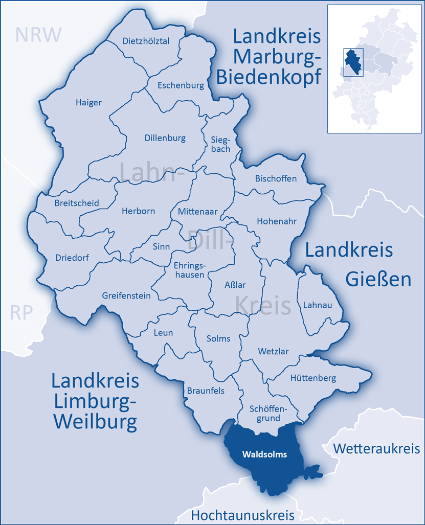
English: The map shows a district in the area of Lahn-Dill-Kreis
Deutsch: Die Karte zeigt eine Gemeinde im Lahn-Dill-Kreis |
||
| Datum | |||
| Boarne |
|
||
| Auteur | Andreas Trepte | ||
| Tastimming (Reusing this file) |
Own work, copyleft: Multi-license with GFDL and Creative Commons CC-BY-SA-2.5 and older versions (2.0 and 1.0) |
I, the copyright holder of this work, hereby publish it under the following licenses:

|
Der wurdt tastimming jûn ta kopiearjen, fersprieden en/of wizigjen fan dit dokumint ûnder de betinksten fan de GNU-lisinsje foar iepen dokumintaasje, ferzje 1.2, as eltse lettere ferzje útjûn troch de Free Software Foundation; sûnder Ynfariante Seksjes, sûnder Omkaftteksten foar de Foarkante en sûnder Omkaftteksten foar de Efterkante. In kopy fan de lisinsje is opnaam yn de seksje "Text of the GNU Free Documentation License". |
| This file is licensed under the Creative Commons Attribution-Share Alike 3.0 Unported license. | ||
| ||
| This licensing tag was added to this file as part of the GFDL licensing update. |
This file is licensed under the Creative Commons Attribution-Share Alike 2.5 Generic, 2.0 Generic and 1.0 Generic license.
- Fiel jo frij:
- te dielen – it wurk te kopiearjen, fersprieden en út te stjoeren
- te fermingen – it wurk oan te passen
- Under de neikommende betingsten:
- Nammefermelding – You must give appropriate credit, provide a link to the license, and indicate if changes were made. You may do so in any reasonable manner, but not in any way that suggests the licensor endorses you or your use.
- Lyk diele – If you remix, transform, or build upon the material, you must distribute your contributions under the same or compatible license as the original.
You may select the license of your choice.
Triemskiednis
Klik op in datum/tiid om it bestân te besjen sa't it op dat stuit wie.
| Datum/Tiid | Miniatuer | ôfmjittings | Meidogger | Opmerking | |
|---|---|---|---|---|---|
| lêste | 28 apr 2007, 21.36 | | 831 × 1.027 (165 KB) | Merops | {{Information| |Description= Category:Herborn, Germany Category:Maps of Hesse ==Summary== {{Information| |Description={{en|The map shows a district in the area of Lahn-Dill-Kreis}} {{de|Die Karte zeigt eine Gemeinde im [[: |
| 2 sep 2006, 21.38 |  | 831 × 1.027 (155 KB) | Merops | {{Information| |Description={{en|The map shows a district in the area of Lahn-Dill-Kreis}} {{de|Die Karte zeigt eine Gemeinde im Lahn-Dill-Kreis}} |Source={{User:Merops/GraInfo}} |Date=01. Sep. 2006 |Autho |
Bestânsgebrûk
De neikommende side brûkt dit bestân:
Globaal bestânsgebrûk
De neikommende oare wiki's brûke dit bestân:
- Gebrûk op ceb.wikipedia.org
- Gebrûk op de.wikipedia.org
- Gebrûk op el.wikipedia.org
- Gebrûk op en.wikipedia.org
- Gebrûk op eo.wikipedia.org
- Gebrûk op eu.wikipedia.org
- Gebrûk op fa.wikipedia.org
- Gebrûk op hu.wikipedia.org
- Gebrûk op ja.wikipedia.org
- Gebrûk op nl.wikipedia.org
- Gebrûk op pl.wikipedia.org
- Gebrûk op ro.wikipedia.org
- Gebrûk op sh.wikipedia.org
- Gebrûk op sr.wikipedia.org
- Gebrûk op sv.wikipedia.org
- Gebrûk op tt.wikipedia.org
- Gebrûk op uk.wikipedia.org
- Gebrûk op www.wikidata.org