
Ofbyld:Illyrians.jpg

Grutte fan dit proefbyld: 800 × 542 piksels. Oare resolúsjes: 320 × 217 piksels | 640 × 434 piksels | 1.054 × 714 piksels.
Oarspronklik bestân (1.054 × 714 pixels, bestânsgrutte: 1,27 MB, MIME-type: image/jpeg)
Gearfetting
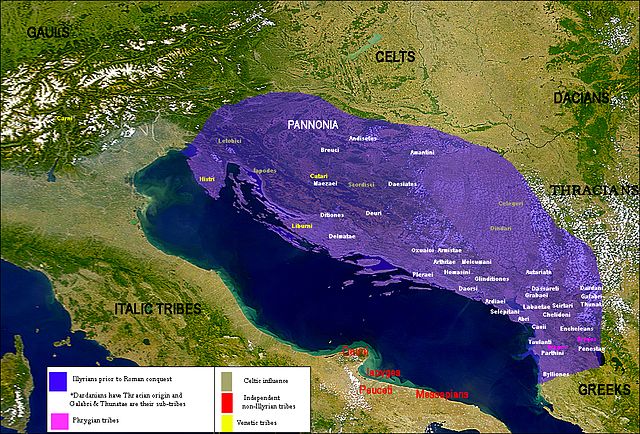
| Beskriuwing | Map of the Illyrian tribes | ||||||||||||
| Datum | |||||||||||||
| Boarne |
Own work data from
|
||||||||||||
| Auteur | User:Megistias | ||||||||||||
| Tastimming (Reusing this file) |
I, the copyright holder of this work, hereby publish it under the following licenses:
This file is licensed under the Creative Commons Attribution-Share Alike 2.5 Generic license.
You may select the license of your choice. |
||||||||||||
| Oare ferzjes |
|


.png)

.svg)
.svg)
.svg)
Lisinsje
I, the copyright holder of this work, hereby publish it under the following licenses:

|
Der wurdt tastimming jûn ta kopiearjen, fersprieden en/of wizigjen fan dit dokumint ûnder de betinksten fan de GNU-lisinsje foar iepen dokumintaasje, ferzje 1.2, as eltse lettere ferzje útjûn troch de Free Software Foundation; sûnder Ynfariante Seksjes, sûnder Omkaftteksten foar de Foarkante en sûnder Omkaftteksten foar de Efterkante. In kopy fan de lisinsje is opnaam yn de seksje "Text of the GNU Free Documentation License". |
| This file is licensed under the Creative Commons Attribution-Share Alike 3.0 Unported license. | ||
| ||
| This licensing tag was added to this file as part of the GFDL licensing update. |
You may select the license of your choice.
Triemskiednis
Klik op in datum/tiid om it bestân te besjen sa't it op dat stuit wie.
| Datum/Tiid | Miniatuer | ôfmjittings | Meidogger | Opmerking | |
|---|---|---|---|---|---|
| lêste | 19 jul 2016, 20.06 | | 1.054 × 714 (1,27 MB) | MaryroseB54 | The Illyrian Atintani, the Epirotic Atintanes and the Roman Protectorate N. G. L. Hammond, The Journal of Roman Studies Vol. 79 (1989), pp. 11-25 "There were Illyrian Amantini in Pannonia and Greek Amantes in North Epirus" |
| 14 aug 2011, 20.04 |  | 1.054 × 714 (1,27 MB) | Martin H. | Reverted to version as of 13:39, 11 February 2010. Bad overwriting | |
| 14 aug 2011, 19.41 | Gjin miniatuerôfbylding | 640 × 586 (101 KB) | AceDouble | original map. | |
| 11 feb 2010, 15.39 |  | 1.054 × 714 (1,27 MB) | Megistias | lopsi | |
| 11 feb 2010, 15.38 |  | 1.054 × 714 (1,27 MB) | Megistias | lopsi | |
| 22 jan 2010, 23.45 |  | 1.054 × 714 (1,27 MB) | Megistias | tweaks | |
| 30 sep 2009, 12.21 |  | 1.054 × 714 (1,27 MB) | Megistias | correction | |
| 30 sep 2009, 11.59 |  | 1.054 × 714 (1,27 MB) | Megistias | Update | |
| 29 sep 2009, 23.52 |  | 1.054 × 714 (1,28 MB) | Megistias | Update | |
| 22 sep 2009, 13.36 |  | 1.054 × 714 (1,23 MB) | Megistias | update |
Bestânsgebrûk
Der binne gjin siden dy't dit bestân brûke.
Globaal bestânsgebrûk
De neikommende oare wiki's brûke dit bestân:
- Gebrûk op bs.wikipedia.org
- Gebrûk op de.wikipedia.org
- Gebrûk op en.wikipedia.org
- Gebrûk op fr.wikipedia.org
- Gebrûk op hr.wikipedia.org
- Gebrûk op pl.wikipedia.org
- Gebrûk op sh.wikipedia.org
- Gebrûk op sl.wikipedia.org
- Gebrûk op sq.wikipedia.org
- Gebrûk op sr.wikipedia.org
- Gebrûk op tr.wikipedia.org
- Gebrûk op www.wikidata.org