Ofbyld:Illyrian Tribes (English).svg

Size of this PNG preview of this SVG file: 600 × 600 piksels. Oare resolúsjes: 240 × 240 piksels | 480 × 480 piksels | 768 × 768 piksels | 1.024 × 1.024 piksels | 2.048 × 2.048 piksels | 1.600 × 1.600 piksels.
Oarspronklik bestân (SVG-bestân, nominaal 1.600 × 1.600 pixels, bestânsgrutte: 8,57 MB)
Triemskiednis
Klik op in datum/tiid om it bestân te besjen sa't it op dat stuit wie.
| Datum/Tiid | Miniatuer | ôfmjittings | Meidogger | Opmerking | |
|---|---|---|---|---|---|
| lêste | 23 jul 2022, 18.52 |  | 1.600 × 1.600 (8,57 MB) | Khirurg | more minor fixes |
| 23 jul 2022, 18.22 |  | 1.600 × 1.600 (8,56 MB) | Khirurg | More fixes | |
| 23 jul 2022, 17.08 | 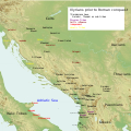 | 1.600 × 1.600 (8,57 MB) | Khirurg | Fixes | |
| 25 jun 2016, 11.34 |  | 1.600 × 1.600 (8,57 MB) | MaryroseB54 | Paionia text position | |
| 23 jun 2016, 02.11 |  | 1.600 × 1.600 (8,57 MB) | MaryroseB54 | The Illyrian Atintani, the Epirotic Atintanes and the Roman Protectorate N. G. L. Hammond, The Journal of Roman Studies Vol. 79 (1989), pp. 11-25 "There were Illyrian Amantini in Pannonia and Greek Amantes in North Epirus" | |
| 22 jun 2016, 23.48 |  | 1.600 × 1.600 (8,57 MB) | MaryroseB54 | position | |
| 22 jun 2016, 21.49 |  | 1.600 × 1.600 (8,57 MB) | MaryroseB54 | Placed Byllis, 25 kilometers from the sea | |
| 22 jun 2016, 16.06 |  | 1.600 × 1.600 (8,57 MB) | MaryroseB54 | 3 Cities in order to make sense of the locations | |
| 19 jun 2016, 12.18 |  | 1.600 × 1.600 (8,57 MB) | MaryroseB54 | Corrected position of 2 tribes | |
| 17 jun 2016, 13.49 |  | 1.600 × 1.600 (8,57 MB) | MaryroseB54 | User created page with UploadWizard |
Bestânsgebrûk
De neikommende side brûkt dit bestân:
Globaal bestânsgebrûk
De neikommende oare wiki's brûke dit bestân:
- Gebrûk op an.wikipedia.org
- Gebrûk op ar.wikipedia.org
- Gebrûk op az.wikipedia.org
- Gebrûk op be.wikipedia.org
- Gebrûk op bg.wikipedia.org
- Gebrûk op bn.wikipedia.org
- Gebrûk op bs.wikipedia.org
- Gebrûk op ca.wikipedia.org
- Gebrûk op cs.wikipedia.org
- Gebrûk op da.wikipedia.org
- Gebrûk op en.wikipedia.org
- Gebrûk op eo.wikipedia.org
- Gebrûk op fa.wikipedia.org
- Gebrûk op gl.wikipedia.org
- Gebrûk op he.wikipedia.org
- Gebrûk op hr.wikipedia.org
- Gebrûk op hy.wikipedia.org
- Gebrûk op id.wikipedia.org
- Gebrûk op it.wikipedia.org
- Gebrûk op ja.wikipedia.org
- Gebrûk op ja.wikibooks.org
- Gebrûk op ka.wikipedia.org
- Gebrûk op kk.wikipedia.org
- Gebrûk op ko.wikipedia.org
- Gebrûk op lt.wikipedia.org
- Gebrûk op lv.wikipedia.org
- Gebrûk op mg.wikipedia.org
- Gebrûk op nl.wikipedia.org
- Gebrûk op no.wikipedia.org
- Gebrûk op nrm.wikipedia.org
- Gebrûk op pl.wikipedia.org
Mear globaal gebrûk fan dit bestân besjen.


