
Ofbyld:Hockenheimring prior to 2002.svg

Size of this PNG preview of this SVG file: 800 × 507 piksels. Oare resolúsjes: 320 × 203 piksels | 640 × 406 piksels | 1.024 × 650 piksels | 1.280 × 812 piksels | 2.560 × 1.624 piksels | 1.381 × 876 piksels.
Oarspronklik bestân (SVG-bestân, nominaal 1.381 × 876 pixels, bestânsgrutte: 57 KB)
Gearfetting
| Beskriuwing |
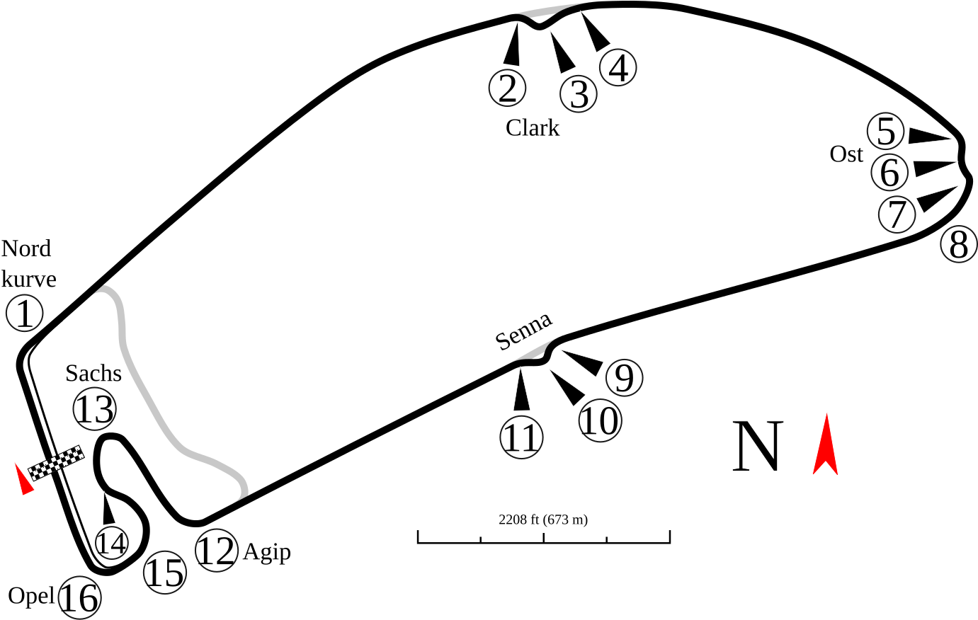
English: Track map of Hockenheimring as it was prior to 2002. All turn numbers were assigned by the image author as no data was available. A version showing the current layout will be done as soon as I see updated imagery in Google Earth. Without that, not much I can do. |
| Datum | |
| Boarne | Eigen wurk |
| Auteur | Will Pittenger |
| Oare ferzjes |
|


.png)

| Camera location | | View this and other nearby images on: OpenStreetMap |
|---|
Lisinsje
I, the copyright holder of this work, hereby publish it under the following license:
This file is licensed under the Creative Commons Attribution-Share Alike 3.0 Unported license.
- Fiel jo frij:
- te dielen – it wurk te kopiearjen, fersprieden en út te stjoeren
- te fermingen – it wurk oan te passen
- Under de neikommende betingsten:
- Nammefermelding – You must give appropriate credit, provide a link to the license, and indicate if changes were made. You may do so in any reasonable manner, but not in any way that suggests the licensor endorses you or your use.
- Lyk diele – If you remix, transform, or build upon the material, you must distribute your contributions under the same or compatible license as the original.
Triemskiednis
Klik op in datum/tiid om it bestân te besjen sa't it op dat stuit wie.
| Datum/Tiid | Miniatuer | ôfmjittings | Meidogger | Opmerking | |
|---|---|---|---|---|---|
| lêste | 10 sep 2008, 02.08 | | 1.381 × 876 (57 KB) | Will Pittenger | Fixed location of Opel Kurve (was outside the image) |
| 10 sep 2008, 02.01 |  | 1.374 × 899 (57 KB) | Will Pittenger | New version with bigger text | |
| 9 sep 2008, 22.22 |  | 1.374 × 899 (56 KB) | Will Pittenger | New version has bigger text and some repositioned labels. | |
| 9 sep 2008, 21.59 |  | 1.374 × 899 (56 KB) | Will Pittenger | {{Information |Description={{en|1=Track map of w:Hockenheimring as it was prior to 2002. All turn numbers were assigned by the image author as no data was available.}} |Source=Own work by uploader |Author=Will Pittenger |Date |
Bestânsgebrûk
De neikommende 2 siden brûke dit bestân:
Globaal bestânsgebrûk
De neikommende oare wiki's brûke dit bestân:
- Gebrûk op ar.wikipedia.org
- جائزة ألمانيا الكبرى 1994
- جائزة ألمانيا الكبرى 1995
- جائزة ألمانيا الكبرى 1996
- جائزة ألمانيا الكبرى 1997
- جائزة ألمانيا الكبرى 1998
- جائزة ألمانيا الكبرى 1999
- جائزة ألمانيا الكبرى للدراجات النارية 1987
- جائزة ألمانيا الكبرى للدراجات النارية 1989
- جائزة ألمانيا الكبرى للدراجات النارية 1991
- جائزة ألمانيا الكبرى للدراجات النارية 1992
- جائزة ألمانيا الكبرى للدراجات النارية 1993
- جائزة ألمانيا الكبرى للدراجات النارية 1994
- جائزة ألمانيا الكبرى 2001
- جائزة ألمانيا الكبرى 2000
- Gebrûk op bg.wikipedia.org
- Gebrûk op cs.wikipedia.org
- Gebrûk op de.wikipedia.org
- Gebrûk op en.wikipedia.org
Mear globaal gebrûk fan dit bestân besjen.