
Ofbyld:Gem-Noardeast-Fryslan-OpenTopo.jpg

Grutte fan dit proefbyld: 800 × 570 piksels. Oare resolúsjes: 320 × 228 piksels | 640 × 456 piksels | 1.024 × 730 piksels | 1.280 × 912 piksels | 2.560 × 1.824 piksels | 13.265 × 9.453 piksels.
Oarspronklik bestân (13.265 × 9.453 pixels, bestânsgrutte: 9,44 MB, MIME-type: image/jpeg)
Gearfetting
| Warning | The original file is very high-resolution. It might not load properly or could cause your browser to freeze when opened at full size. |
|---|
| Beskriuwing |
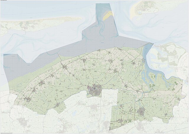
Nederlands: Topografisch kaartbeeld van de toekomstige gemeente, samengesteld door Jan-Willem van Aalst met open data uit het Stelsel van Overheidsgegevens en OpenStreetMap, CC-BY OSM bijdragers.
English: Topographic map of the upcoming municipality. Compiled by Jan-Willem van Aalst using open data from the Dutch Government collection of Geodata, plus OpenStreetMap, CC-BY OSM contributors. |
| Datum | |
| Boarne | Eigen wurk |
| Auteur | Janwillemvanaalst |
Lisinsje
I, the copyright holder of this work, hereby publish it under the following license:
This file is licensed under the Creative Commons Attribution-Share Alike 4.0 International license.
- Fiel jo frij:
- te dielen – it wurk te kopiearjen, fersprieden en út te stjoeren
- te fermingen – it wurk oan te passen
- Under de neikommende betingsten:
- Nammefermelding – You must give appropriate credit, provide a link to the license, and indicate if changes were made. You may do so in any reasonable manner, but not in any way that suggests the licensor endorses you or your use.
- Lyk diele – If you remix, transform, or build upon the material, you must distribute your contributions under the same or compatible license as the original.
Triemskiednis
Klik op in datum/tiid om it bestân te besjen sa't it op dat stuit wie.
| Datum/Tiid | Miniatuer | ôfmjittings | Meidogger | Opmerking | |
|---|---|---|---|---|---|
| lêste | 1 mrt 2024, 22.52 | | 13.265 × 9.453 (9,44 MB) | Janwillemvanaalst | Map layers update, Feb. 2024 |
| 24 sep 2023, 17.18 |  | 13.262 × 9.447 (9,93 MB) | Janwillemvanaalst | Map layers update, September 2023 | |
| 17 sep 2022, 14.40 |  | 16.372 × 11.663 (19,65 MB) | Janwillemvanaalst | Map layers update, September 2022 | |
| 22 jun 2021, 20.11 |  | 16.372 × 11.663 (19,71 MB) | Janwillemvanaalst | Map layers update, 30 June 2021 | |
| 4 nov 2020, 19.02 |  | 16.372 × 11.663 (19,63 MB) | Janwillemvanaalst | Map layers update, Sept. 2020 | |
| 22 apr 2019, 11.11 |  | 16.376 × 11.671 (19,25 MB) | Janwillemvanaalst | Map layers update, April 2019 | |
| 16 nov 2018, 09.02 |  | 16.376 × 11.671 (19,31 MB) | Janwillemvanaalst | User created page with UploadWizard |
Bestânsgebrûk
De neikommende 13 siden brûke dit bestân:
Globaal bestânsgebrûk
De neikommende oare wiki's brûke dit bestân:
- Gebrûk op af.wikipedia.org
- Gebrûk op de.wikipedia.org
- Gebrûk op en.wikipedia.org
- Gebrûk op frr.wikipedia.org
- Gebrûk op nds-nl.wikipedia.org
- Gebrûk op nl.wikipedia.org
- Gebrûk op ru.wikipedia.org
- Gebrûk op sv.wikipedia.org
- Gebrûk op uk.wikipedia.org
- Gebrûk op www.wikidata.org
- Gebrûk op zea.wikipedia.org