
Ofbyld:EU-Austria.svg

Size of this PNG preview of this SVG file: 713 × 600 piksels. Oare resolúsjes: 285 × 240 piksels | 571 × 480 piksels | 913 × 768 piksels | 1.218 × 1.024 piksels | 2.435 × 2.048 piksels | 2.045 × 1.720 piksels.
Oarspronklik bestân (SVG-bestân, nominaal 2.045 × 1.720 pixels, bestânsgrutte: 7,33 MB)
Gearfetting
| Beskriuwing |
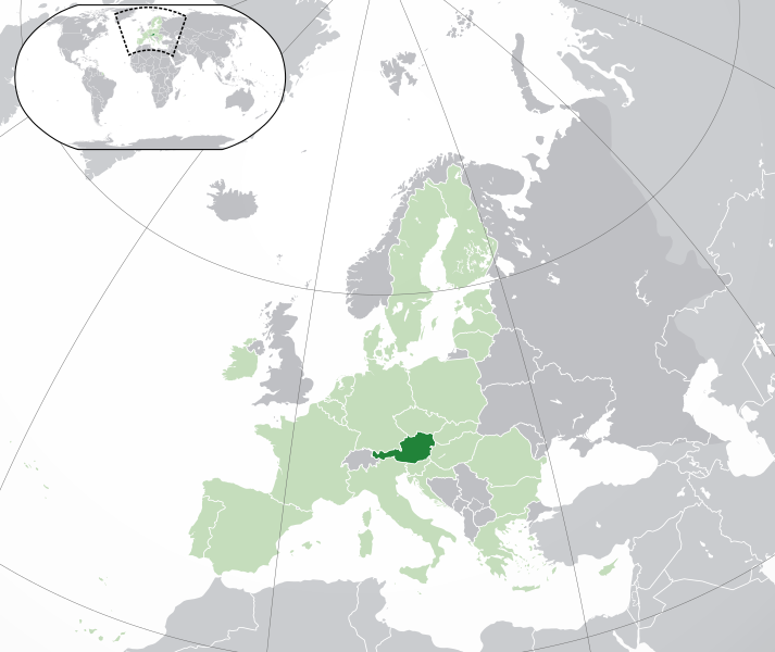
English: (Dark-Green) Austria. (Light-Green) The rest of the European Union (EU). (Dark-gray) The rest of Europe. (Light-gray) The surrounding region.
See also: |
| SVG genesis | |
| Datum | |
| Boarne | Own work based on: Location European nation states.svg |
| Auteur | NuclearVacuum |
| Oare ferzjes |
|
| SVG genesis |


Lisinsje
I, the copyright holder of this work, hereby publish it under the following licenses:
This file is licensed under the Creative Commons Attribution-Share Alike 3.0 Unported license.
- Fiel jo frij:
- te dielen – it wurk te kopiearjen, fersprieden en út te stjoeren
- te fermingen – it wurk oan te passen
- Under de neikommende betingsten:
- Nammefermelding – You must give appropriate credit, provide a link to the license, and indicate if changes were made. You may do so in any reasonable manner, but not in any way that suggests the licensor endorses you or your use.
- Lyk diele – If you remix, transform, or build upon the material, you must distribute your contributions under the same or compatible license as the original.

|
Der wurdt tastimming jûn ta kopiearjen, fersprieden en/of wizigjen fan dit dokumint ûnder de betinksten fan de GNU-lisinsje foar iepen dokumintaasje, ferzje 1.2, as eltse lettere ferzje útjûn troch de Free Software Foundation; sûnder Ynfariante Seksjes, sûnder Omkaftteksten foar de Foarkante en sûnder Omkaftteksten foar de Efterkante. In kopy fan de lisinsje is opnaam yn de seksje "Text of the GNU Free Documentation License". |
You may select the license of your choice.
Triemskiednis
Klik op in datum/tiid om it bestân te besjen sa't it op dat stuit wie.
| Datum/Tiid | Miniatuer | ôfmjittings | Meidogger | Opmerking | |
|---|---|---|---|---|---|
| lêste | 1 feb 2020, 06.30 | | 2.045 × 1.720 (7,33 MB) | Rob984 | UK and Gibraltar have left the EU. New base which includes all of Portugal's islands within frame, as well as Arctic Russian islands part of Europe. Also fixed Flevoland in the Netherlands. |
| 25 okt 2016, 20.58 |  | 2.045 × 1.720 (7,33 MB) | Giorgi Balakhadze | + | |
| 24 des 2015, 11.21 |  | 2.045 × 1.720 (7,33 MB) | Nordwestern | Per original framework and Commons' rules. Agree with A2D2. | |
| 18 mrt 2015, 18.24 |  | 2.045 × 1.720 (7,38 MB) | Mapclean | Reverted to Leftcry's version, please go to your talk page | |
| 21 feb 2015, 16.02 |  | 2.045 × 1.720 (2,62 MB) | VS6507 | Spain. Greece. Slovakia. Cyprus. Romania VETO | |
| 16 nov 2014, 21.33 |  | 2.045 × 1.720 (7,38 MB) | Leftcry | Reverted to version as of 22:30, 18 October 2014 Please go to your talk page | |
| 16 nov 2014, 18.17 |  | 2.045 × 1.720 (2,62 MB) | A2D2 | The map must show the original de-jure status with no breakaway regions, as it was originally created. An alternative map showing the de-facto status with breakaway regions needs to created instead. | |
| 16 nov 2014, 17.40 |  | 2.045 × 1.720 (7,38 MB) | A2D2 | Reverted to version as of 21:04, 18 October 2014 | |
| 19 okt 2014, 00.30 |  | 2.045 × 1.720 (7,38 MB) | Leftcry | Minor fix | |
| 18 okt 2014, 23.07 |  | 2.045 × 1.720 (7,38 MB) | Leftcry | Minor fix |
Bestânsgebrûk
De neikommende side brûkt dit bestân:
Globaal bestânsgebrûk
De neikommende oare wiki's brûke dit bestân:
- Gebrûk op ady.wikipedia.org
- Gebrûk op af.wikipedia.org
- Gebrûk op als.wikipedia.org
- Gebrûk op ami.wikipedia.org
- Gebrûk op an.wikipedia.org
- Gebrûk op ar.wikipedia.org
- النمسا
- معاملة المثليين في النمسا
- مستخدم:ElWaliElAlaoui/ملعب 8
- مستخدم:جار الله/قائمة صور مقالات العلاقات الثنائية
- العلاقات النمساوية الأمريكية
- العلاقات الأنغولية النمساوية
- العلاقات النمساوية الكورية الجنوبية
- العلاقات النمساوية الإريترية
- العلاقات النمساوية السويسرية
- العلاقات الألمانية النمساوية
- العلاقات النمساوية الليختنشتانية
- العلاقات النمساوية البوليفية
- العلاقات النمساوية الموزمبيقية
- العلاقات الألبانية النمساوية
- العلاقات النمساوية البلجيكية
- العلاقات النمساوية الإثيوبية
- العلاقات النمساوية البيلاروسية
- العلاقات النمساوية الطاجيكستانية
- العلاقات النمساوية الروسية
- العلاقات النمساوية الرومانية
- العلاقات الأرجنتينية النمساوية
- العلاقات النمساوية الغامبية
- العلاقات النمساوية القبرصية
- العلاقات النمساوية السيراليونية
- العلاقات النمساوية النيبالية
- العلاقات النمساوية الليبيرية
- العلاقات التشيكية النمساوية
- العلاقات النمساوية الميانمارية
- العلاقات النمساوية الكندية
- العلاقات النمساوية الزيمبابوية
- العلاقات النمساوية الإسرائيلية
- العلاقات النمساوية البالاوية
- العلاقات النمساوية المالية
- العلاقات النمساوية النيجيرية
- العلاقات النمساوية اليمنية
- العلاقات النمساوية الفانواتية
- العلاقات الغابونية النمساوية
- العلاقات النمساوية البنمية
- العلاقات النمساوية الكوبية
- العلاقات النمساوية الجورجية
- العلاقات النمساوية التونسية
- العلاقات النمساوية الكورية الشمالية
- العلاقات النمساوية الهندية
- العلاقات النمساوية اليابانية
Mear globaal gebrûk fan dit bestân besjen.