
Ofbyld:CuxtonMedway9914.JPG
Grutte fan dit proefbyld: 800 × 600 piksels. Oare resolúsjes: 320 × 240 piksels | 640 × 480 piksels | 1.024 × 768 piksels | 1.280 × 960 piksels | 2.016 × 1.512 piksels.
Oarspronklik bestân (2.016 × 1.512 pixels, bestânsgrutte: 764 KB, MIME-type: image/jpeg)
Gearfetting
| Beskriuwing |
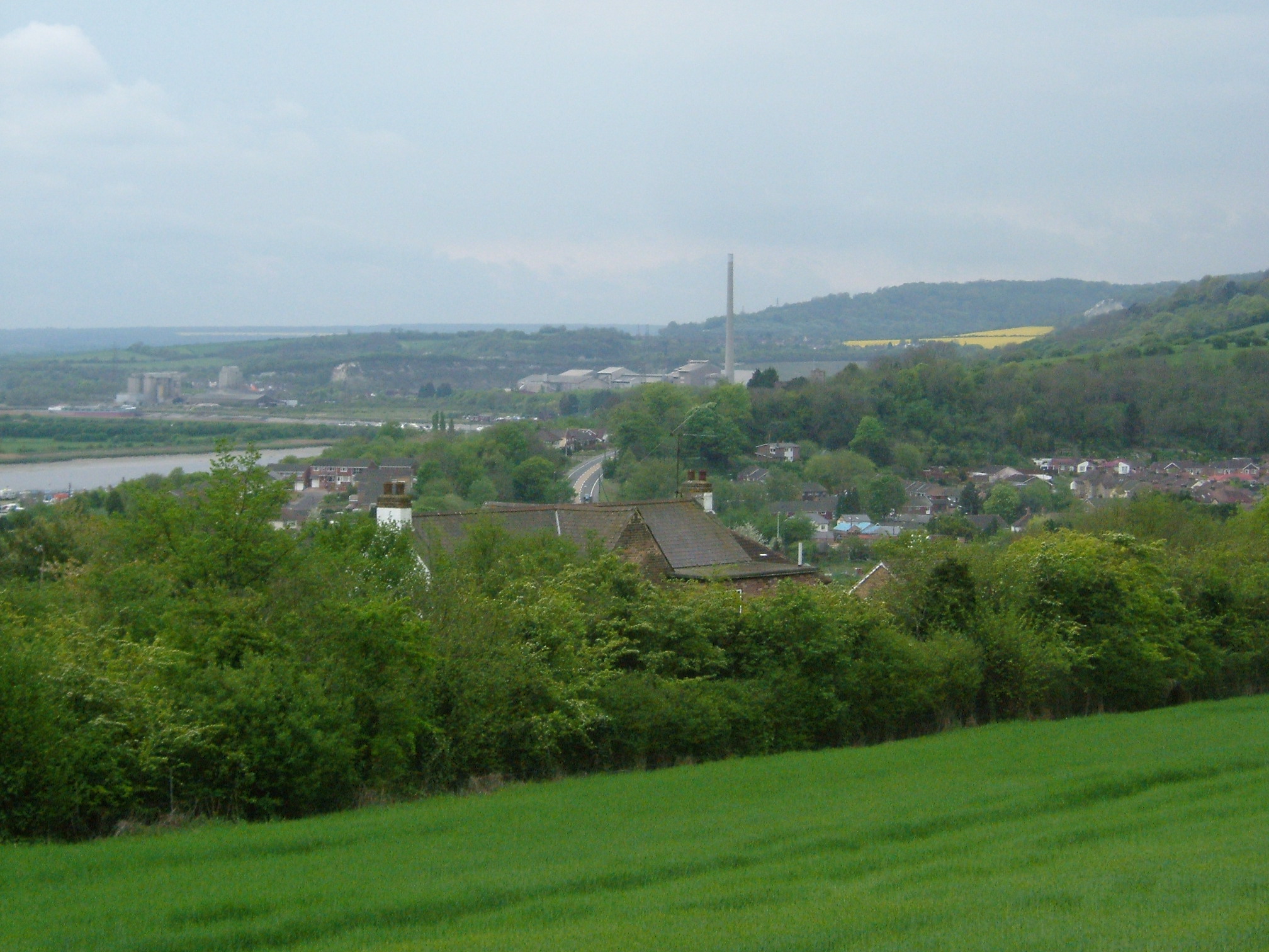
A view of Cuxton, Kent from Ranscombe Farm. The village is sited in a valley in the North Downs leading to the River Medway. In the background is a chimney of the Cement Works at Halling. It is April and the fields are planted with Oil Seed rape giving it the distinctive yellow colour
|
||||
| Datum | |||||
| Boarne | Eigen wurk | ||||
| Auteur | ClemRutter |
Lisinsje
I, the copyright holder of this work, hereby publish it under the following licenses:

|
Der wurdt tastimming jûn ta kopiearjen, fersprieden en/of wizigjen fan dit dokumint ûnder de betinksten fan de GNU-lisinsje foar iepen dokumintaasje, ferzje 1.2, as eltse lettere ferzje útjûn troch de Free Software Foundation; sûnder Ynfariante Seksjes, sûnder Omkaftteksten foar de Foarkante en sûnder Omkaftteksten foar de Efterkante. In kopy fan de lisinsje is opnaam yn de seksje "Text of the GNU Free Documentation License". |
| This file is licensed under the Creative Commons Attribution-Share Alike 3.0 Unported license. | ||
| ||
| This licensing tag was added to this file as part of the GFDL licensing update. |
This file is licensed under the Creative Commons Attribution 2.5 Generic license.
- Fiel jo frij:
- te dielen – it wurk te kopiearjen, fersprieden en út te stjoeren
- te fermingen – it wurk oan te passen
- Under de neikommende betingsten:
- Nammefermelding – You must give appropriate credit, provide a link to the license, and indicate if changes were made. You may do so in any reasonable manner, but not in any way that suggests the licensor endorses you or your use.
You may select the license of your choice.
Triemskiednis
Klik op in datum/tiid om it bestân te besjen sa't it op dat stuit wie.
| Datum/Tiid | Miniatuer | ôfmjittings | Meidogger | Opmerking | |
|---|---|---|---|---|---|
| lêste | 25 apr 2007, 19.33 | | 2.016 × 1.512 (764 KB) | ClemRutter | {{Information |Description=A view of Cuxton, Kent from Ranscombe Farm. The village is sited in a valley in the North Downs leading to the River Medway. In the background is a chimney of the Cement Works at Halling. It is April and the fields are planted w |
Bestânsgebrûk
De neikommende side brûkt dit bestân:
Globaal bestânsgebrûk
De neikommende oare wiki's brûke dit bestân:
- Gebrûk op en.wikipedia.org
- Gebrûk op it.wikipedia.org
- Gebrûk op pl.wikipedia.org
- Gebrûk op simple.wikipedia.org