
Ofbyld:Canada Maritime provinces map.png
Gjin hegere resolúsje beskikber.
Canada_Maritime_provinces_map.png (262 × 212 pixels, bestânsgrutte: 4 KB, MIME-type: image/png)
| Beskriuwing |
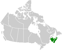
English: Map of the Maritime provinces. See Image:Canada provinces blank vide.png for additional information.
Français : Carte des provinces maritimes. Voir Image:Canada provinces blank vide.png pour de renseignements supplémentaires. |
|||
| Boarne | user created | |||
| Auteur | QuartierLatin1968 | |||
| Tastimming (Reusing this file) |
|
|||
| Oare ferzjes |
|


Triemskiednis
Klik op in datum/tiid om it bestân te besjen sa't it op dat stuit wie.
| Datum/Tiid | Miniatuer | ôfmjittings | Meidogger | Opmerking | |
|---|---|---|---|---|---|
| lêste | 24 sep 2005, 04.24 | | 262 × 212 (4 KB) | QuartierLatin1968 | * {{english}} Map of the Maritime provinces. See Image:Canada provinces blank vide.png for additional information. * {{français}} Carte des provinces maritimes. Voir Image:Canada provinces blank vide.png pour de renseignements supplémentaires. |
Bestânsgebrûk
Der binne gjin siden dy't dit bestân brûke.
Globaal bestânsgebrûk
De neikommende oare wiki's brûke dit bestân:
- Gebrûk op en.wikipedia.org
- Gebrûk op es.wikipedia.org
- Gebrûk op fr.wikipedia.org