
Ofbyld:Behouden Huys in 1881.jpg

Behouden_Huys_in_1881.jpg (728 × 504 pixels, bestânsgrutte: 197 KB, MIME-type: image/jpeg)
Gearfetting
| Beskriuwing |
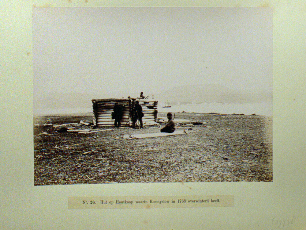
Nederlands: Het Behouden Huys in 1881 tijdens de Nederlandse expeditie naar het gebied tijdens het Eerste Internationale Pooljaar. (Het is de vraag of dit daadwerkelijk het Behouden Huys is. Dat was namelijk 6 m. breed en 10 m. lang en bij de vondst in 1871 al behoorlijk ingestort. Bovendien meldt Zeeberg, J.J. (2007) - p. 87 dat deze expeditie het Behouden Huys niet heeft weten te bereiken.
|
||||||||||||||||||||||||||
| Datum | |||||||||||||||||||||||||||
| Boarne | Maritiem Digitaal (direct link) - original description: "Bemanningsleden van de schoener Willem Barentsz, tijdens de reis voor wetenschappelijk onderzoek in de Noordelijke IJszee van 1881, bij de overblijfselen van het 'Behouden Huys' waarin de ontdekkingsreiziger Willem Barentsz in de winter van 1596-1597 overwinterde op Nova Zembla" . | ||||||||||||||||||||||||||
| Auteur |
Grant, William J.A. [1851–1935], currently located in the
|
||||||||||||||||||||||||||
.svg)
| Camera location | | View this and other nearby images on: OpenStreetMap |
|---|
Lisinsje
|
The author died in 1935, so this work is in the public domain in its country of origin and other countries and areas where the copyright term is the author's life plus 80 years or fewer. This work is in the public domain in the United States because it was published (or registered with the U.S. Copyright Office) before January 1, 1929. | |
| This file has been identified as being free of known restrictions under copyright law, including all related and neighboring rights. | |
Triemskiednis
Klik op in datum/tiid om it bestân te besjen sa't it op dat stuit wie.
| Datum/Tiid | Miniatuer | ôfmjittings | Meidogger | Opmerking | |
|---|---|---|---|---|---|
| lêste | 13 jun 2022, 06.06 | | 728 × 504 (197 KB) | Ras67 | cropped and leveled |
| 13 jun 2022, 06.05 |  | 1.024 × 768 (384 KB) | Ras67 | original scan for archival purpose | |
| 2 mai 2008, 16.22 |  | 400 × 275 (20 KB) | Hardscarf | {{Information |Description={{nl|Het Behouden Huys in 1881 tijdens de Nederlandse expeditie naar het gebied tijdens het Eerste Internationale Pooljaar}} |Source=[http://www.maritiemdigitaal.nl/ Maritiem Digitaal] - original description: "Bemanningsleden va |
Bestânsgebrûk
De neikommende side brûkt dit bestân:
Globaal bestânsgebrûk
De neikommende oare wiki's brûke dit bestân:
- Gebrûk op ar.wikipedia.org
- Gebrûk op ast.wikipedia.org
- Gebrûk op ca.wikipedia.org
- Gebrûk op de.wikipedia.org
- Gebrûk op es.wikipedia.org
- Gebrûk op fr.wikipedia.org
- Gebrûk op it.wikipedia.org
- Gebrûk op nl.wikipedia.org
- Gebrûk op pnb.wikipedia.org
- Gebrûk op sl.wikipedia.org