
Ofbyld:AmsterdamIsl Map.png
Grutte fan dit proefbyld: 536 × 600 piksels. Oare resolúsjes: 214 × 240 piksels | 429 × 480 piksels | 686 × 768 piksels | 915 × 1.024 piksels | 1.887 × 2.112 piksels.
Oarspronklik bestân (1.887 × 2.112 pixels, bestânsgrutte: 732 KB, MIME-type: image/png)
Gearfetting
| Beskriuwing |
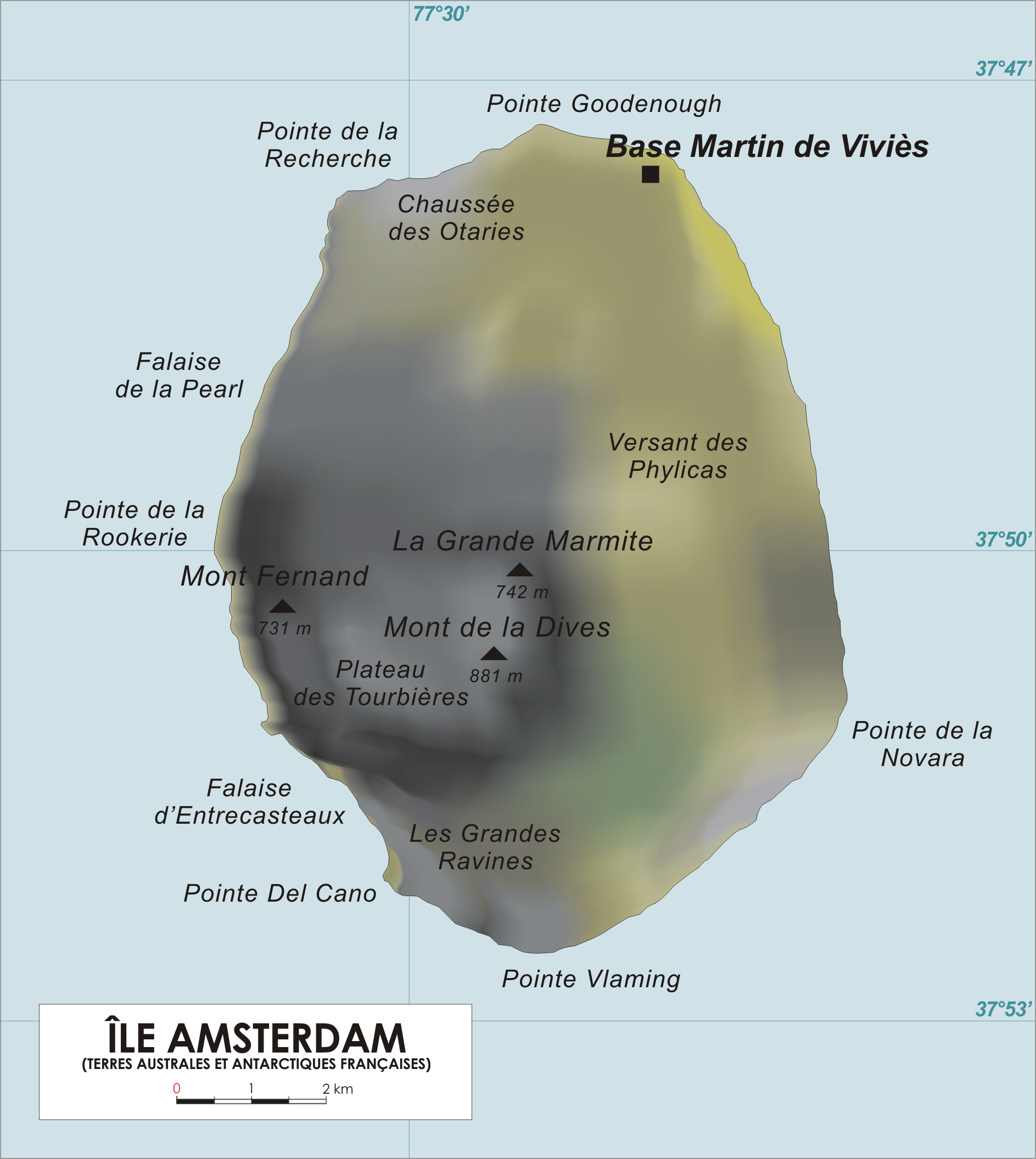
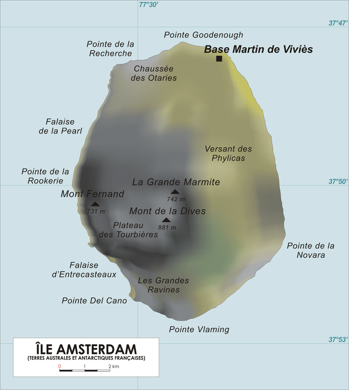
English: Map of Amsterdam Island, French Southern and Antarctic Territories.
Français : Carte de l'Ile Amsterdam, Terres australes et antarctiques françaises. |
| Datum | |
| Boarne | Original drawing |
| Auteur | varp |
Lisinsje
| I, the copyright holder of this work, release this work into the public domain. This applies worldwide. In some countries this may not be legally possible; if so: I grant anyone the right to use this work for any purpose, without any conditions, unless such conditions are required by law. |
Triemskiednis
Klik op in datum/tiid om it bestân te besjen sa't it op dat stuit wie.
| Datum/Tiid | Miniatuer | ôfmjittings | Meidogger | Opmerking | |
|---|---|---|---|---|---|
| lêste | 28 jan 2013, 19.43 | | 1.887 × 2.112 (732 KB) | Olli Niemitalo | Correct scale bar length |
| 27 apr 2006, 16.05 |  | 1.887 × 2.112 (1,05 MB) | Varp~commonswiki | ||
| 26 apr 2006, 15.50 |  | 1.887 × 1.965 (1,01 MB) | Varp~commonswiki | *Map of Amsterdam Island, French Southern and Antarctic Territories *drawn by varp |
Bestânsgebrûk
De neikommende side brûkt dit bestân:
Globaal bestânsgebrûk
De neikommende oare wiki's brûke dit bestân:
- Gebrûk op af.wikipedia.org
- Gebrûk op ar.wikipedia.org
- Gebrûk op az.wikipedia.org
- Gebrûk op bg.wikipedia.org
- Gebrûk op br.wikipedia.org
- Gebrûk op ca.wikipedia.org
- Gebrûk op ceb.wikipedia.org
- Gebrûk op cs.wikipedia.org
- Gebrûk op cv.wikipedia.org
- Gebrûk op da.wikipedia.org
- Gebrûk op de.wikipedia.org
- Gebrûk op el.wikipedia.org
- Gebrûk op en.wikipedia.org
- Gebrûk op en.wikivoyage.org
- Gebrûk op eo.wikipedia.org
- Gebrûk op es.wikipedia.org
- Gebrûk op fi.wikipedia.org
- Gebrûk op fr.wikipedia.org
- Gebrûk op fr.wiktionary.org
- Gebrûk op gl.wikipedia.org
- Gebrûk op hr.wikipedia.org
- Gebrûk op hu.wikipedia.org
- Gebrûk op id.wikipedia.org
- Gebrûk op it.wikipedia.org
- Gebrûk op ja.wikipedia.org
- Gebrûk op ka.wikipedia.org
- Gebrûk op ky.wikipedia.org
- Gebrûk op lij.wikipedia.org
- Gebrûk op lld.wikipedia.org
- Gebrûk op lt.wikipedia.org
- Gebrûk op lv.wikipedia.org
- Gebrûk op mk.wikipedia.org
- Gebrûk op nds-nl.wikipedia.org
Mear globaal gebrûk fan dit bestân besjen.