
Ofbyld:Federal Capital Territory Nigeria.png
Gjin hegere resolúsje beskikber.
Federal_Capital_Territory_Nigeria.png (270 × 221 pixels, bestânsgrutte: 19 KB, MIME-type: image/png)
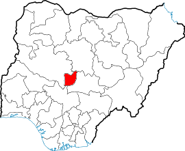
en:Map showing location of Federal Capital Territory in Nigeria
fr:Carte montrant la position du territoire de la capitale fédérale au Nigeria
Drawn by/dessiné par User:Jaimz height-field

|
Der wurdt tastimming jûn ta kopiearjen, fersprieden en/of wizigjen fan dit dokumint ûnder de betinksten fan de GNU-lisinsje foar iepen dokumintaasje, ferzje 1.2, as eltse lettere ferzje útjûn troch de Free Software Foundation; sûnder Ynfariante Seksjes, sûnder Omkaftteksten foar de Foarkante en sûnder Omkaftteksten foar de Efterkante. In kopy fan de lisinsje is opnaam yn de seksje "Text of the GNU Free Documentation License". |
| This file is licensed under the Creative Commons Attribution-Share Alike 3.0 Unported license. | ||
| ||
| This licensing tag was added to this file as part of the GFDL licensing update. |
Triemskiednis
Klik op in datum/tiid om it bestân te besjen sa't it op dat stuit wie.
| Datum/Tiid | Miniatuer | ôfmjittings | Meidogger | Opmerking | |
|---|---|---|---|---|---|
| lêste | 17 apr 2005, 14.41 | | 270 × 221 (19 KB) | Jaimz height-field | en:Map showing location of Abuja state in Nigeria fr:Carte montrant la position de l'état d'Abuja au Nigeria Drawn by/dessiné par Jaimz height-field {{GFDL}} Category:Maps of Nigeria |
| 9 apr 2005, 20.29 |  | 236 × 196 (28 KB) | Jaimz height-field | en:Map showing location of Federal Capital Territory in Nigeria fr:Carte montrant la position du territoire de la capitale fédérale au Nigeria Drawn by/dessiné par User:Jaimz height-field {{GFDL}} |
Bestânsgebrûk
De neikommende side brûkt dit bestân:
Globaal bestânsgebrûk
De neikommende oare wiki's brûke dit bestân:
- Gebrûk op fo.wikipedia.org
- Gebrûk op ko.wikipedia.org
- Gebrûk op nl.wikipedia.org
- Gebrûk op qu.wikipedia.org
- Gebrûk op zh.wikipedia.org