
Ofbyld:5 Boroughs Labels New York City Map Julius Schorzman.png
Grutte fan dit proefbyld: 616 × 600 piksels. Oare resolúsjes: 247 × 240 piksels | 493 × 480 piksels | 789 × 768 piksels | 1.052 × 1.024 piksels | 2.104 × 2.048 piksels | 2.652 × 2.582 piksels.
Oarspronklik bestân (2.652 × 2.582 pixels, bestânsgrutte: 6,5 MB, MIME-type: image/png)
Gearfetting
| Beskriuwing |
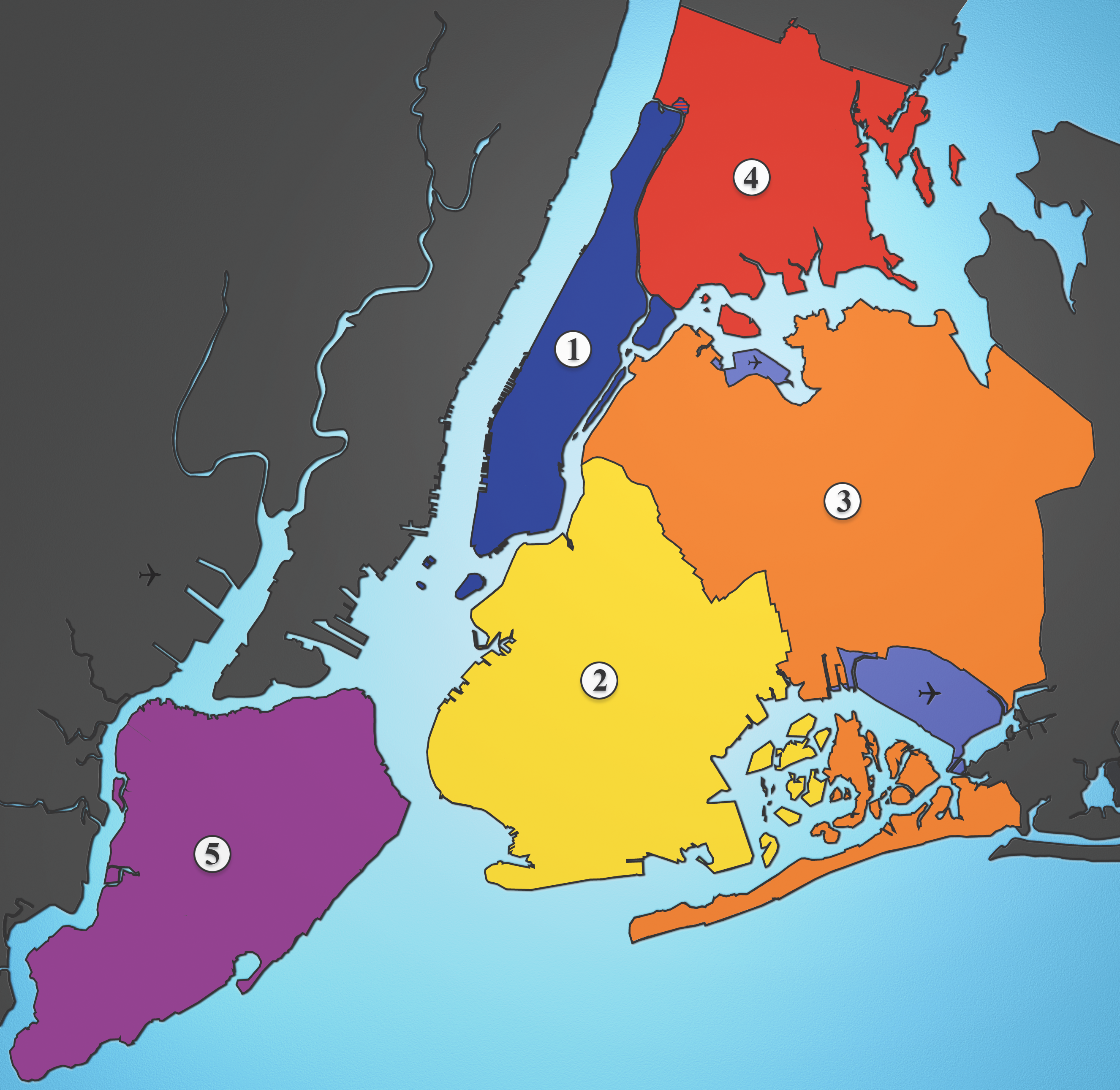
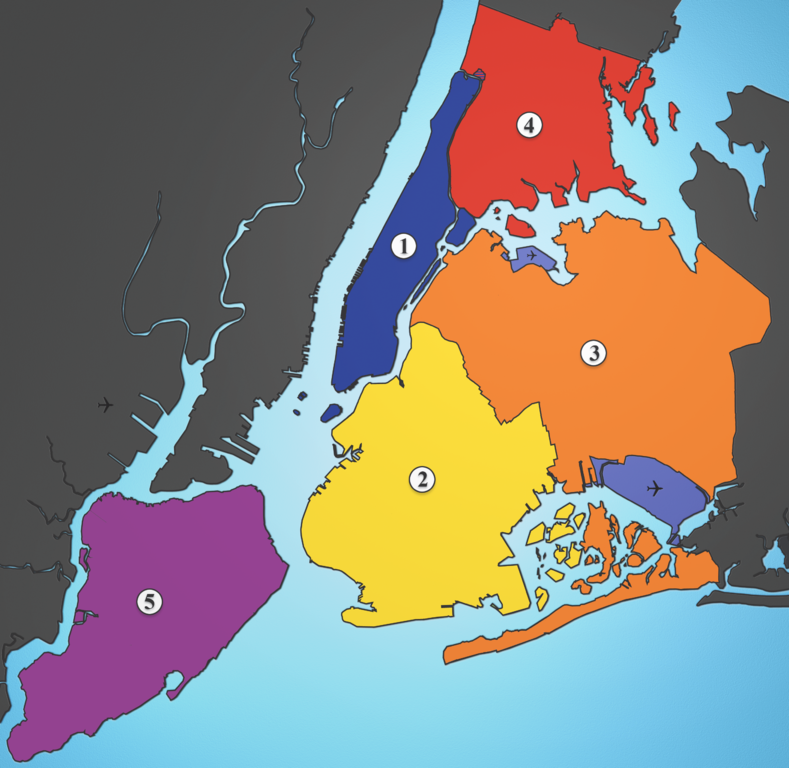
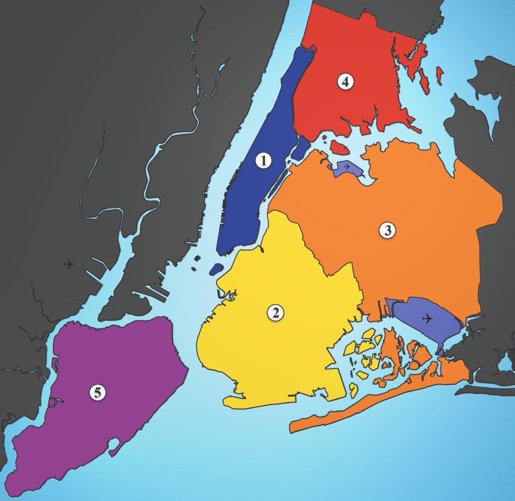
A map showing the five boroughs of New York City, as well as airports. Airports: North East: LGA; South East: JFK; West: EWR |
| Datum | |
| Boarne | I created this image using various maps and images. |
| Auteur | Julius Schorzman |
| Oare ferzjes |
 |
Lisinsje
This file is licensed under the Creative Commons Attribution-Share Alike 2.5 Generic license.
- Fiel jo frij:
- te dielen – it wurk te kopiearjen, fersprieden en út te stjoeren
- te fermingen – it wurk oan te passen
- Under de neikommende betingsten:
- Nammefermelding – You must give appropriate credit, provide a link to the license, and indicate if changes were made. You may do so in any reasonable manner, but not in any way that suggests the licensor endorses you or your use.
- Lyk diele – If you remix, transform, or build upon the material, you must distribute your contributions under the same or compatible license as the original.
Triemskiednis
Klik op in datum/tiid om it bestân te besjen sa't it op dat stuit wie.
| Datum/Tiid | Miniatuer | ôfmjittings | Meidogger | Opmerking | |
|---|---|---|---|---|---|
| lêste | 19 aug 2005, 04.21 | | 2.652 × 2.582 (6,5 MB) | Quasipalm | A map showing the five boroughs of New York City, as well as airports. # Manhattan # Brooklyn # Queens # Bronx # Staten Island Airports: Nort East: LGA Sout East: JFK West: EWR Source: I created this image using various maps and images. {{cc-by-sa-2.5} |
Bestânsgebrûk
De neikommende side brûkt dit bestân:
Globaal bestânsgebrûk
De neikommende oare wiki's brûke dit bestân:
- Gebrûk op af.wikipedia.org
- Gebrûk op als.wikipedia.org
- Gebrûk op ar.wikipedia.org
- Gebrûk op ast.wikipedia.org
- Gebrûk op ay.wikipedia.org
- Gebrûk op be-tarask.wikipedia.org
- Gebrûk op be.wikipedia.org
- Gebrûk op bg.wikipedia.org
- Gebrûk op br.wikipedia.org
- Gebrûk op ca.wikipedia.org
- Gebrûk op ca.wikinews.org
- Gebrûk op da.wikipedia.org
- Gebrûk op de.wikipedia.org
- Gebrûk op de.wikivoyage.org
- Gebrûk op diq.wikipedia.org
- Gebrûk op el.wikipedia.org
- Gebrûk op en.wikipedia.org
- Gebrûk op en.wikiversity.org
- Gebrûk op eo.wikipedia.org
- Gebrûk op es.wikipedia.org
- Gebrûk op et.wikipedia.org
- Gebrûk op eu.wikipedia.org
- Gebrûk op ext.wikipedia.org
- Gebrûk op fa.wikipedia.org
- Gebrûk op fi.wikipedia.org
- Gebrûk op fo.wikipedia.org
Mear globaal gebrûk fan dit bestân besjen.