
Ofbyld:2018 OCHA OpT map Ramallah.jpg

Oarspronklik bestân (2.500 × 1.768 pixels, bestânsgrutte: 819 KB, MIME-type: image/jpeg)
Gearfetting
| Beskriuwing |
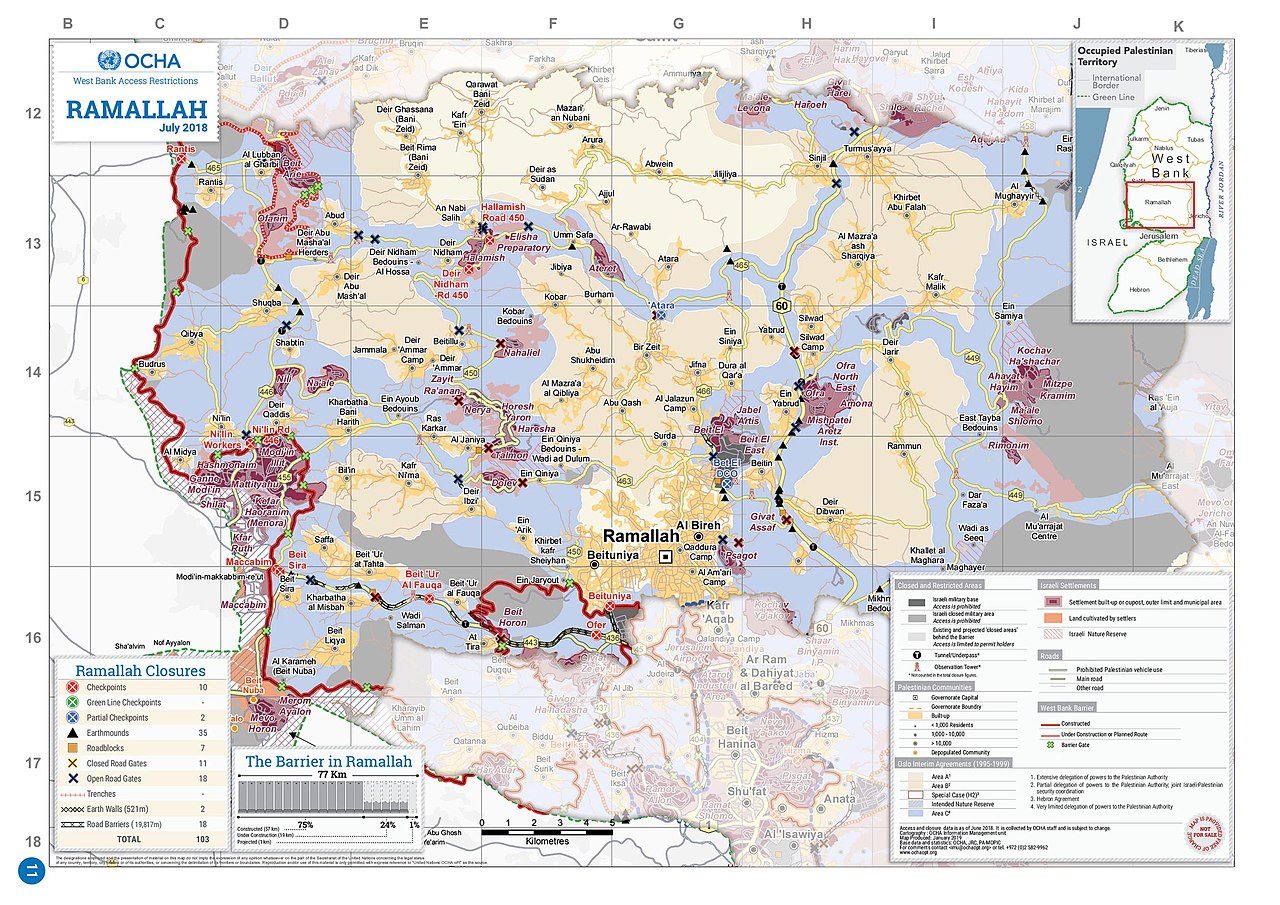
English: 2018 OCHA OpT map |
| Datum | |
| Boarne | https://www.ochaopt.org/atlas2019/wbclosure.html |
| Auteur | OCHA OpT |
| Oare ferzjes |
.jpg)
.jpg)
_in_the_2018_OCHA_OpT_map_Ramallah_(cropped).jpg)
.jpg)
Lisinsje
| This image is a map derived from a United Nations map.
Unless stated otherwise, UN maps are to be considered in the public domain. This applies worldwide. UN maps are, in principle, open source material and you can use them in your work or for making your own map. UN requests however that you delete the UN name, logo and reference number upon any modification to the map. Content of your map will be your responsibility. You can state in your publication, if you wish, something like: based on UN map … (map name, map number, revision number and date). See: Geospatial Information Section. And: Geospatial, location data for a better world. |
 |
Triemskiednis
Klik op in datum/tiid om it bestân te besjen sa't it op dat stuit wie.
| Datum/Tiid | Miniatuer | ôfmjittings | Meidogger | Opmerking | |
|---|---|---|---|---|---|
| lêste | 3 jul 2020, 13.44 | | 2.500 × 1.768 (819 KB) | Onceinawhile | Uploaded a work by OCHA OpT from https://www.ochaopt.org/atlas2019/wbclosure.html with UploadWizard |
Bestânsgebrûk
De neikommende side brûkt dit bestân:
Globaal bestânsgebrûk
De neikommende oare wiki's brûke dit bestân:
- Gebrûk op en.wikipedia.org
- Gebrûk op id.wikipedia.org
- Gebrûk op it.wikipedia.org
- Gebrûk op no.wikipedia.org
- Gebrûk op ta.wikipedia.org
- Gebrûk op zh.wikipedia.org