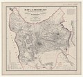
Ofbyld:1861 map of Azerbaijan.jpg

Page contents not supported in other languages.
Ut Wikipedy

Oarspronklik bestân(7.696 × 7.130 pixels, bestânsgrutte: 10,34 MB, MIME-type: image/jpeg)

Dit bestân komt fan Wikimedia Commons, en kin ek troch oare projekten brûkt wurde. De beskriuwing op syn bestânsside dêre wurdt hjirûnder werjûn.

Gearfetting

Beskriuwing
English: Map of Aderbeijan compiled principally from personal observations and surveys made in the years 1851-53 by N. Khanikof and based upon all the points hitherto determined, principally the astronomical observations of Mr. Lemm and the Caucasian Triangulation. 1 : 800 000 Drawn and engraved under general direction of H. Kiepert
Datum
Boarne
Gallica
This file comes from Gallica Digital Library and is available under the digital ID btv1b530987709

This tag does not indicate the copyright status of the attached work. A normal copyright tag is still required. See Commons:Licensing.

Other languages:
Auteur
Heinrich Kiepert  (1818–1899)  wikidata:Q65958 s:it:Autore:Heinrich Kiepert
 
Heinrich Kiepert
Alternative names
H.Kiepert
Description Dútsk geographer en cartographer
Date of birth/death 31 july 1818 Edit this at Wikidata 21 april 1899 Edit this at Wikidata
Location of birth/death Berlyn Berlyn
Work location
Authority file
creator QS:P170,Q65958
Nikolay Vladimirovich Khanykov  (1819–1878) wikidata:Q1932393 s:ru:Николай Владимирович Ханыков
 
Nikolay Vladimirovich Khanykov
Alternative names
Xanikov Nikolay Vladimirovich
Description Russysk skriuwer, diplomat, ûntdekkingsreizger, orientalist, ethnographer en collector
Date of birth/death 1819 / 24 oktober 1819 Edit this at Wikidata 15 novimber 1878 Edit this at Wikidata
Location of birth/death Kaluga Governorate Rambouillet
Authority file
creator QS:P170,Q1932393

Lisinsje

Public domain

This work is in the public domain in its country of origin and other countries and areas where the copyright term is the author's life plus 70 years or fewer.


This work is in the public domain in the United States because it was published (or registered with the U.S. Copyright Office) before January 1, 1929.

Captions

Add a one-line explanation of what this file represents
1861 map of Azerbaijan (made in 1851-53)

Items portrayed in this file

depicts Ingelsk

inception Ingelsk

1861

MIME type Ingelsk

image/jpeg

checksum Ingelsk

b859e8c7ef0d2684bc81663da7ed23a610652b48

determination method Ingelsk: SHA-1 Ingelsk

data size Ingelsk

10.841.965 byte

height Ingelsk

7.130 pixel

width Ingelsk

7.696 pixel

Triemskiednis

Klik op in datum/tiid om it bestân te besjen sa't it op dat stuit wie.

Datum/TiidMiniatuerôfmjittingsMeidoggerOpmerking
lêste16 mrt 2019, 21.17Miniatuer foar de ferzje fan 16 mrt 2019 om 21.177.696 × 7.130 (10,34 MB)BalkaniqueUser created page with UploadWizard

De neikommende side brûkt dit bestân:

Globaal bestânsgebrûk

De neikommende oare wiki's brûke dit bestân: