
Ofbyld:1842TreatyOfLaPointe.jpg
Grutte fan dit proefbyld: 800 × 582 piksels. Oare resolúsjes: 320 × 233 piksels | 640 × 465 piksels | 1.024 × 745 piksels | 1.280 × 931 piksels | 1.650 × 1.200 piksels.
Oarspronklik bestân (1.650 × 1.200 pixels, bestânsgrutte: 1,2 MB, MIME-type: image/jpeg)
Gearfetting
| Beskriuwing |
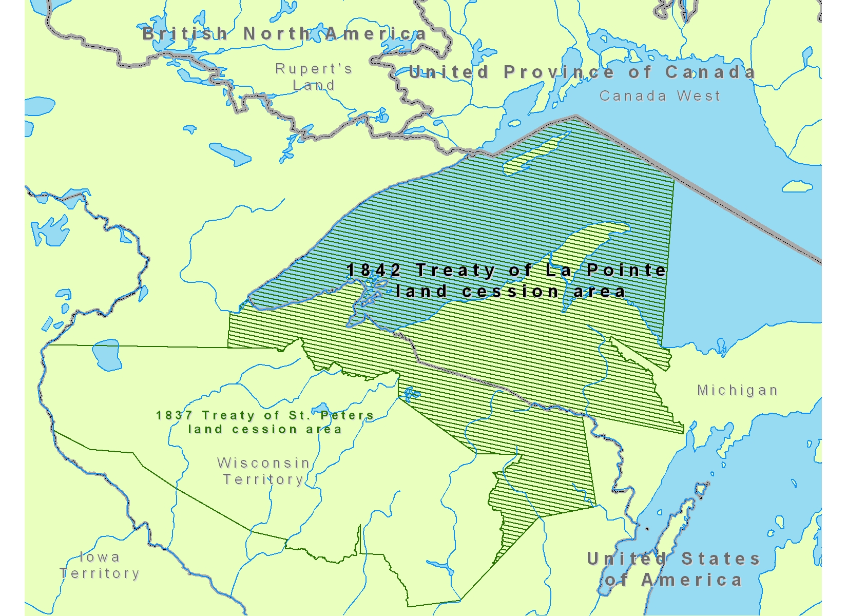
English: Map of Lake Superior region showing the 1842 Treaty of La Pointe land cession area of Native American tribal territories.
|
| Datum | |
| Boarne | Eigen wurk |
| Auteur | CJLippert |
Lisinsje
| I, the copyright holder of this work, release this work into the public domain. This applies worldwide. In some countries this may not be legally possible; if so: I grant anyone the right to use this work for any purpose, without any conditions, unless such conditions are required by law. |
Triemskiednis
Klik op in datum/tiid om it bestân te besjen sa't it op dat stuit wie.
| Datum/Tiid | Miniatuer | ôfmjittings | Meidogger | Opmerking | |
|---|---|---|---|---|---|
| lêste | 22 aug 2008, 20.36 | | 1.650 × 1.200 (1,2 MB) | CJLippert | {{Information |Description={{en|1=Map of Lake Superior region showing the 1842 Treaty of La Pointe land cession area in reference to Rupert's Land, Canada West, [[w:Michig |
Bestânsgebrûk
De neikommende side brûkt dit bestân:
Globaal bestânsgebrûk
De neikommende oare wiki's brûke dit bestân:
- Gebrûk op en.wikipedia.org
- Gebrûk op fr.wikipedia.org
- Gebrûk op ro.wikipedia.org
- Gebrûk op ru.wikipedia.org