
Ofbyld:Wat's Dyke near Northop - geograph.org.uk - 202714.jpg
Gjin hegere resolúsje beskikber.
Wat's_Dyke_near_Northop_-_geograph.org.uk_-_202714.jpg (640 × 480 pixels, bestânsgrutte: 101 KB, MIME-type: image/jpeg)
Gearfetting
| Beskriuwing |
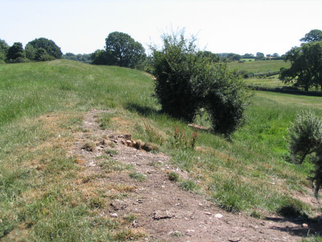
English: Wat's Dyke near Northop. Although the dyke at this point is not very impressive visually, it must have taken a lot of work to make it. For more info see Wat's Dyke |
| Datum | |
| Boarne | From geograph.org.uk |
| Auteur | Peter Craine |
| Nammefermelding (required by the license) | Peter Craine / Wat's Dyke near Northop / |
| Camera location | | View this and other nearby images on: OpenStreetMap |
|---|
_heading:135.00&language=fy)
Lisinsje

|
This image was taken from the Geograph project collection. See this photograph's page on the Geograph website for the photographer's contact details. The copyright on this image is owned by Peter Craine and is licensed for reuse under the Creative Commons Attribution-ShareAlike 2.0 license.
|
This file is licensed under the Creative Commons Attribution-Share Alike 2.0 Generic license.
Nammefermelding: Peter Craine
- Fiel jo frij:
- te dielen – it wurk te kopiearjen, fersprieden en út te stjoeren
- te fermingen – it wurk oan te passen
- Under de neikommende betingsten:
- Nammefermelding – You must give appropriate credit, provide a link to the license, and indicate if changes were made. You may do so in any reasonable manner, but not in any way that suggests the licensor endorses you or your use.
- Lyk diele – If you remix, transform, or build upon the material, you must distribute your contributions under the same or compatible license as the original.
- Remove redundant categories and try to put this image in the most specific category/categories
- Remove this template
- The location categories are based on information from this geonames tool and this OpenStreetMap tool combined with a database. You can also have a look at this tool from mysociety.
- The topic category from Geograph was Dyke (defensive earthwork) (find similar images (defensive earthwork) at Geograph)
Triemskiednis
Klik op in datum/tiid om it bestân te besjen sa't it op dat stuit wie.
| Datum/Tiid | Miniatuer | ôfmjittings | Meidogger | Opmerking | |
|---|---|---|---|---|---|
| lêste | 1 feb 2010, 00.44 | | 640 × 480 (101 KB) | GeographBot | == {{int:filedesc}} == {{Information |description={{en|1=Wat's Dyke near Northop. Although the dyke at this point is not very impressive visually, it must have taken a lot of work to make it. For more info see http://en.wikipedia.org/wiki/Wat%27s_Dyke}} | |
Bestânsgebrûk
De neikommende side brûkt dit bestân:
Globaal bestânsgebrûk
De neikommende oare wiki's brûke dit bestân:
- Gebrûk op cy.wikipedia.org
- Gebrûk op da.wikipedia.org
- Gebrûk op de.wikipedia.org
- Gebrûk op en.wikipedia.org
- Gebrûk op en.wikivoyage.org
- Gebrûk op es.wikipedia.org
- Gebrûk op fr.wikipedia.org
- Gebrûk op www.wikidata.org