
Ofbyld:Victoria locator-MJC.png
Gjin hegere resolúsje beskikber.
Victoria_locator-MJC.png (563 × 476 pixels, bestânsgrutte: 12 KB, MIME-type: image/png)

|
This locator map image could be re-created using vector graphics as an SVG file. This has several advantages; see Commons:Media for cleanup for more information. If an SVG form of this image is available, please upload it and afterwards replace this template with
{{vector version available|new image name}}.
It is recommended to name the SVG file “Victoria locator-MJC.svg”—then the template Vector version available (or Vva) does not need the new image name parameter. |
Gearfetting
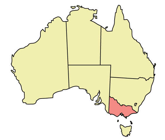
Map of Australia highlighting Victoria
Made in Adobe Illustrator by Martynam and released under the GFDL
Lisinsje
| This file is licensed under the Creative Commons Attribution-Share Alike 3.0 Unported license. Subject to disclaimers. | ||
| ||
| This licensing tag was added to this file as part of the GFDL licensing update. |

|
Der wurdt tastimming jûn ta kopiearjen, fersprieden en/of wizigjen fan dit dokumint ûnder de betinksten fan de GNU-lisinsje foar iepen dokumintaasje, ferzje 1.2, as eltse lettere ferzje útjûn troch de Free Software Foundation; sûnder Ynfariante Seksjes, sûnder Omkaftteksten foar de Foarkante en sûnder Omkaftteksten foar de Efterkante. In kopy fan de lisinsje is opnaam yn de seksje "Text of the GNU Free Documentation License". Subject to disclaimers. |
Triemskiednis
Klik op in datum/tiid om it bestân te besjen sa't it op dat stuit wie.
| Datum/Tiid | Miniatuer | ôfmjittings | Meidogger | Opmerking | |
|---|---|---|---|---|---|
| lêste | 31 des 2005, 00.49 | | 563 × 476 (12 KB) | Snowdog | Map of Australia highlighting Victoria Made in Adobe Illustrator by Martynam and released under the GFDL Category:Maps of Australia |
Bestânsgebrûk
Der binne gjin siden dy't dit bestân brûke.
Globaal bestânsgebrûk
De neikommende oare wiki's brûke dit bestân:
- Gebrûk op af.wikipedia.org
- Gebrûk op ar.wikipedia.org
- Gebrûk op be.wikipedia.org
- Gebrûk op ckb.wikipedia.org
- Gebrûk op cs.wikipedia.org
- Gebrûk op cy.wikipedia.org
- Gebrûk op de.wikipedia.org
- Gebrûk op en.wikipedia.org
- City of Maroondah
- Hobsons Bay
- Paisley railway station, Melbourne
- Galvin railway station
- Williamstown Pier railway station
- Chum Creek, Victoria
- Don Valley, Victoria
- Gruyere, Victoria
- Kalorama, Victoria
- Launching Place, Victoria
- Macclesfield, Victoria
- Menzies Creek, Victoria
- Seville, Victoria
- Seville East, Victoria
- Sherbrooke, Victoria
- Tremont, Victoria
- Yellingbo, Victoria
- Cranbourne South, Victoria
- Narre Warren East, Victoria
- Warneet, Victoria
- Dandenong North, Victoria
- Dandenong South, Victoria
- Noble Park North, Victoria
- Skye, Victoria
- Blairgowrie, Victoria
- Boneo, Victoria
- Main Ridge, Victoria
- Merricks North, Victoria
- Red Hill, Victoria
- Red Hill South, Victoria
- Capel Sound, Victoria
- Simpson Barracks
- Yallambie
- Attwood, Victoria
- Coolaroo, Victoria
- Oaklands Junction, Victoria
- Somerton, Victoria
- Burnside, Victoria
- Hillside, Victoria
- Kurunjang
- Rockbank, Victoria
- Ardeer, Victoria
- Calder Park, Victoria
Mear globaal gebrûk fan dit bestân besjen.