
Ofbyld:South Orkney Islands-en.svg

Size of this PNG preview of this SVG file: 800 × 476 piksels. Oare resolúsjes: 320 × 190 piksels | 640 × 381 piksels | 1.024 × 609 piksels | 1.280 × 761 piksels | 2.560 × 1.523 piksels | 2.303 × 1.370 piksels.
Oarspronklik bestân (SVG-bestân, nominaal 2.303 × 1.370 pixels, bestânsgrutte: 252 KB)
Gearfetting
| Beskriuwing |
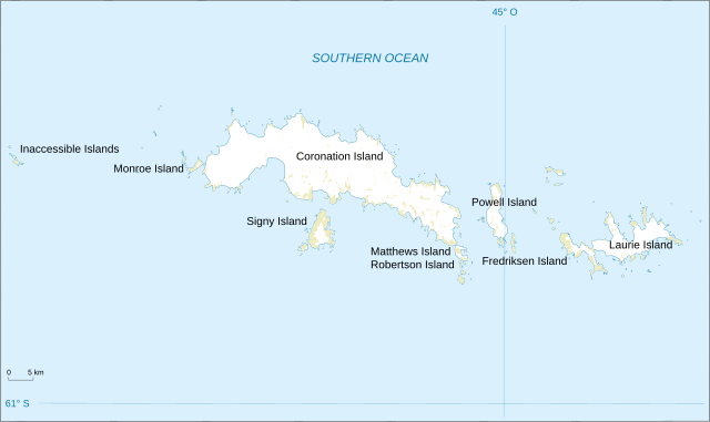
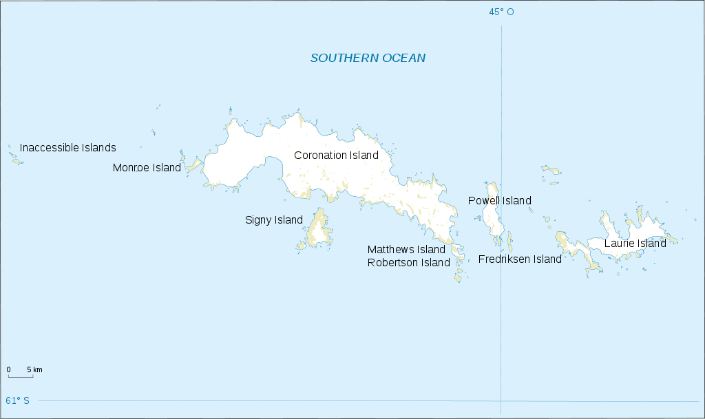
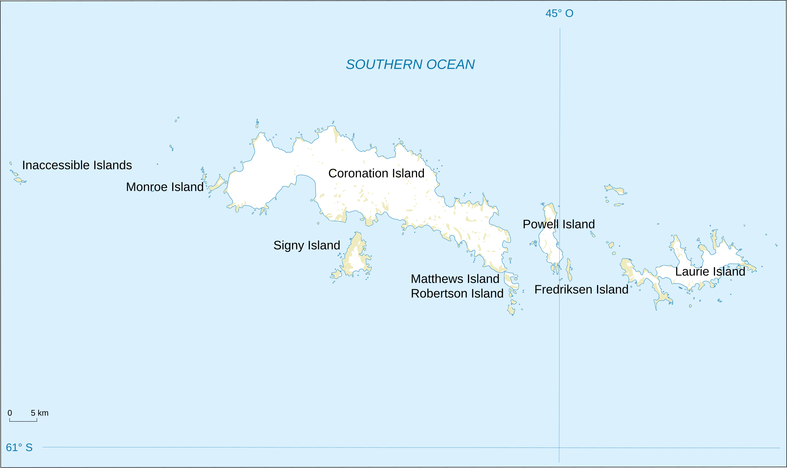
English: Map of South Orkney Islands.
Français : Carte des Iles Orcades du Sud.
Italiano: Mappa delle Isole Orcadi Meridionali. |
| Datum | |
| Boarne | Landsat Image Mosaic Of Antarctica (LIMA) |
| Auteur | Shakki |
| Oare ferzjes |
|


Lisinsje
This image is in the public domain in the United States because it only contains materials that originally came from the United States Geological Survey, an agency of the United States Department of the Interior. For more information, see the official USGS copyright policy.
|
Triemskiednis
Klik op in datum/tiid om it bestân te besjen sa't it op dat stuit wie.
| Datum/Tiid | Miniatuer | ôfmjittings | Meidogger | Opmerking | |
|---|---|---|---|---|---|
| lêste | 17 mrt 2008, 20.32 | | 2.303 × 1.370 (252 KB) | Shakki | {{Information |Description={{en|Map of South Orkney Islands}} {{fr|Carte des Iles Orcades du Sud}} |Source=[http://gisdata.usgs.gov/website/antarctic_research_atlas/ Landsat Image Mosaic Of Antarctica (LIMA)] |Date=Mar 2008 |Author=Shakki |
Bestânsgebrûk
De neikommende side brûkt dit bestân:
Globaal bestânsgebrûk
De neikommende oare wiki's brûke dit bestân:
- Gebrûk op af.wikipedia.org
- Gebrûk op ang.wikipedia.org
- Gebrûk op ar.wikipedia.org
- Gebrûk op ast.wikipedia.org
- Gebrûk op az.wikipedia.org
- Gebrûk op be.wikipedia.org
- Gebrûk op br.wikipedia.org
- Gebrûk op bs.wikipedia.org
- Gebrûk op ca.wikipedia.org
- Gebrûk op ceb.wikipedia.org
- Gebrûk op cs.wikipedia.org
- Gebrûk op da.wikipedia.org
- Gebrûk op de.wikipedia.org
- Gebrûk op el.wikipedia.org
- Gebrûk op en.wikipedia.org
- South Orkney Islands
- Scottish National Antarctic Expedition
- Laws Glacier
- Buchanan Point
- Orwell Glacier
- Jane Peak
- Sunshine Glacier
- Cape Murdoch
- Cape Mabel
- McLeod Glacier (South Orkney Islands)
- Thomson Point
- Cape Valavielle
- Cape Robertson
- Roald Glacier
- Tioga Lake (South Orkney Islands)
- Three Lakes Valley (South Orkney Islands)
- Module:Location map/data/South Orkney Islands
- Module:Location map/data/South Orkney Islands/doc
- Gebrûk op es.wikipedia.org
Mear globaal gebrûk fan dit bestân besjen.