
Ofbyld:Scandinavia1219.png
Grutte fan dit proefbyld: 513 × 600 piksels. Oare resolúsjes: 205 × 240 piksels | 410 × 480 piksels | 657 × 768 piksels | 876 × 1.024 piksels | 1.500 × 1.754 piksels.
Oarspronklik bestân (1.500 × 1.754 pixels, bestânsgrutte: 41 KB, MIME-type: image/png)
| Beskriuwing |
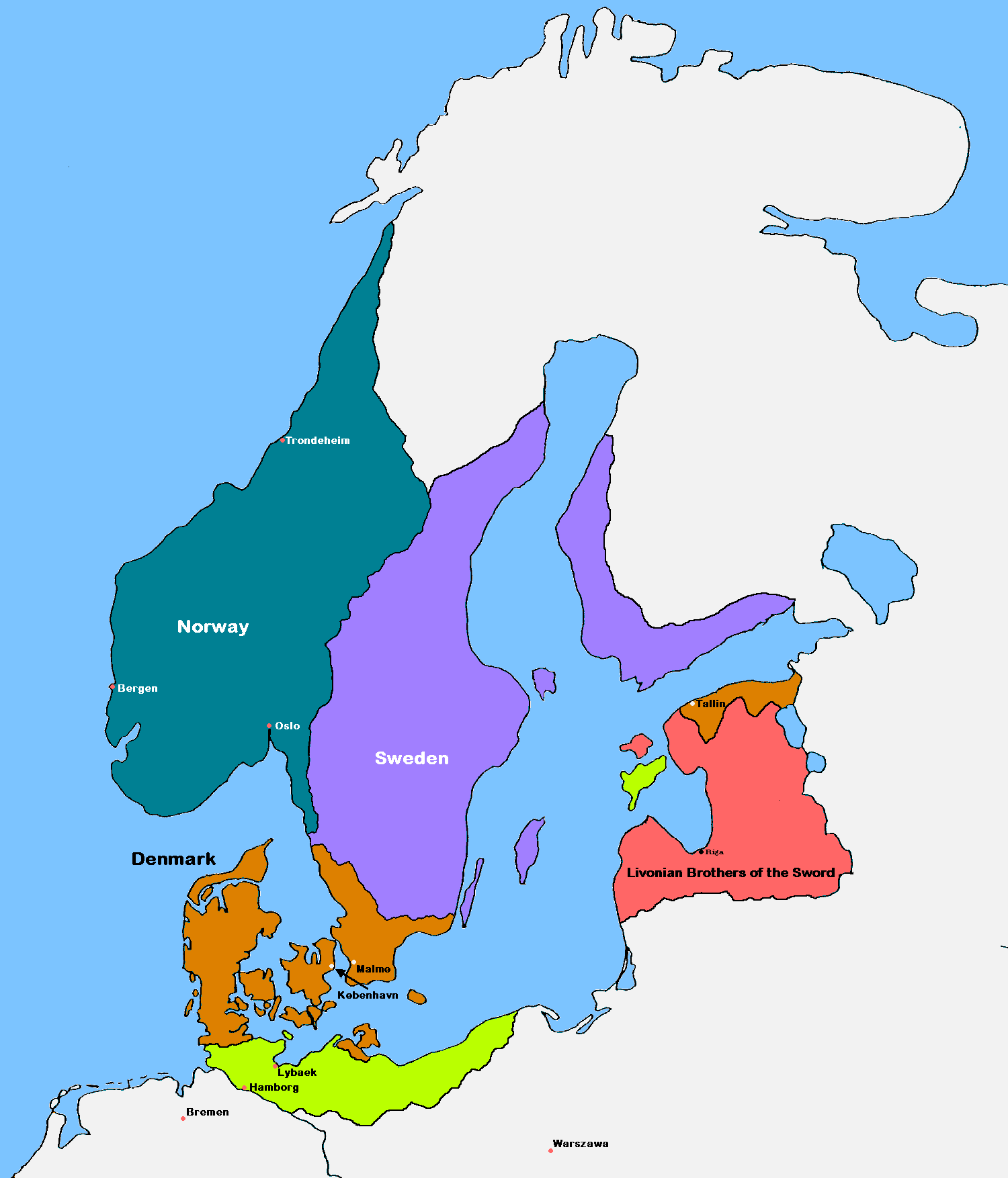
English: Update of the historical and political map, created in 2005 by Kasper Holl. It is a compressed format, has an easier colour scheme and has greater sized labels. NB on accuracy: Sweden did not reach this size until after the 1330s, when colonialization of Västerbotten started. Swedish colonialization of Finnish coast started before 1250. Sweden lost Gotland to Denmark in 1361. Trondheim has a wrong placement on map.
Denmark
Norway
Sweden
The Sword Brethren
Territories conquered by Denmark in 1219 |
| Datum | (UTC) |
| Boarne |
|
| Auteur | MasterOfHisOwnDomain |
| Oare ferzjes |
|

I, the copyright holder of this work, hereby publish it under the following licenses:

|
Der wurdt tastimming jûn ta kopiearjen, fersprieden en/of wizigjen fan dit dokumint ûnder de betinksten fan de GNU-lisinsje foar iepen dokumintaasje, ferzje 1.2, as eltse lettere ferzje útjûn troch de Free Software Foundation; sûnder Ynfariante Seksjes, sûnder Omkaftteksten foar de Foarkante en sûnder Omkaftteksten foar de Efterkante. In kopy fan de lisinsje is opnaam yn de seksje "Text of the GNU Free Documentation License". |
| This file is licensed under the Creative Commons Attribution-Share Alike 3.0 Unported license. | ||
| ||
| This licensing tag was added to this file as part of the GFDL licensing update. |
You may select the license of your choice.
Triemskiednis
Klik op in datum/tiid om it bestân te besjen sa't it op dat stuit wie.
| Datum/Tiid | Miniatuer | ôfmjittings | Meidogger | Opmerking | |
|---|---|---|---|---|---|
| lêste | 16 sep 2016, 19.18 | | 1.500 × 1.754 (41 KB) | VulpesVulpes42 | According to the description, the cities of Stockholm and Göteborg did not exist in 1219, so I removed them from the map. |
| 12 aug 2009, 16.37 |  | 1.500 × 1.754 (68 KB) | MasterOfHisOwnDomain | Update of the historical and political map, created in 2005 by Kasper Holl. It is a compressed format, has an easier colour scheme and has greater sized labels. {{Self|GFDL|Cc-by-sa-3.0-migrated}} Category:Maps of the history of Denmark [[Category: |
Bestânsgebrûk
De neikommende 2 siden brûke dit bestân:
Globaal bestânsgebrûk
De neikommende oare wiki's brûke dit bestân:
- Gebrûk op ast.wikipedia.org
- Gebrûk op be.wikipedia.org
- Gebrûk op ca.wikipedia.org
- Gebrûk op cs.wikipedia.org
- Gebrûk op da.wikipedia.org
- Gebrûk op de.wikipedia.org
- Gebrûk op dsb.wikipedia.org
- Gebrûk op el.wikipedia.org
- Gebrûk op en.wikipedia.org
- Gebrûk op eo.wikipedia.org
- Gebrûk op es.wikipedia.org
- Gebrûk op et.wikipedia.org
- Gebrûk op fr.wikipedia.org
- Gebrûk op id.wikipedia.org
- Gebrûk op is.wikipedia.org
- Gebrûk op it.wikipedia.org
Mear globaal gebrûk fan dit bestân besjen.