
Ofbyld:Oberfallenberg 11.jpg

Grutte fan dit proefbyld: 800 × 532 piksels. Oare resolúsjes: 320 × 213 piksels | 640 × 426 piksels | 1.024 × 681 piksels | 1.280 × 851 piksels | 3.008 × 2.000 piksels.
Oarspronklik bestân (3.008 × 2.000 pixels, bestânsgrutte: 2,13 MB, MIME-type: image/jpeg)
|

| Beskriuwing |
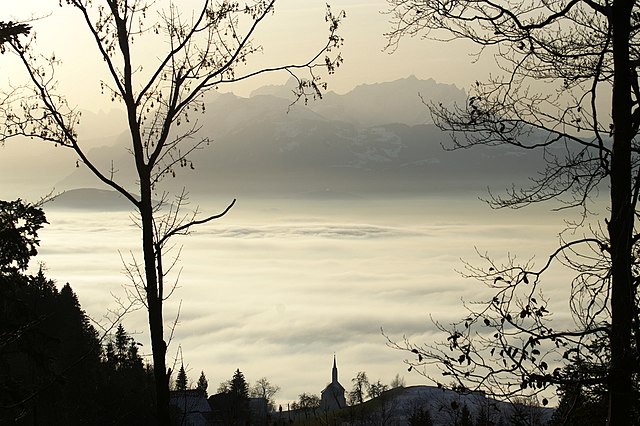
Deutsch: Blick von der Rickatschwende am Oberfallenberg in Dornbirn über das nebelbedeckte Rheintal zum schweizerischen Alpsteingebirge mit dem Hohen Kasten 1.795m und dem Altmann 2.436m (Bildmitte) sowie dem 38,3 km entfernten Säntis.
English: Fog. View from Oberfallenberg, Dornbirn district, towards the Mountains of Switzerland.
Français : Brume. Vue de Oberfallenberg (district de Dornbirn, Autriche) sur les montagnes suisses. |
| Datum | |
| Boarne | Eigen wurk |
| Auteur | böhringer friedrich |
| Tastimming (Reusing this file) |
I, the copyright holder of this work, hereby publish it under the following license: This file is licensed under the Creative Commons Attribution-Share Alike 2.5 Generic license.
|
| Oare ferzjes |
|


This Photo was taken by Böhringer Friedrich.
|
Feel free to use my photos, but please mention me as the author and if you want send me a message. or (rufre@lenz-nenning.at) |
| Camera location | | View this and other nearby images on: OpenStreetMap |
|---|
| Annotations | This image is annotated: View the annotations at Commons |
Triemskiednis
Klik op in datum/tiid om it bestân te besjen sa't it op dat stuit wie.
| Datum/Tiid | Miniatuer | ôfmjittings | Meidogger | Opmerking | |
|---|---|---|---|---|---|
| lêste | 5 jun 2007, 21.56 | | 3.008 × 2.000 (2,13 MB) | Böhringer | {{Information |Description= vom Oberfallenberg zu den Schweizer Bergen |Source= own work |Date= 2006-12-16 |Author= böhringer friedrich |Permission= |other_versions= }} Category: Dornbirn == Licensing == {{self|cc-by-sa-2.5}} |
Bestânsgebrûk
De neikommende side brûkt dit bestân:
Globaal bestânsgebrûk
De neikommende oare wiki's brûke dit bestân:
- Gebrûk op af.wikipedia.org
- Gebrûk op als.wikipedia.org
- Wikipedia:Houptsyte/Bildervorlagen
- Vorlage:Houptsyte/Bilder/1.10
- Vorlage:Houptsyte/Bilder/2.10
- Vorlage:Houptsyte/Bilder/3.10
- Vorlage:Houptsyte/Bilder/4.10
- Vorlage:Houptsyte/Bilder/5.10
- Vorlage:Houptsyte/Bilder/7.10
- Vorlage:Houptsyte/Bilder/8.10
- Vorlage:Houptsyte/Bilder/9.10
- Vorlage:Houptsyte/Bilder/10.10
- Vorlage:Houptsyte/Bilder/11.10
- Vorlage:Houptsyte/Bilder/12.10
- Wikipedia:Bilder fir d Houptsyte
- Benutzer:SSastry (WMF)/Sandbox
- Gebrûk op ca.wikiquote.org
- Gebrûk op de.wikipedia.org
- Gebrûk op eu.wikipedia.org
- Gebrûk op fr.wikipedia.org
- Gebrûk op kk.wikipedia.org
- Gebrûk op ko.wikipedia.org
- Gebrûk op pl.wikipedia.org
- Gebrûk op sv.wikipedia.org
- Gebrûk op tt.wikipedia.org