
Ofbyld:Mont Saint Michel bordercropped.jpg
Gjin hegere resolúsje beskikber.
Mont_Saint_Michel_bordercropped.jpg (794 × 594 pixels, bestânsgrutte: 174 KB, MIME-type: image/jpeg)
Gearfetting
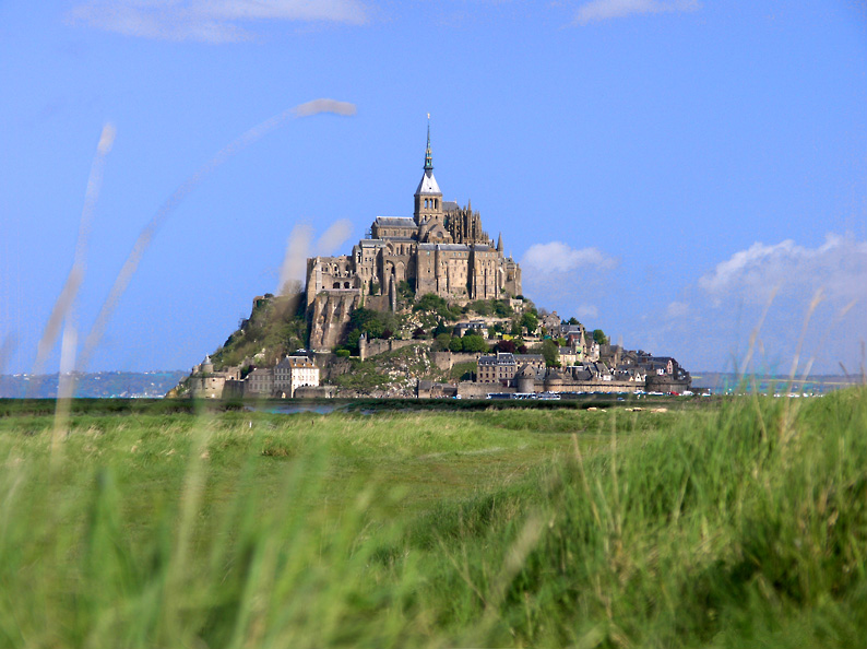
Le mont saint Michel, department of Manche, France
Author : -- Eric Pouhier Date : June 2005
- Removed watermark read: Eric Pouhier 2005
| Object location | | View this and other nearby images on: OpenStreetMap |
|---|
Lisinsje
I, the copyright holder of this work, hereby publish it under the following license:
This file is licensed under the Creative Commons Attribution-Share Alike 2.5 Generic license.
- Fiel jo frij:
- te dielen – it wurk te kopiearjen, fersprieden en út te stjoeren
- te fermingen – it wurk oan te passen
- Under de neikommende betingsten:
- Nammefermelding – You must give appropriate credit, provide a link to the license, and indicate if changes were made. You may do so in any reasonable manner, but not in any way that suggests the licensor endorses you or your use.
- Lyk diele – If you remix, transform, or build upon the material, you must distribute your contributions under the same or compatible license as the original.

|
Attribution information, such as the author's name, e-mail, website, or signature, that was once visible in the image itself has been moved into the image metadata and/or image description page. This makes the image easier to reuse and more language-neutral, and makes the text easier to process and search for. Commons discourages placing visible author information in images.
|
Triemskiednis
Klik op in datum/tiid om it bestân te besjen sa't it op dat stuit wie.
| Datum/Tiid | Miniatuer | ôfmjittings | Meidogger | Opmerking | |
|---|---|---|---|---|---|
| lêste | 15 feb 2007, 12.55 | | 794 × 594 (174 KB) | Dcoetzee | Oops, appears I didn't upload the correct image |
| 13 feb 2007, 17.21 |  | 794 × 594 (174 KB) | Dcoetzee | Losslessly remove watermark with BetterJPEG Photoshop plugin | |
| 3 mrt 2006, 19.40 |  | 794 × 594 (175 KB) | Para | ===Description=== == Summary == Le mont saint Michel, department of Manche, France Author : -- Eric Pouhier Date : June 2005 {{cleanup image done|lossless jpegtran crop of white borders|Mont_Saint_Michel.jpg}} == Licensing == {{se |
Bestânsgebrûk
De neikommende 2 siden brûke dit bestân:
Globaal bestânsgebrûk
De neikommende oare wiki's brûke dit bestân:
- Gebrûk op af.wikipedia.org
- Gebrûk op ar.wikipedia.org
- Gebrûk op arz.wikipedia.org
- Gebrûk op az.wikipedia.org
- Gebrûk op be.wikipedia.org
- Gebrûk op bg.wikipedia.org
- Gebrûk op ca.wikipedia.org
- Gebrûk op de.wikipedia.org
- Gebrûk op de.wikivoyage.org
- Gebrûk op en.wikipedia.org
- Gebrûk op en.wikivoyage.org
- Gebrûk op eo.wikipedia.org
- Gebrûk op et.wikipedia.org
- Gebrûk op fi.wikipedia.org
- Gebrûk op fr.wikipedia.org
- Gebrûk op ga.wikipedia.org
- Gebrûk op he.wikipedia.org
Mear globaal gebrûk fan dit bestân besjen.